Fraud Blocker Skip to main content

Home > Asia > Taiwan > Maps

Maps Collection

Maps of Taiwan Asia are essential for travelers and locals alike

Choose a picture from our Maps Collection for your Wall Art and Photo Gifts

41 items

Background imageMaps Collection: Map of Taiwan

Map of Taiwan

Background imageMaps Collection: Taiwan country map

Taiwan country map
2011 edition

Background imageMaps Collection: China map

China map
illustration of a South Eastern Asia map

Background imageMaps Collection: CHINA: FUJIAN MAP, 1662. Engraved map of the province of Fujian, China

CHINA: FUJIAN MAP, 1662. Engraved map of the province of Fujian, China, also showing the Strait of Taiwan and part of Taiwan (Formosa) from Jan Blaeus Atlas Major published in Amsterdam in 1662

Background imageMaps Collection: 1863, Cassells Dispatch Atlas Map of Taiwan, Formosa and the Hainan Coast of China

1863, Cassells Dispatch Atlas Map of Taiwan, Formosa and the Hainan Coast of China

Background imageMaps Collection: Map of Asia circa 1810. Handcoloured copperplate engraving by Andrea Bernieri from Giulio

Map of Asia circa 1810. Handcoloured copperplate engraving by Andrea Bernieri from Giulio Ferrario's Ancient
FLO4622502 Map of Asia circa 1810. Handcoloured copperplate engraving by Andrea Bernieri from Giulio Ferrario's Ancient and Modern Costumes of all the Peoples of the World

Background imageMaps Collection: Map of the Liu-Kiu Islands and Formosa, c.1900 (engraving)

Map of the Liu-Kiu Islands and Formosa, c.1900 (engraving)
533335 Map of the Liu-Kiu Islands and Formosa, c.1900 (engraving); (add.info.: Historical map of Southern part of Japan, Liu-Kiu Islands and Formosa with inset map of Bonin and Sulphur Islands)

Background imageMaps Collection: TAIPEI

TAIPEI
StudioSix

Background imageMaps Collection: Black Maps Earth Tones 85

Black Maps Earth Tones 85
Emiliano Deificus

Background imageMaps Collection: 1 Maps 2 15

1 Maps 2 15
Emiliano Deificus

Background imageMaps Collection: City Love Maps 85

City Love Maps 85
Emiliano Deificus

Background imageMaps Collection: City Heart Maps 85

City Heart Maps 85
Emiliano Deificus

Background imageMaps Collection: City Heart Maps 85

City Heart Maps 85
Emiliano Deificus

Background imageMaps Collection: Political map of the Japanese Empire, early 20th century

Political map of the Japanese Empire, early 20th century. Korea was under Japanese rule from 1910-1945. Japanese forces invaded and occupied Sakhalin during the Russo-Japanese War in 1905

Background imageMaps Collection: Political map of Eastern China

Political map of Eastern China, showing Taiwan, Tianjin and the Bohai Sea. Plate 64 from The Times Atlas

Background imageMaps Collection: The Japanese Empire, including Korea and Sakhalin (colour litho)

The Japanese Empire, including Korea and Sakhalin (colour litho)
7169503 The Japanese Empire, including Korea and Sakhalin (colour litho) by English School, (20th century); Private Collection; (add.info.: The Japanese Empire, including Korea and Sakhalin)

Background imageMaps Collection: Map of Asia circa 1810

Map of Asia circa 1810. Handcoloured copperplate engraving by Andrea Bernieri from Giulio Ferrarios Ancient and Modern Costumes of all the Peoples of the World, Florence, Italy, 1843

Background imageMaps Collection: Geographical map of China

Geographical map of China. Plate 63 from The Times Atlas

Background imageMaps Collection: Formosan people and costumes, 1895. Artist: A Bertrand

Formosan people and costumes, 1895. Artist: A Bertrand
Formosan people and costumes, 1895. From The Universal Geography with Illustrations and Maps, division XIV, written by Elisee Reclus and published by Virtue & Co. Limited (London, 1895)

Background imageMaps Collection: Highland Landscape, Formosa, c1890

Highland Landscape, Formosa, c1890. Scene in Taiwan. Illustration from The Universal Geography with Illustrations and Maps, Division XIII, (Virtue & Co Limited, London, c1890)

Background imageMaps Collection: Interior figures fainted wife Antonius Hambroeck

Interior figures fainted wife Antonius Hambroeck
Interior with figures about fainted wife Antonius Hambroeck and his family, Interior with a fainted woman seated in a chair. She is supported by a woman

Background imageMaps Collection: Map Europe parts Asia Africa Tubala Universalis Locorum

Map Europe parts Asia Africa Tubala Universalis Locorum
Map of Europe and parts of Asia and Africa Tubala Universalis Locorum, quae Phoenicum Navigationibus Maxime frequentata Sunt a Taprobana Thulen usque (title on object), Print upper right: Pag: 346

Background imageMaps Collection: Taiwan locator map

Taiwan locator map
2012 edition

Background imageMaps Collection: China and Japan, lithograph, published in 1881

China and Japan, lithograph, published in 1881
Antique map of China and Japan. Lithograph, published in 1881

Background imageMaps Collection: Map of China and Japan, lithograph, published in 1875

Map of China and Japan, lithograph, published in 1875
Map of China and Japan. Lithograph, published in 1875

Background imageMaps Collection: Map of China and northeastern Asia

Map of China and northeastern Asia

Background imageMaps Collection: Taiwan Map

Taiwan Map
Taiwan High detailed map with navigation icons

Background imageMaps Collection: 1895, Meiji 28 Japanese Map of Imperial Japan with Taiwan, topography, cartography

1895, Meiji 28 Japanese Map of Imperial Japan with Taiwan, topography, cartography
1895, Meiji 28 Japanese Map of Imperial Japan with Taiwan

Background imageMaps Collection: 1781, Japanese Temmei 1 Manuscript Map of Taiwan and the Ryukyu Dominion, topography

1781, Japanese Temmei 1 Manuscript Map of Taiwan and the Ryukyu Dominion, topography
1781, Japanese Temmei 1 Manuscript Map of Taiwan and the Ryukyu Dominion

Background imageMaps Collection: 1876, Imray Blue-back Nautical Chart or Map of Taiwan, Formosa, China, topography

1876, Imray Blue-back Nautical Chart or Map of Taiwan, Formosa, China, topography
1876, Imray Blue-back Nautical Chart or Map of Taiwan, Formosa, China

Background imageMaps Collection: 1865, Johnson Map of China and Taiwan, topography, cartography, geography, land, illustration

1865, Johnson Map of China and Taiwan, topography, cartography, geography, land, illustration
1865, Johnson Map of China and Taiwan

Background imageMaps Collection: 1855, Colton Map of China, Taiwan, and Korea, topography, cartography, geography

1855, Colton Map of China, Taiwan, and Korea, topography, cartography, geography
1855, Colton Map of China, Taiwan, and Korea

Background imageMaps Collection: 1818, Pinkerton Map of China, with Taiwan or Formosa, John Pinkerton, 1758 - 1826

1818, Pinkerton Map of China, with Taiwan or Formosa, John Pinkerton, 1758 - 1826, Scottish antiquarian, cartographer, UK

Background imageMaps Collection: 1815, Thomson Map of China and Formosa, Taiwan, John Thomson, 1777 - 1840, was a

1815, Thomson Map of China and Formosa, Taiwan, John Thomson, 1777 - 1840, was a Scottish cartographer from Edinburgh, UK

Background imageMaps Collection: 1799, Clement Cruttwell Map of China, Korea, and Taiwan, topography, cartography

1799, Clement Cruttwell Map of China, Korea, and Taiwan, topography, cartography
1799, Clement Cruttwell Map of China, Korea, and Taiwan

Background imageMaps Collection: 1771, Bonne Map of Tonkin, Vietnam China, Formosa, Taiwan and Luzon, Philippines

1771, Bonne Map of Tonkin, Vietnam China, Formosa, Taiwan and Luzon, Philippines, Rigobert Bonne 1727 - 1794, one of the most important cartographers of the late 18th century

Background imageMaps Collection: Taiwan Map

Taiwan Map
Taiwan High detailed map with navigation icons

Background imageMaps Collection: The Chinese Empire, Chinese Tartary and the Kingdom of Korea, with the Islands of Japan

The Chinese Empire, Chinese Tartary and the Kingdom of Korea, with the Islands of Japan
KW206604 The Chinese Empire, Chinese Tartary and the Kingdom of Korea, with the Islands of Japan, from Atlas de Toutes les Parties Connues du Globe Terrestre by Guillaume Raynal (1713-96)

Background imageMaps Collection: The Philippines, Formosa, South China, the Kingdoms of Tonkin, Cochin China, Cambodia

The Philippines, Formosa, South China, the Kingdoms of Tonkin, Cochin China, Cambodia
KW205831 The Philippines, Formosa, South China, the Kingdoms of Tonkin, Cochin China, Cambodia, Siam, Laos, and part of those of Pegu and Ava

Background imageMaps Collection: China, Relief Map With Border and Mask

China, Relief Map With Border and Mask
Relief map of China (with border and mask). This image was compiled from data acquired by landsat 5 & 7 satellites combined with elevation data

Background imageMaps Collection: Philippine Sea, satellite artwork C015 / 6580

Philippine Sea, satellite artwork C015 / 6580
Philippine Sea. Simulated satellite map of the Philippine Sea in perspective projection, taken from low Earth orbit over the western Pacific Ocean


All Professionally Made to Order for Quick Shipping


-

Maps Collection

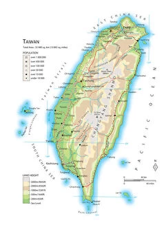
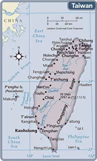
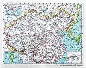
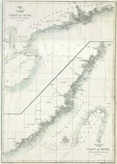
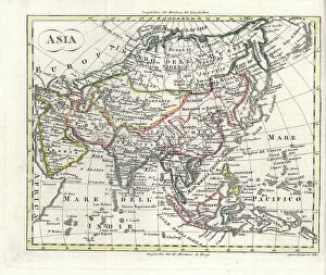
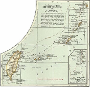
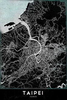
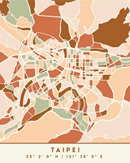
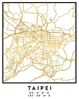
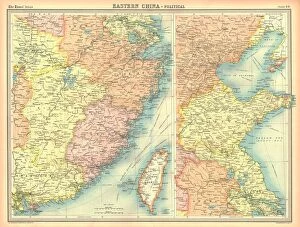
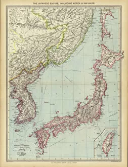
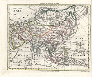
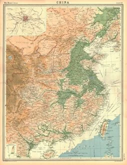
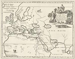
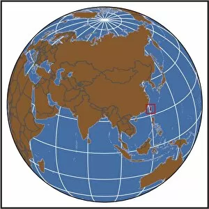
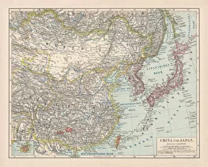
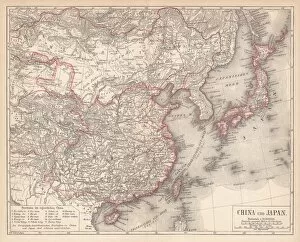
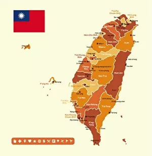
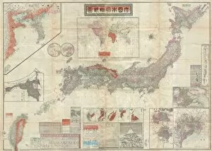
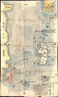
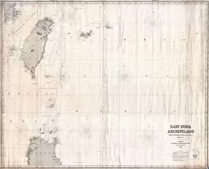
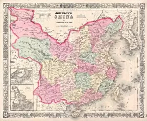
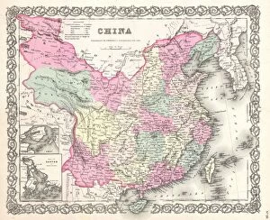
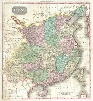
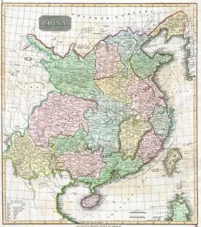
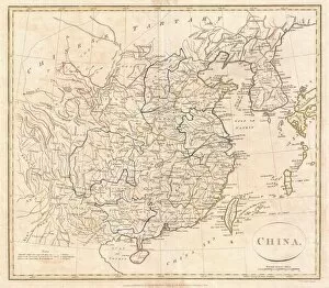
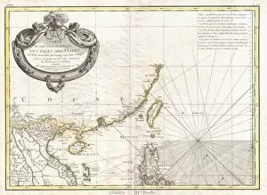
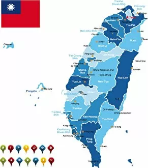
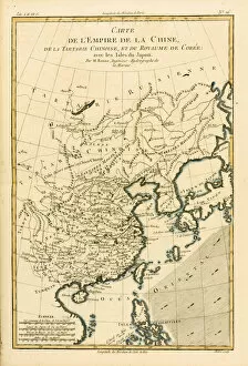
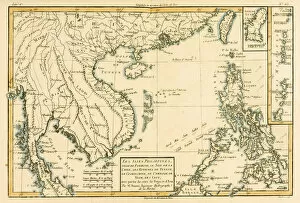
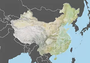
Maps of Taiwan Asia are essential for travelers and locals alike. They provide detailed information about the geography, roads, cities, and other features of the island nation. Maps of Taiwan Asia can be found in print form or online. They typically include detailed information on major highways, airports, railways and other transportation networks as well as points of interest such as parks and monuments. Additionally, they often feature political boundaries such as provinces or districts within Taiwan. Maps of Taiwan Asia also provide a wealth of cultural information including local festivals and events that may be taking place in different parts of the country at any given time. Ultimately, they can an invaluable resource for anyone looking to explore this vibrant nation with its unique culture and history.
+

Our beautiful pictures are available as Framed Prints, Photos, Wall Art and Photo Gifts

The Maps of Taiwan Asia collection from Media Storehouse is a stunning range of wall art and framed prints that showcase the beauty and diversity of Taiwan. Our collection features a wide variety of maps, ranging from vintage designs to modern interpretations, each capturing the unique geography and culture of this fascinating country. Whether you're looking for a striking centerpiece for your living room or an eye-catching addition to your office decor, these maps are sure to impress. From intricate city plans to detailed topographical surveys, there's something here for every taste and style. Each print is expertly crafted using high-quality materials and printing techniques, ensuring that it will look great on your walls for years to come. So if you're looking for a beautiful way to celebrate Taiwan's rich history and culture, be sure to check out the Maps of Taiwan Asia collection from Media Storehouse today.
+

What are Maps of Taiwan Asia art prints?

Maps of Taiwan Asia art prints are high-quality reproductions of maps that depict the geography and topography of Taiwan, an island nation located in East Asia. These prints showcase the intricate details and features of Taiwan's landscape, including its mountains, rivers, cities, and landmarks. They are created using advanced printing techniques that ensure accurate color reproduction and sharpness. These art prints are not only visually stunning but also serve as educational tools for those interested in learning more about Taiwan's history and culture. They can be used to decorate homes or offices with a unique Asian flair or given as gifts to friends or family members who have a connection to Taiwan. Whether you're a traveler who has visited this beautiful country before or simply someone who appreciates fine art, Maps of Taiwan Asia art prints offer a captivating glimpse into one of the most fascinating places on earth.
+

What Maps of Taiwan Asia art prints can I buy from Media Storehouse?

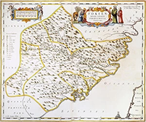
We offer a wide range of Maps of Taiwan Asia art prints that you can choose from. These maps are beautifully designed and printed on high-quality paper, making them perfect for home or office decoration. You can find antique maps that showcase the history of Taiwan, as well as modern-day maps that highlight the country's geography and landmarks. Some popular options include vintage-style maps with intricate illustrations, colorful political maps with detailed borders and regions, and topographical maps that show elevation changes across Taiwan's landscape. Additionally, Media Storehouse also offers customizable map prints where you can add your own text or markers to make it unique to your needs. Whether you're looking for a decorative piece or a functional tool for navigation purposes, we have got you covered with our extensive collection of Maps of Taiwan Asia art prints.
+

How do I buy Maps of Taiwan Asia art prints?

To buy Maps of Taiwan Asia art prints from Media Storehouse, you can browse our extensive collection online. Simply search for "Maps of Taiwan" in the search bar on our website and select the artwork that catches your eye. Once you have found a print that you like, click on it to view more details about the product. From there, you can choose the size and format of your print, such as canvas or framed options. Add your chosen item to your cart and proceed to checkout where you will be prompted to enter payment information. We offer high-quality prints made with archival materials so that they last for years without fading or yellowing. Their selection includes a variety of styles and sizes suitable for any decor style. Buying Maps of Taiwan Asia art prints from Media Storehouse is easy and convenient thanks to their user-friendly website and wide range of products available at affordable prices.
+

How much do Maps of Taiwan Asia art prints cost?

We offer a wide range of Maps of Taiwan Asia art prints that are available at varying prices. Our collection includes high-quality prints that showcase the beauty and intricacies of Taiwan's geography and culture. The cost of our Maps of Taiwan Asia art prints depends on several factors such as size, framing options, and printing materials. We take pride in offering affordable yet premium quality art prints to our customers. Our products are sourced from some of the best artists and photographers around the world who have captured stunning images of Taiwan's landscapes, landmarks, and people. Whether you're looking for a unique piece to decorate your home or office or searching for a thoughtful gift for someone special, our Maps of Taiwan Asia art prints are an excellent choice. With their vibrant colors and intricate details, they will surely add character and personality to any space they adorn.
+

How will my Maps of Taiwan Asia art prints be delivered to me?

Your Maps of Taiwan Asia art prints will be delivered to you in a secure and timely manner. We take great care in packaging your prints to ensure they arrive undamaged. Depending on the size and quantity of your order, we may use either flat or rolled shipping methods. Flat shipping is used for smaller orders that can fit into a standard envelope or box. These prints are carefully placed between sturdy cardboard sheets to prevent any bending or creasing during transit. For larger orders or oversized prints, we use rolled shipping methods. Your print will be carefully rolled and placed inside a durable tube before being shipped directly to your doorstep. Regardless of which method is used, all shipments are tracked so you can monitor the progress of your delivery from start to finish. Rest assured that we strive to provide excellent customer service throughout the entire process.