
Africa Collection
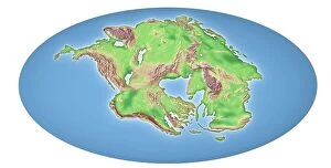
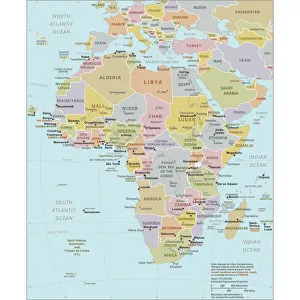
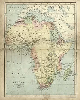
Africa is the world's second-largest continent
Choose a picture from our Africa Collection for your Wall Art and Photo Gifts
2,235 items
All Professionally Made to Order for Quick Shipping
-
Africa Collection
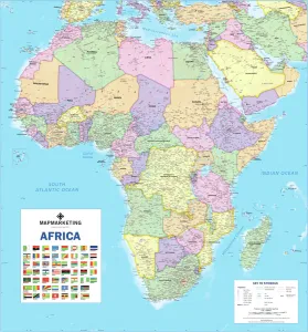
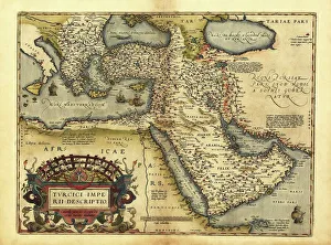
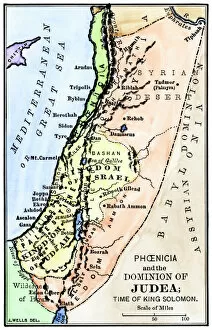
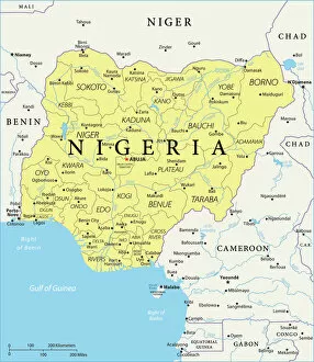
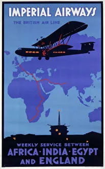
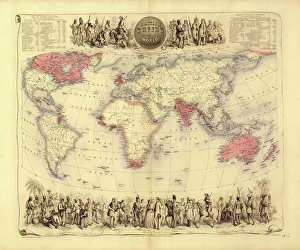
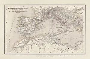
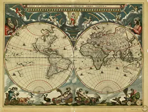
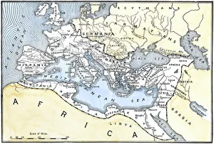
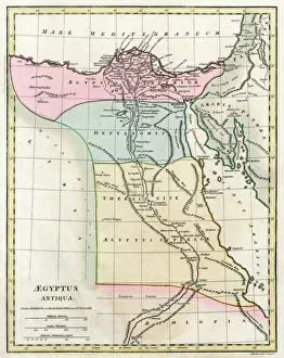
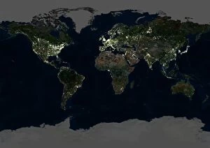
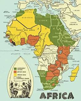
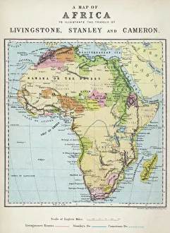
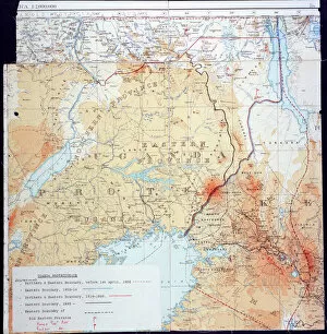
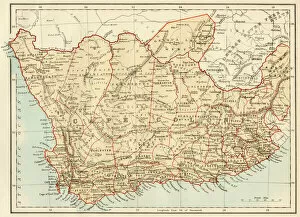
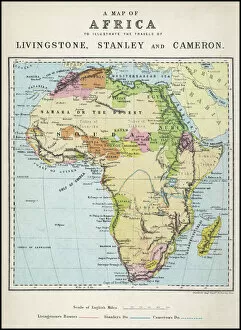
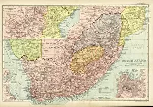
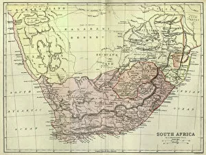
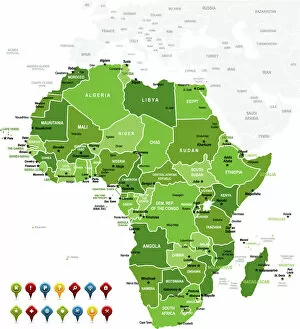
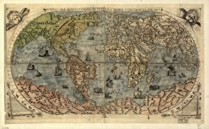
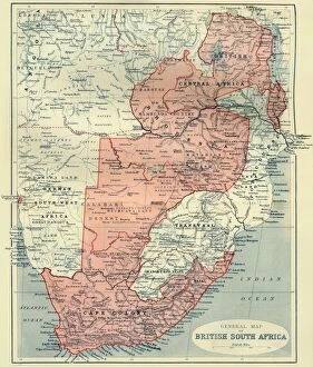
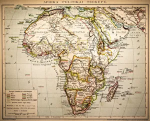
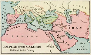
Africa is the world's second-largest continent, covering approximately 30 million square kilometers and has a population of over one billion people and is home to some of the most diverse cultures and languages on earth, and is known for its vast natural resources, including oil, gold, diamonds, and other minerals. However, despite its wealth in resources, many African countries struggle with poverty and political instability. Maps and charts can help us understand the geography as well as economic trends such as trade flows or GDP growth rates and can also highlight issues like climate change or disease outbreaks that affect different regions differently.
+
Our beautiful pictures are available as Framed Prints, Photos, Wall Art and Photo Gifts
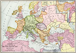
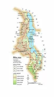
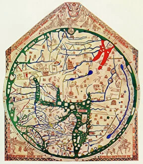
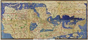
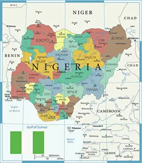
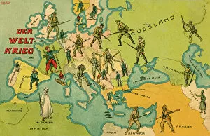
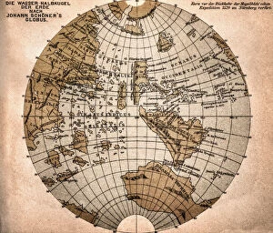
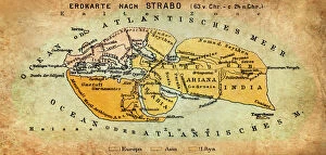
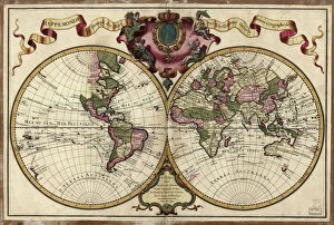
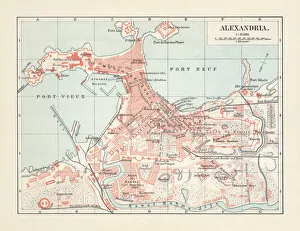
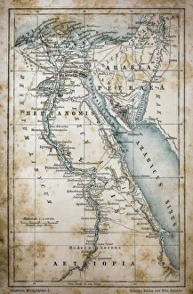
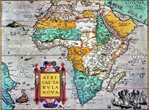
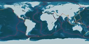
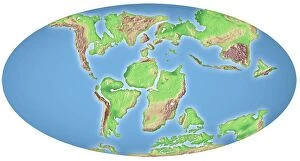
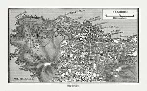
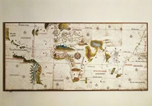
Media Storehouse offers a vast collection of Africa maps and charts that showcase the beauty and diversity of the continent. Our collection includes vintage maps, political maps, topographical maps, geological charts, and more. These prints are perfect for anyone who loves geography or wants to add an African touch to their home decor. The Africa Maps and Charts collection features high-quality prints that are available in various sizes and formats such as canvas prints, art prints, framed prints, or posters. Customers can choose from different styles ranging from colorful abstract designs to detailed black-and-white illustrations. These stunning pieces of wall art capture the essence of Africa's rich history and culture while providing educational value for those interested in learning about its geography. Whether you're looking to decorate your living room or office space with unique artwork or want to gift someone with a meaningful present related to their interests - our Africa Maps and Charts collection is definitely worth exploring.
+
What are Africa (Maps and Charts) art prints?
Africa art prints are a collection of high-quality, visually stunning artworks that showcase the diverse geography and topography of the African continent. These prints feature detailed maps and charts that highlight various regions, countries, cities, landmarks, and natural wonders across Africa. These art prints are perfect for anyone who has an interest in African history, culture or geography. They can be used to decorate homes or offices with a unique touch of elegance while also serving as educational resources for students studying African geography or history. The Africa art print collection is available in a variety of sizes to suit different needs. The prints are produced using state-of-the-art printing technology on premium quality paper to ensure they last for years without fading or losing their vibrancy. These art prints offer an excellent way to appreciate the beauty and diversity of Africa's landscapes while also learning more about its rich cultural heritage.
+
What Africa (Maps and Charts) art prints can I buy from Media Storehouse?
We offer a wide range of Africa maps and charts art prints that are perfect for anyone looking to add some African flair to their home or office decor. These prints feature detailed maps and charts of various regions in Africa, showcasing the diverse geography, topography, and cultural heritage of this vast continent. Some popular options include vintage-style maps that highlight colonial-era borders and territories, as well as more contemporary designs that showcase modern political boundaries and natural landmarks. You can also find charts depicting wildlife populations, climate patterns, and other fascinating data about different parts of Africa. Whether you're a history buff, nature lover, or simply appreciate beautiful artwork with an African theme, we have something for everyone. With high-quality printing techniques and a variety of sizes available to choose from, these art prints are sure to make a stunning addition to any space.
+
How do I buy Africa (Maps and Charts) art prints?
To buy Africa art prints from Media Storehouse, you can browse our extensive collection of high-quality prints online. Simply search for the specific artwork or artist that you are interested in, or explore their curated collections to discover new pieces. Once you have found a print that you would like to purchase, simply add it to your cart and proceed to checkout. You will be prompted to enter your shipping and payment information, after which your order will be processed. We offer a range of sizes and framing options for their prints, so be sure to choose the one that best suits your needs. Whether you are looking for a small print to display on your desk or a large statement piece for your living room wall, they have something for everyone. Buying Africa art prints from Media Storehouse is an easy and convenient way to bring beautiful artwork into your home or office.
+
How much do Africa (Maps and Charts) art prints cost?
We offer a wide range of Africa maps and charts art prints that are available at varying prices. Our collection features different styles and designs to suit your preferences. The cost of our Africa maps and charts art prints is dependent on several factors such as the size, quality, and type of print you choose. We provide affordable options for those looking for budget-friendly pieces while also offering high-end prints for those who want something more luxurious. Our pricing structure ensures that everyone can find an artwork that fits their budget without compromising on quality. Our Africa maps and charts art prints are perfect for adding a touch of culture to any space in your home or office. They make great gifts too. We take pride in providing our customers with exceptional products at reasonable prices so they can enjoy beautiful artwork without breaking the bank.
+
How will my Africa (Maps and Charts) art prints be delivered to me?
We take great care in ensuring that your Africa art prints are delivered to you in the best possible condition. We use high-quality packaging materials to protect your artwork during transit, including sturdy cardboard tubes for rolled prints and flat cardboard envelopes for smaller sizes. Once your order is processed, our team carefully packs your artwork and sends it out for delivery via a trusted courier service. You will receive a tracking number so that you can follow the progress of your package until it arrives at your doorstep. We understand how important it is to receive your artwork promptly and securely, which is why we work hard to ensure that all orders are dispatched as quickly as possible. Whether you're ordering from within the UK or overseas, we strive to provide a reliable and efficient delivery service every time.