Fraud Blocker Skip to main content

Home > Maps and Charts > Early Maps

Early Maps Collection

Early maps, also known as maps and charts, were created by ancient civilizations to navigate their surroundings

Choose a picture from our Early Maps Collection for your Wall Art and Photo Gifts

27,346 items

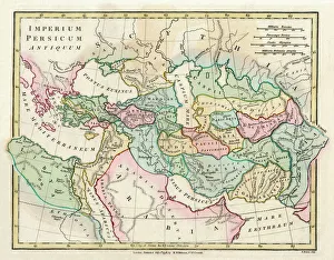
Background imageEarly Maps Collection: Map of the Ancient Persian Empire

Map of the Ancient Persian Empire, encompassing Greece to the north west, Arabia to the south east, Egypt and Libya to the south west and deep in the Caucasus in the north east. Date: 1798

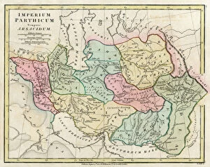
Background imageEarly Maps Collection: Map of Persia (Iran)

Map of Persia (Iran) - all place names in their Latin form. The ancient realms of Assyria, Babylonia Date: 1807

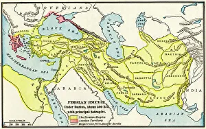
Background imageEarly Maps Collection: Persian Empire about 500 BC

Persian Empire about 500 BC
Map of the Persian Empire under Darius I, with principal satrapies, about 500 BC. Color lithograph reproduction of a 19th-century illustration

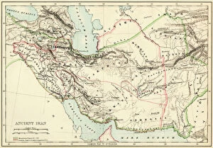
Background imageEarly Maps Collection: Extent of the Persian empire

Extent of the Persian empire
Map of the ancient Persian empire. Printed color lithograph of a 19th-century illustration

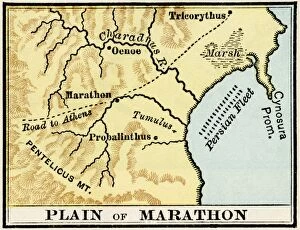
Background imageEarly Maps Collection: Plain of Marathon in ancient Greece

Plain of Marathon in ancient Greece
Map showing the Plain of Marathon, site of the battle in 490 BC. Color lithograph of a 19th-century illustration

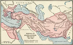
Background imageEarly Maps Collection: PANC2A-00003

PANC2A-00003
Map of the empire of Alexander the Great in 323 BC. Printed color lithograph of a 19th-century illustration

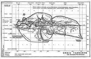
Background imageEarly Maps Collection: NOSTRADAMUS - CLIMATA Nostradamus frequently made references to places by way of

NOSTRADAMUS - CLIMATA Nostradamus frequently made references to places by way of latitudes (in the 16th century normally called climata) familiar to him from ancient literature

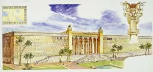
Background imageEarly Maps Collection: Palace of Darius I Great in Persepolis, Persian column and design, illustration

Palace of Darius I Great in Persepolis, Persian column and design, illustration
Persian Civilization. Reconstruction of Palace of Darius, called Apadana, in Persepolis; map of Ancient Persia and detail of a capital. Color illustration

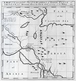
Background imageEarly Maps Collection: Map of biblical locations, 18th century C013 / 7822

Map of biblical locations, 18th century C013 / 7822
Map of biblical locations. 18th-century map showing the suggested Middle Eastern location of the Garden of Eden, the Plain of Shinaar, and Mount Ararat (where the ark came to rest after the deluge)

Background imageEarly Maps Collection: Kiss of the Oceans - Atlantic meets Pacific - Panama Canal

Kiss of the Oceans - Atlantic meets Pacific - Panama Canal
The Kiss of the Oceans - The Atlantic meets the Pacific due to the construction of The Panama Canal - A lovely allegorical card relating to this phenomenal engineering project

Background imageEarly Maps Collection: Reflexology foot map, artwork

Reflexology foot map, artwork. Reflexology is a form of alternative medicine in which disorders in the body are treated by massaging areas of the feet thought to correspond to the affected area

Background imageEarly Maps Collection: Antique map of the Roman Empire

Antique map of the Roman Empire, with a detail on Rome

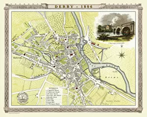
Background imageEarly Maps Collection: Old Map of Derby 1806 by Cole and Roper

Old Map of Derby 1806 by Cole and Roper
An attractive and detailed early 19th century reproduction town plan of Derby 1805. First published by Cole and Roper as a finely engraved series of county maps

Background imageEarly Maps Collection: Antique map of Britain under the Anglo Saxons

Antique map of Britain under the Anglo Saxons

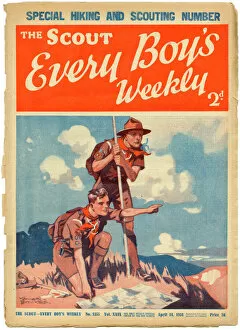
Background imageEarly Maps Collection: The Scout, Every Boys Weekly front cover

The Scout, Every Boys Weekly front cover
Front cover of The Scout magazine, the " only weekly official organ of the boy scouts" featuring two enthusiastic and earnest looking boy scouts reading a map while out on a hike

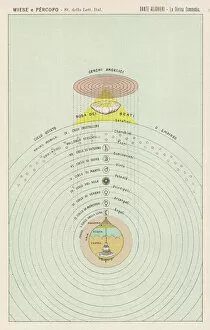
Background imageEarly Maps Collection: Dante / Map of Paradise

Dante / Map of Paradise
Schematic plan of Paradise, visited by Dante Alighieri in company with Beatrice

Background imageEarly Maps Collection: Al-Idrisis world map, 1154

Al-Idrisis world map, 1154
Al-Idrisis world map. This world map, known as the Tabula Rogeriana, dates from 1154, and is orientated with North at bottom

Background imageEarly Maps Collection: Map of Ancient Greece

Map of Ancient Greece
A map showing the extent of the Greek Empire and the surrounding territories

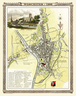
Background imageEarly Maps Collection: Old Map of Worcester 1808 by Cole and Roper

Old Map of Worcester 1808 by Cole and Roper
An attractive and detailed early 19th century reproduction town plan of Worcester 1808. First published by Cole and Roper as a finely engraved series of county maps

Background imageEarly Maps Collection: St Martins Church, Ashton on Mersey, Cheshire (engraving)

St Martins Church, Ashton on Mersey, Cheshire (engraving)
7164119 St Martins Church, Ashton on Mersey, Cheshire (engraving) by English School, (19th century); Private Collection; (add.info.: St Martins Church, Ashton on Mersey, Cheshire)

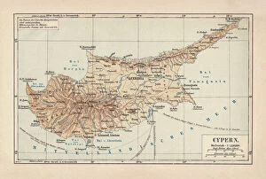
Background imageEarly Maps Collection: Map of Cyprus, published in 1880

Map of Cyprus, published in 1880
Ancient map of Cyprus. Lithograph, published in 1880

Background imageEarly Maps Collection: D-DAY MAP 1944

D-DAY MAP 1944
Plan 1C - Operation Neptune, an elaborate map detailing the proposed D-Day Normandy assault landings by Allied troops on the French beaches. Date: June 1944

Background imageEarly Maps Collection: Map of ancient Rome

Map of ancient Rome
City plan of ancient Rome. Lithograph

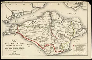
Background imageEarly Maps Collection: Map of Isle of Wight

Map of Isle of Wight
A Map of the Isle of Wight, showing the internal railway system and the new & short route between the island and the Hampshire coast

Background imageEarly Maps Collection: Map / Asia / Mongol Empire

Map / Asia / Mongol Empire
The Mongol Empire at its greatest extent : commenced by Genghis Khan in the 13th century, it was enlarged by Kublai Khan but broke up after about 1380

Background imageEarly Maps Collection: Daily Mail War Map, WW1

Daily Mail War Map, WW1
A fold out war map issued by the Daily Mail in the early weeks of the First World War. The map offers statistics regarding the manpower strength of each of the warring nations

Background imageEarly Maps Collection: Map of The Byzantine Empire

Map of The Byzantine Empire
A map showing the extent of the Byzantine Empire - the predominantly Greek-speaking continuation of the Roman Empire during Late Antiquity and the Middle Ages. Date: 1800

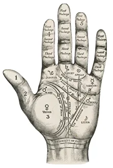
Background imageEarly Maps Collection: Palmistry map of the hand

Palmistry map of the hand
A palmistry map of the hand, labelling the different areas

Background imageEarly Maps Collection: Apostle Pauls Missionary Journeys, lithograph, published in 1886

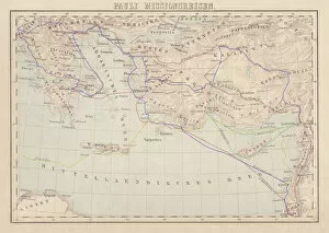
Apostle Pauls Missionary Journeys, lithograph, published in 1886
Apostle Pauls Missionary Journeys: 1st (green); 2nd (red); 3rd (blue); last to Rome (yellow). Lithograph, published in 1886. Paul travelled over 10, 000 miles proclaiming the gospel of Jesus Christ

Background imageEarly Maps Collection: Maps / Jamaica

Maps / Jamaica
Maps/Jamaica

Background imageEarly Maps Collection: Map of the Roman Empire

Map of the Roman Empire
A map showing the extent of the Roman Empire

Background imageEarly Maps Collection: Map of the Clans and Tartans of Scotland

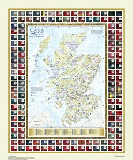
Map of the Clans and Tartans of Scotland
This map of Scotland indicates the general sphere of influence held by the clans and considerable families at the beginning of the 17th century

Background imageEarly Maps Collection: Battle of Cannae plan, 216 BC

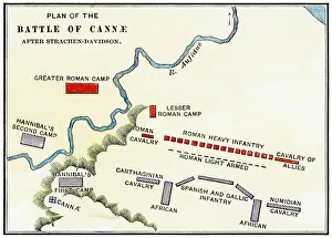
Battle of Cannae plan, 216 BC
Map of the Battle of Cannae, in which Hannibal defeated the Romans during the Second Punic War, 216 BC. Hand-colored woodcut of a 19th-century illustration

Background imageEarly Maps Collection: WW2 Poster -- Map of the British Army

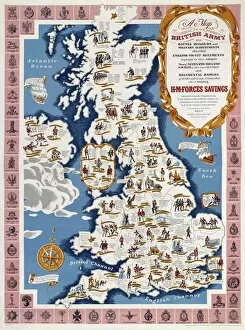
WW2 Poster -- Map of the British Army
A Map of the British Army with Battle Honours, Military Achievements and Regimental Badges, first published in 1944 by HM Forces Savings Committee

Background imageEarly Maps Collection: WW2 poster, activities of 52 (Lowland) Division

WW2 poster, activities of 52 (Lowland) Division
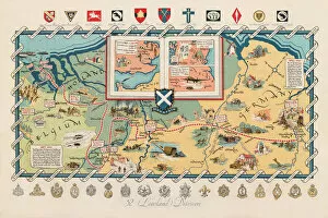
Screen-print poster, published circa 1950, showing the activities of the 52nd Lowland Division during the Second World War, with a map of Northern Europe, and unit badges along the top and bottom

Background imageEarly Maps Collection: London Zoo 1929 MD93_07025

London Zoo 1929 MD93_07025
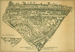
London Zoo, Regents Park, Westminster. Line drawing entitled " The Gardens of the Zoological Society of London 1929" and " the Gardens 1829" (inset)

Background imageEarly Maps Collection: Ancient Greece and its colonies around the Aegean

Ancient Greece and its colonies around the Aegean
Map of the Aegean Sea in the time of ancient Greece. Printed color lithograph of a 19th-century illustration

Background imageEarly Maps Collection: Map of Britain in 597 AD

Map of Britain in 597 AD
Map of territory controlled by Celts, Picts, Anglos, Saxons, and other tribes in Britain in 597 AD. Printed color lithograph of a 19th-century illustration

Background imageEarly Maps Collection: Crusades Map

Crusades Map
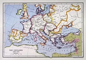
A map of Europe depicting the paths of various Crusades between 1096 and 1270

Background imageEarly Maps Collection: Europe Map C1914

Europe Map C1914
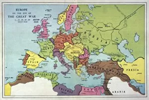
The map of Europe on the eve of World War One

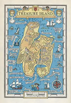
Background imageEarly Maps Collection: Treasure Island Map

Treasure Island Map
A map of the island

Background imageEarly Maps Collection: Pictorial Story Map of Scotland

Pictorial Story Map of Scotland
This map has been remastered from an original published by Colortext, it was one of a series they labelled aeStory MapAE. It combines pictorial images

Background imageEarly Maps Collection: Old Caucasus map

Old Caucasus map
Antique map of Caucasus

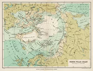
Background imageEarly Maps Collection: Map / Arctic Circle 1895

Map / Arctic Circle 1895
Map of the Arctic Circle and surrounding areas

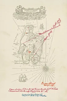
Background imageEarly Maps Collection: Treasure Island Map / Col

Treasure Island Map / Col
A map of Treasure Island

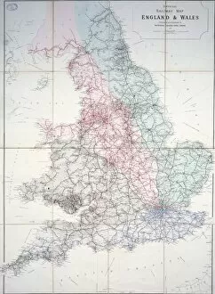
Background imageEarly Maps Collection: Railway map of Britain

Railway map of Britain
1920 Historical map

Background imageEarly Maps Collection: Continental drift after 250 million years

Continental drift after 250 million years, showing the supercontinent of Pangea Ultima, which was named for the ancient supercontinent of Pangea

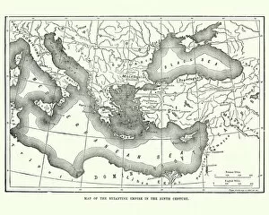
Background imageEarly Maps Collection: Map of the Byzantine Empire in the 9th Century

Map of the Byzantine Empire in the 9th Century
Vintage engraving of a Map of the Byzantine Empire in the 9th Century


All Professionally Made to Order for Quick Shipping


-

Early Maps Collection

Early maps, also known as maps and charts, were created by ancient civilizations to navigate their surroundings. These early cartographers used various techniques such as observation, measurement, and estimation to create accurate depictions of the world around them. The earliest known map dates back to 6th century BCE in Babylonia. As time progressed, more advanced mapping techniques were developed including the use of longitude and latitude lines for navigation purposes. Maps have played a significant role in history by aiding explorers in discovering new lands and helping nations establish boundaries. Today, they can valuable artifacts that provide insight into the past and serve as a reminder of how far cartography has come over time.
+

Our beautiful pictures are available as Framed Prints, Photos, Wall Art and Photo Gifts

The Early Maps collection from Media Storehouse is a fascinating assortment of historical maps and charts that offer an insight into the evolution of cartography. Our collection features antique maps dating back to the 16th century, including world maps, regional maps, city plans, and nautical charts. These meticulously crafted pieces are not only visually stunning but also provide valuable information about the geography, topography, and political boundaries of different regions throughout history. The Early Maps collection offers a unique opportunity for art enthusiasts, historians or anyone interested in exploring the past through visual representation. The prints are available in various sizes and formats such as canvas prints or framed wall art making them suitable for any home or office decor. Whether you're looking to add a touch of vintage charm to your living space or seeking inspiration for research projects on historical geography or navigation techniques - our collection has something for everyone.
+

What are Early Maps (Maps and Charts) art prints?

Early Maps art prints are reproductions of historical maps and charts that were created centuries ago. These maps were originally made by cartographers who used various techniques to accurately depict the geography, topography, and other features of different regions around the world. Early Maps art prints offer a glimpse into how people perceived the world in earlier times, as well as providing valuable information about past civilizations, cultures, and trade routes. These art prints are ideal for history buffs, collectors or anyone who appreciates vintage artwork. They can be displayed in homes or offices to add a touch of elegance and sophistication to any space. We offer a wide variety of Early Maps art prints from different eras such as medieval Europe, ancient Rome or China during the Ming dynasty. These beautiful reproductions provide an opportunity for individuals to own a piece of history while also enjoying stunning works of art that showcase incredible craftsmanship from long ago.
+

What Early Maps (Maps and Charts) art prints can I buy from Media Storehouse?

We offer a wide range of early maps and charts art prints for purchase. These include antique world maps, vintage city plans, historical nautical charts, and topographical surveys from various periods in history. Some of the most popular collections available on Media Storehouse are the 16th-century world maps by Gerardus Mercator and Abraham Ortelius, as well as the 18th-century British county maps by John Speed. In addition to these classic pieces, Media Storehouse also has an extensive collection of rare and unique maps that showcase different regions around the globe. Whether you're looking for a map of ancient Rome or a detailed chart of the Caribbean islands from the 17th century, there is something for everyone at Media Storehouse. All art prints are produced using high-quality materials to ensure they look great on any wall. They come in a variety of sizes and finishes to suit your needs. With so many options available, finding the perfect early map or chart print has never been easier.
+

How do I buy Early Maps (Maps and Charts) art prints?

To buy Early Maps art prints from Media Storehouse, you can browse our online collection of maps and charts. Once you have found the print that you like, simply add it to your cart and proceed to checkout. You will be prompted to enter your shipping information and payment details. After completing your purchase, your print will be printed on high-quality paper using archival inks. We offer a wide range of sizes for their prints so that you can choose the perfect size for your space. We also offer framing options if you prefer to receive a framed print rather than an unframed one. Whether you are looking for antique maps or modern interpretations of historical cartography, we have a vast selection of Early Maps art prints available for purchase. Our easy-to-use website makes it simple to find the perfect piece of artwork for any room in your home or office.
+

How much do Early Maps (Maps and Charts) art prints cost?

We offer a wide range of Early Maps art prints that vary in price depending on the size and type of print you choose. Our prices are competitive and affordable, making it easy for anyone to own a piece of history through our collection of vintage maps and charts. Our Early Maps art prints come in various sizes ranging from small to large, so you can find the perfect fit for your home or office space. We also offer different types of paper finishes such as matte or glossy to suit your preference. Whether you're looking for a unique gift or want to add some character to your living space, our Early Maps art prints are an excellent choice. With their intricate details and historical significance, they make for fascinating conversation starters while adding charm to any room.
+

How will my Early Maps (Maps and Charts) art prints be delivered to me?

We take great care in delivering your Early Maps art prints to you. We use high-quality packaging materials to ensure that your prints are protected during transit. Depending on the size of your order, we may use either a sturdy cardboard tube or a flat package with reinforced corners. We work closely with our trusted delivery partners to ensure that your order arrives safely and on time. Our standard delivery service is reliable and efficient, but if you need your order urgently, we also offer express shipping options for an additional fee. Once your order has been dispatched, you will receive a tracking number so that you can monitor its progress online. If there are any issues with the delivery of your print(s), please do not hesitate to contact us - our friendly customer service team will be happy to assist you in resolving any problems as quickly as possible.