
Hungary Collection
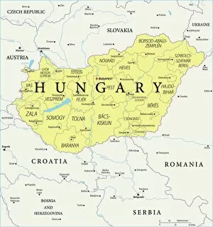
Hungary is a landlocked country located in Central Europe, bordered by Austria, Slovakia, Ukraine, Romania, Serbia, Croatia and Slovenia
Choose a picture from our Hungary Collection for your Wall Art and Photo Gifts
255 items


All Professionally Made to Order for Quick Shipping
-
Hungary Collection
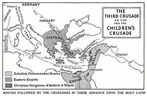
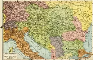
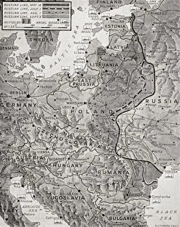
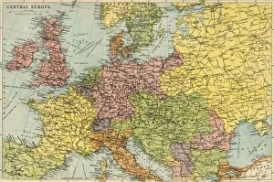
Hungary is a landlocked country located in Central Europe, bordered by Austria, Slovakia, Ukraine, Romania, Serbia, Croatia and Slovenia. The country has a population of approximately 9.8 million people and its capital city is Budapest. Hungary's economy is heavily reliant on exports and foreign investment with industries such as automotive manufacturing being major contributors to the country's GDP. The Hungarian currency is the forint (HUF) and the official language spoken is Hungarian. A rich cultural heritage with influences from various civilizations including Roman Empire, Ottoman Empire and Habsburg Monarchy which can be seen in its architecture and cuisine.
+
Our beautiful pictures are available as Framed Prints, Photos, Wall Art and Photo Gifts
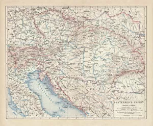
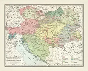
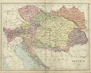
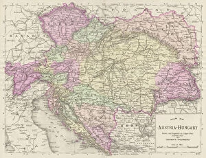
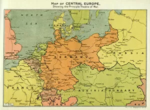
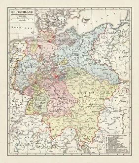
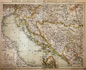
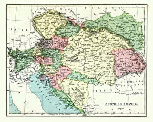
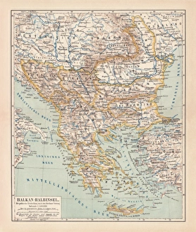
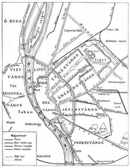
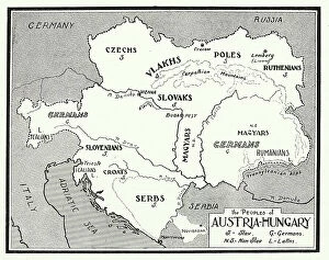
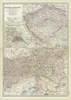
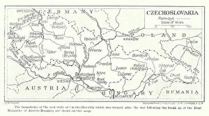
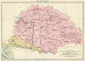
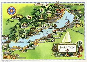
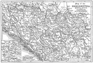
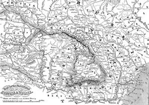
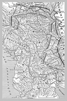
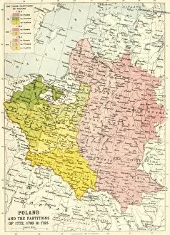
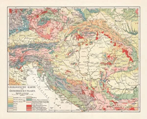
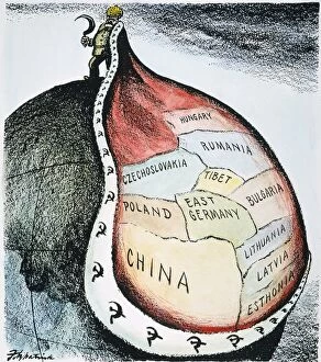
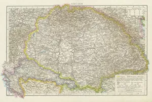
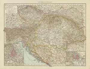
The Hungary collection from Media Storehouse is a stunning collection of wall art and framed prints that showcase the beauty, history, and culture of Hungary. Our collection features an array of maps and charts that depict the country's geography, topography, landmarks, cities, towns, rivers, lakes, mountains, forests and more. Each print in our collection is carefully crafted to provide a unique perspective on Hungary's rich heritage. From vintage maps dating back to the 16th century to modern-day satellite images capturing every detail of the landscape - there is something for everyone in this impressive range. Whether you're looking for a beautiful piece of artwork to adorn your home or office walls or searching for a thoughtful gift for someone special who loves all things Hungarian - Media Storehouse has got you covered with their Hungary collection. With high-quality printing techniques used on premium paper stock materials - these prints are sure to impress anyone who sees them.
+
What are Hungary (Maps and Charts) art prints?
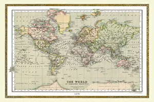
Hungary art prints are high-quality reproductions of vintage maps and charts depicting Hungary. These prints showcase the intricate details of historical cartography, highlighting the country's geography, topography, landmarks, and cities. We offer a unique perspective on Hungary's past and present landscapes, allowing viewers to explore its rich history through visual representation. These art prints are perfect for those who appreciate both history and aesthetics. They make great additions to any home or office decor as they add character and sophistication to any space. Additionally, these prints can serve as educational tools for students studying geography or history. We offer a wide selection of Hungary art prints in various sizes that cater to different preferences. Our collection includes antique maps from renowned cartographers such as Gerard Mercator, Johann Baptist Homann, John Speed, among others. Each print is carefully reproduced using state-of-the-art printing technology to ensure maximum quality and longevity.
+
What Hungary (Maps and Charts) art prints can I buy from Media Storehouse?
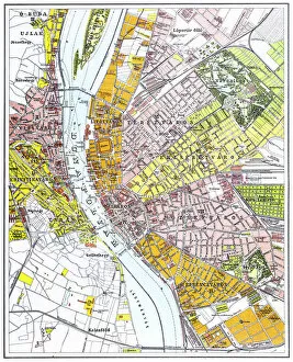
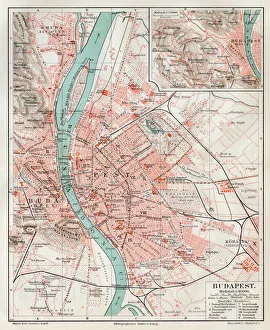
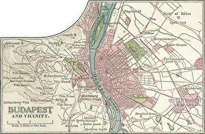
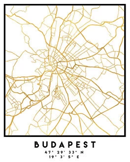
We offer a wide range of Hungary maps and charts art prints that are perfect for decorating your home or office space. You can choose from a variety of styles, including vintage maps, satellite images, and modern designs. Some popular options include the Budapest city map, Danube River chart, and Hungarian wine regions map. These art prints are available in different sizes to suit your needs and preferences. They are printed on high-quality paper using advanced printing techniques to ensure vibrant colors and sharp details. Whether you're looking for a unique gift idea or want to add some personality to your living space, we have something for everyone. In addition to Hungary maps and charts art prints, Media Storehouse also offers a vast collection of artwork from around the world. From iconic landmarks to stunning landscapes, there's no shortage of beautiful pieces to choose from. Browse our selection today and find the perfect piece for your home or office.
+
How do I buy Hungary (Maps and Charts) art prints?
To purchase Hungary art prints from Media Storehouse, you can browse our extensive collection of high-quality images online. Once you have found the print that you would like to purchase, simply select the size and format that suits your needs. You can choose from a range of options including canvas prints, framed prints or unframed prints. To complete your order, add the item to your cart and proceed to checkout. At this stage, you will be prompted to enter your shipping details and payment information. We accept a variety of payment methods including credit cards and PayPal. Once your order has been processed, it will be printed on demand using state-of-the-art printing technology before being shipped directly to your door. With a wide selection of Hungary art prints available at Media Storehouse, finding the perfect piece for your home or office is easy.
+
How much do Hungary (Maps and Charts) art prints cost?
We offer a wide range of Hungary maps and charts art prints that are available at varying prices. Our collection includes vintage and contemporary designs featuring different regions, cities, landmarks, and attractions in Hungary. The cost of each print depends on various factors such as the size, quality of paper or canvas used, printing technique employed, and the complexity of the artwork. We have affordable options for those who want to decorate their homes or offices with beautiful Hungarian art prints without breaking the bank. On the other hand, we also have premium-quality prints for collectors or enthusiasts who value high-resolution images and archival-grade materials. Regardless of your budget or preference, you can find a Hungary map or chart art print that suits your needs at Media Storehouse. We take pride in our extensive selection of artworks from around the world that cater to diverse tastes and interests.
+
How will my Hungary (Maps and Charts) art prints be delivered to me?
We take great care in delivering your Hungary art prints to you. We use high-quality packaging materials to ensure that your print arrives in perfect condition. Your print will be carefully rolled and placed into a sturdy tube for protection during transit. We work with trusted delivery partners who offer reliable and secure shipping services. Once your order has been dispatched, you will receive a tracking number so that you can keep an eye on the progress of your delivery. Our aim is to provide our customers with a hassle-free experience when it comes to receiving their artwork. If for any reason there are issues with the delivery or if the product arrives damaged, please do not hesitate to contact us and we will do everything we can to resolve the issue as quickly as possible. You can expect a professional service from Media Storehouse when it comes to delivering your Hungary art prints.