
Italy Collection
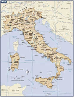
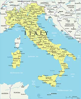
Italy is a country located in southern Europe, bordered by the Mediterranean Sea to the south and surrounded by several other countries including France
Choose a picture from our Italy Collection for your Wall Art and Photo Gifts
4,102 items
All Professionally Made to Order for Quick Shipping
-
Italy Collection
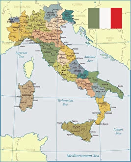
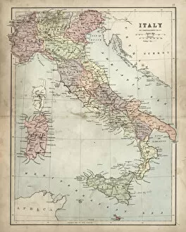
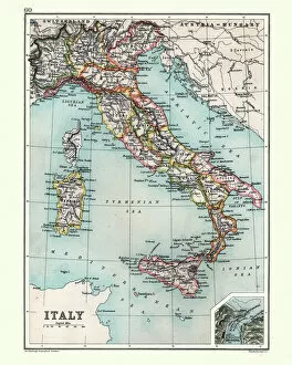
Italy is a country located in southern Europe, bordered by the Mediterranean Sea to the south and surrounded by several other countries including France, Switzerland, Austria, and Slovenia. The country has a population of approximately 60 million people and its capital city is Rome. Italy is known for its rich history, culture, art, architecture, fashion industry and cuisine and has a diverse landscape with mountains in the north and beaches along the coastlines. Italy's economy relies heavily on tourism as well as industries such as agriculture, manufacturing and services. The country also plays an important role in international politics as a member of the European Union (EU) and United Nations (UN).
+
Our beautiful pictures are available as Framed Prints, Photos, Wall Art and Photo Gifts
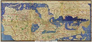
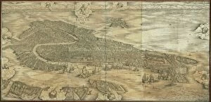
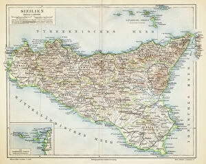
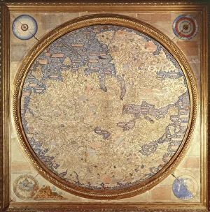
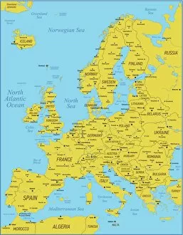
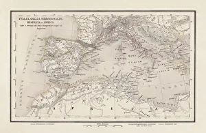
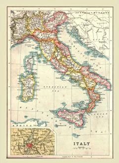
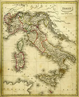
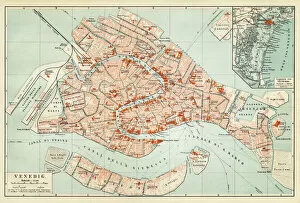
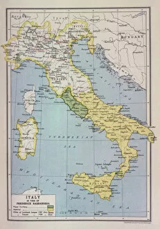
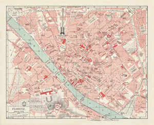
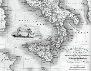
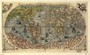
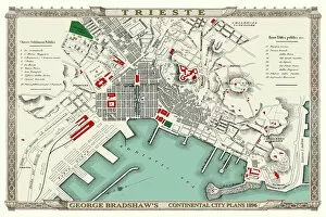
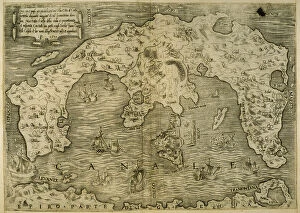
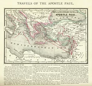
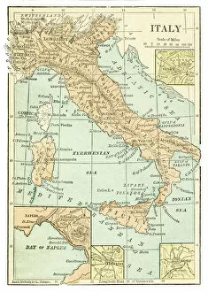
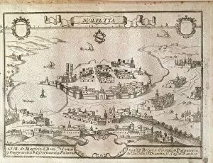
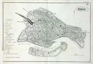
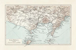
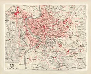
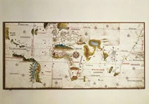
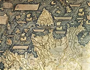
The Italy collection from Media Storehouse is a stunning assortment of wall art and framed prints that showcase the beauty, history, and culture of Italy. Our collection features an extensive range of maps and charts that depict various regions, cities, landmarks, and historical events in Italy. These artworks are available in different sizes to suit any space or decor style. Whether you're a lover of Italian cuisine or architecture, our collection has something for everyone. You can choose from vintage-style maps that capture the essence of old-world charm or modern designs that reflect contemporary trends. Each print is made using high-quality materials to ensure longevity and durability. The Italy collection is perfect for anyone who wants to add a touch of Italian elegance to their home or office decor. With its rich history, breathtaking landscapes, and vibrant culture - there's no better way to celebrate all things Italian than with these beautiful artworks.
+
What are Italy (Maps and Charts) art prints?
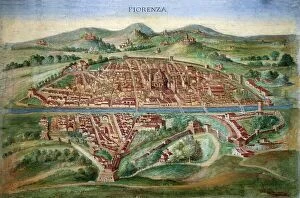
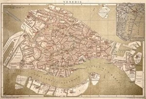
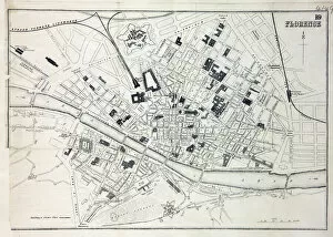
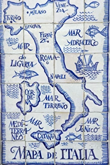
Italy art prints are a collection of high-quality, visually stunning prints that showcase the beauty and history of Italy. These prints feature detailed maps and charts of various regions in Italy, including cities such as Rome, Florence, Venice, and Naples. The artwork is created using advanced printing techniques to ensure that each print captures the intricate details of the original map or chart. The result is a beautiful piece of art that not only looks great on your wall but also provides an educational insight into Italian geography. These art prints are perfect for anyone who loves travel or has an interest in Italian culture. They make excellent gifts for friends or family members who have visited Italy or plan to do so in the future. These Italy art prints offer a unique way to appreciate the beauty and complexity of one of Europe's most fascinating countries.
+
What Italy (Maps and Charts) art prints can I buy from Media Storehouse?
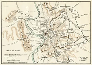
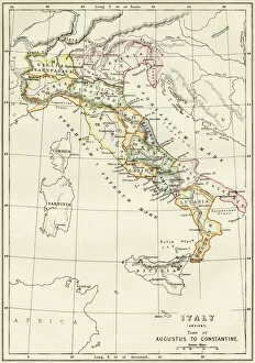
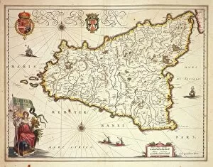
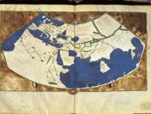
We offer a wide range of Italy art prints that are perfect for adding a touch of Italian charm to your home or office. You can choose from vintage maps, antique charts, and contemporary designs that showcase the beauty and diversity of Italy's landscapes, cities, and regions. Some popular options include detailed maps of Rome, Florence, Venice, Naples, Sicily, Tuscany, and the Amalfi Coast. These prints feature intricate illustrations of famous landmarks such as the Colosseum, St. Peter's Basilica, Ponte Vecchio Bridge or Mount Etna. In addition to city maps you can also find regional maps highlighting areas like Lake Como or Cinque Terre. For those interested in history there are historic charts depicting ancient Roman Empire territories. Whether you're looking for a unique gift or simply want to decorate your own space with beautiful artwork inspired by Italy's rich culture and heritage Media Storehouse has something for everyone.
+
How do I buy Italy (Maps and Charts) art prints?
To purchase Italy art prints from Media Storehouse, you can browse our extensive collection of high-quality prints online. Simply search for the specific print you are looking for or browse through the Italy category to find a selection of maps and charts that capture the beauty and history of this iconic country. Once you have found your desired print, select the size and format that best suits your needs. You can choose from a range of options including framed or unframed prints, canvas wraps, or mounted prints. To complete your purchase, simply add the item to your cart and follow the checkout process. Payment options may vary depending on your location but typically include credit card or PayPal. With our secure online ordering system, you can be confident in purchasing authentic Italy art prints that will make a stunning addition to any home or office decor.
+
How much do Italy (Maps and Charts) art prints cost?
We offer a wide range of Italy art prints at varying prices. Our collection includes vintage maps, contemporary charts, and artistic interpretations of Italy's geography. The cost of each print depends on several factors such as the size, material, and framing options chosen by the customer. We strive to provide affordable yet high-quality art prints that cater to different tastes and preferences. Our selection features various styles ranging from classic black-and-white designs to colorful illustrations that capture the beauty of Italy's landscapes. Whether you're looking for a unique piece to decorate your home or office or searching for a thoughtful gift for someone who loves Italy, our collection has something for everyone. With our easy-to-use website and secure payment system, ordering your favorite Italy art print is just a few clicks away.
+
How will my Italy (Maps and Charts) art prints be delivered to me?
We take pride in delivering your Italy art prints with utmost care. We use high-quality packaging materials to ensure that your print arrives in perfect condition. Your art print will be rolled up carefully and placed inside a sturdy cardboard tube for protection during transit. We work with trusted courier partners who are experienced in handling delicate items like art prints. Once your order is dispatched, you will receive a tracking number so you can monitor the progress of your delivery. Our team also ensures that all necessary customs paperwork is completed accurately and efficiently to avoid any delays or additional charges at the destination country. We understand how important it is for our customers to receive their orders promptly and securely. That's why we strive to provide reliable delivery services that meet our customers' expectations every time.