
Montenegro Collection
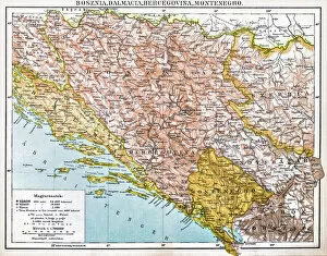
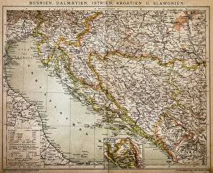
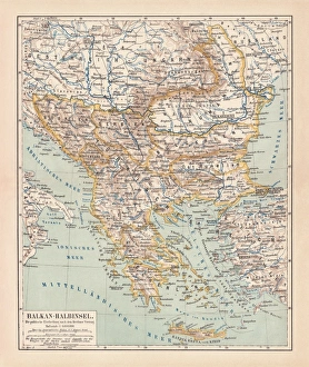
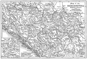
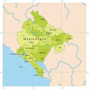
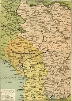
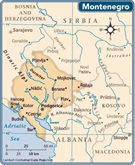
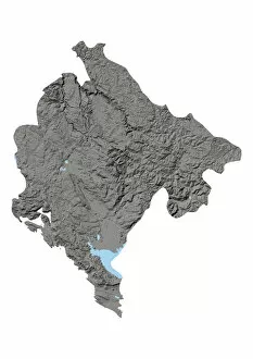
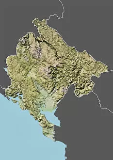
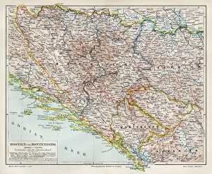
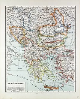
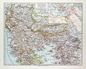
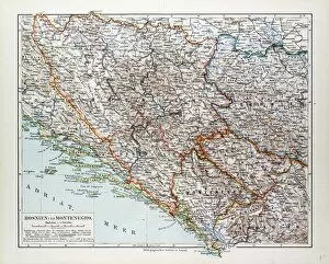
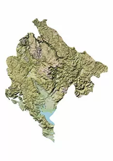
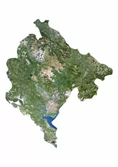
Montenegro is a small country located in Southeastern Europe, bordered by Croatia, Bosnia and Herzegovina, Serbia, Kosovo, and Albania
Choose a picture from our Montenegro Collection for your Wall Art and Photo Gifts
43 items


All Professionally Made to Order for Quick Shipping
-
Montenegro Collection
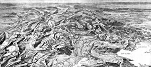
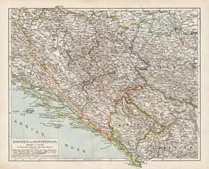
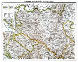
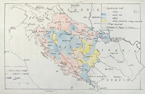
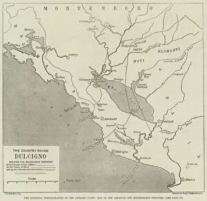
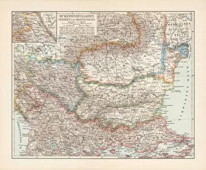
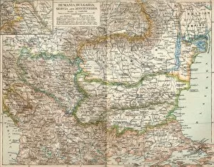
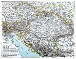
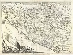
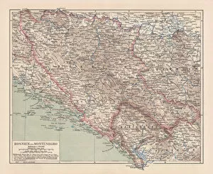
Montenegro is a small country located in Southeastern Europe, bordered by Croatia, Bosnia and Herzegovina, Serbia, Kosovo, and Albania. The country has a population of approximately 620,000 people and covers an area of 13,812 square kilometers. Montenegro's terrain is mostly mountainous with rugged coastlines along the Adriatic Sea. The capital city is Podgorica and the official language is Montenegrin. Tourism plays a significant role in the economy due to its stunning natural beauty and historic landmarks such as Kotor Bay and Durmitor National Park. It also has a developing agricultural sector with production focused on grapes for wine-making and olives for olive oil production.
+
Our beautiful pictures are available as Framed Prints, Photos, Wall Art and Photo Gifts
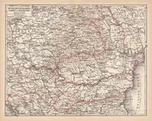
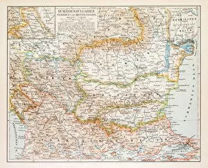
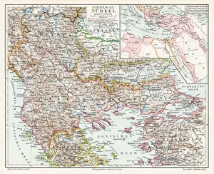
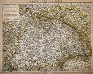
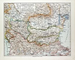
The Montenegro collection from Media Storehouse is a stunning selection of wall art and framed prints that showcase the beauty of this Balkan country. Our collection features vintage maps, charts, and illustrations that depict the geography, history, culture, and landmarks of Montenegro. These high-quality prints are available in various sizes and formats to suit any home or office decor. Our collection includes detailed maps of Montenegro's cities, towns, mountains, rivers, lakes as well as historical maps showing the country's borders over time. There are also beautiful illustrations depicting famous landmarks such as Kotor Bay and Sveti Stefan Island. Additionally, there are nautical charts showcasing the Adriatic Sea coastline around Montenegro. Whether you're a lover of history or just appreciate beautiful artwork inspired by nature's wonders - our collection has something for everyone who wants to bring a piece of Montenegro into their home or workspace.
+
What are Montenegro (Maps and Charts) art prints?
Montenegro art prints are a collection of high-quality, visually stunning prints that showcase the beauty and unique features of Montenegro. These prints feature detailed maps and charts that highlight the geography, topography, and other important aspects of this beautiful country. These art prints are perfect for anyone who loves travel or has an interest in geography. They make great additions to any home or office decor, adding a touch of sophistication and elegance to any space. Whether you're looking for a gift for someone special or simply want to add some visual interest to your own walls, Montenegro art prints from Media Storehouse are an excellent choice. With their exceptional quality and attention to detail, these prints are sure to impress even the most discerning art lover. So why wait? Explore our collection today and discover everything that Montenegro has to offer.
+
What Montenegro (Maps and Charts) art prints can I buy from Media Storehouse?
We offer a wide range of Montenegro art prints in the form of maps and charts. These prints showcase the beautiful landscapes, cities, and coastlines of this stunning country. You can choose from a variety of styles and sizes to suit your preferences. Some popular options include vintage-style maps that highlight the topography and landmarks of Montenegro, as well as colorful charts that depict its coastline and islands. There are also detailed city plans that show the layout of towns like Kotor or Budva. Whether you're looking for a unique piece to decorate your home or office, or simply want to learn more about this fascinating country, we have something for everyone. With high-quality printing on premium materials, these Montenegro art prints are sure to impress anyone who sees them.
+
How do I buy Montenegro (Maps and Charts) art prints?
To purchase Montenegro art prints from Media Storehouse, you can browse our extensive collection of images on their website. Once you have found the print that you like, simply select the size and framing options that suit your preferences. You can choose from a range of materials for framing including wood, metal or canvas. We offer a variety of payment methods to make your purchase easy and convenient. They accept major credit cards as well as PayPal payments. Once your order is confirmed, they will begin processing it immediately. Their high-quality printing process ensures that each print is produced with vibrant colors and sharp details. Whether you are looking for a vintage map or contemporary chart, we have an extensive selection to choose from. Buying Montenegro art prints from Media Storehouse is simple and straightforward. With their wide range of options available at competitive prices, you are sure to find the perfect piece for your home or office décor needs.
+
How much do Montenegro (Maps and Charts) art prints cost?
We offer a wide range of Montenegro art prints that are available at varying prices. Our collection includes high-quality prints featuring detailed maps and charts of the beautiful country of Montenegro. These stunning artworks are perfect for adding a touch of elegance to any living space or office. Our prices vary depending on the size and type of print you choose. We offer both framed and unframed options, so you can select the best option to suit your preferences and budget. Whether you're looking for a small print to hang in your home or a large piece to make an impact in your office, we have something for everyone. All our Montenegro art prints are produced using high-quality materials, ensuring they will stand the test of time. So why not browse our collection today? With such a variety on offer, there's sure to be something that catches your eye.
+
How will my Montenegro (Maps and Charts) art prints be delivered to me?
We take pride in ensuring that our customers receive their Montenegro art prints in the best possible condition. We use high-quality packaging materials to protect your artwork during transit and ensure it arrives at your doorstep intact. Your Montenegro art print will be carefully rolled up and placed inside a sturdy cardboard tube for safe transportation. This method of delivery ensures that your artwork is protected from any potential damage during shipping. Once you receive your package, simply unroll the print and display it as desired. Our team takes great care to ensure that each piece of artwork is printed with precision using high-quality materials to provide you with a stunning finished product. We are committed to providing our customers with exceptional service, which includes delivering their Montenegro art prints safely and securely.