
Norway Collection
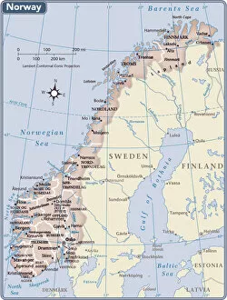
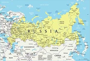
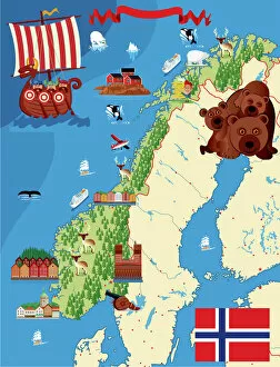
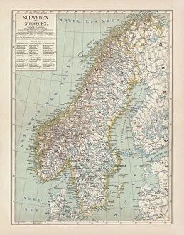
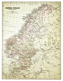
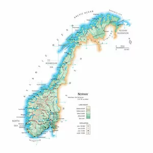
Norway is a country located in Northern Europe, bordered by Sweden, Finland
Choose a picture from our Norway Collection for your Wall Art and Photo Gifts
373 items


All Professionally Made to Order for Quick Shipping
-
Norway Collection
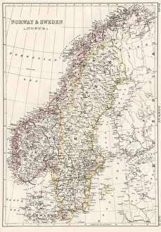
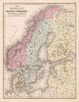
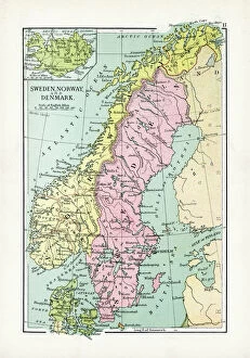
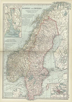
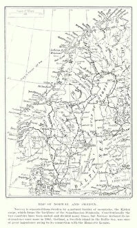
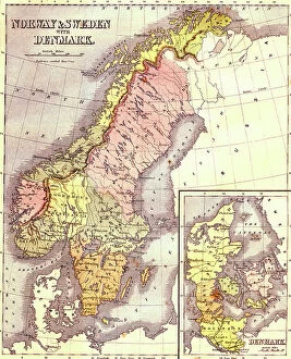
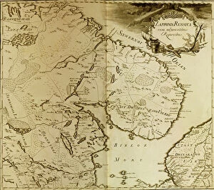
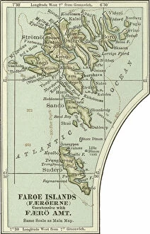
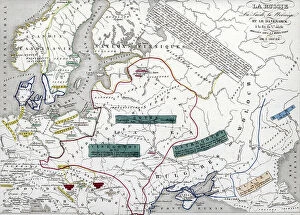
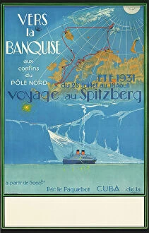
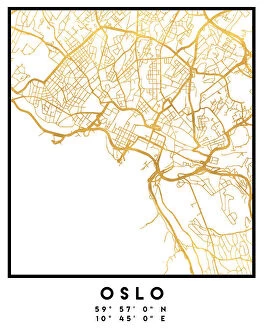
Norway is a country located in Northern Europe, bordered by Sweden, Finland, and Russia and has a population of approximately 5.4 million people and covers an area of 385,207 square kilometers. The country is known for its stunning natural beauty, including fjords, mountains, and glaciers. Norway's economy is highly developed and relies heavily on the exportation of oil and gas as well as fishery products. The capital city is Oslo which has a population of around 700 thousand people. Norway ranks high in terms of quality of life with excellent healthcare services and education systems available to all citizens regardless of their socioeconomic status or background.
+
Our beautiful pictures are available as Framed Prints, Photos, Wall Art and Photo Gifts
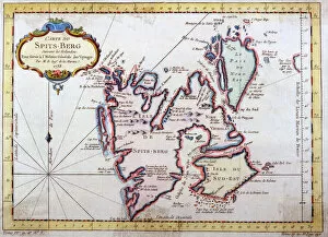
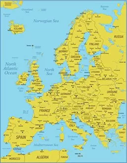
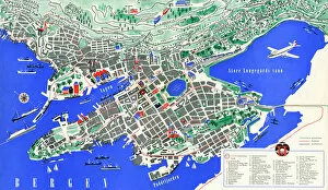
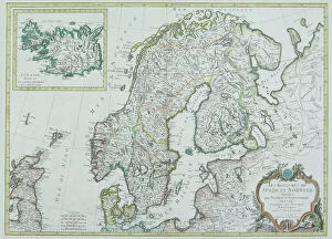
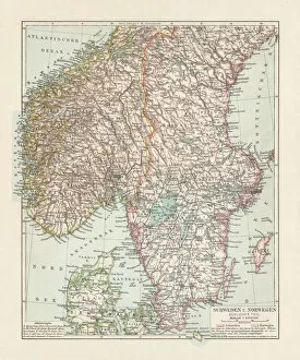
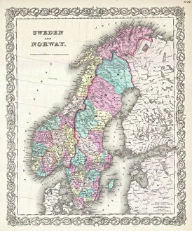
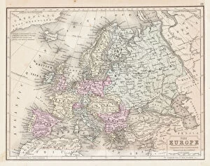
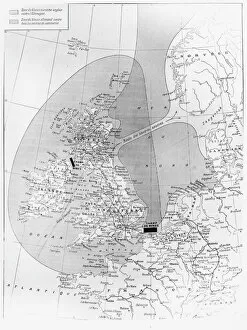
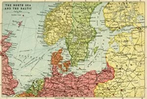
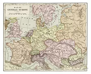
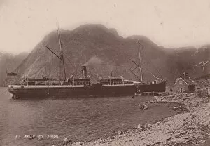
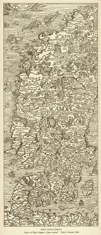
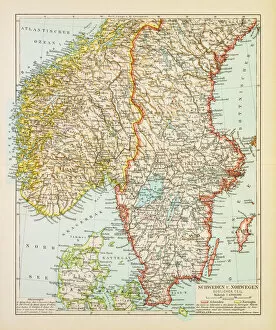
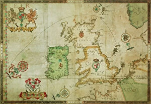
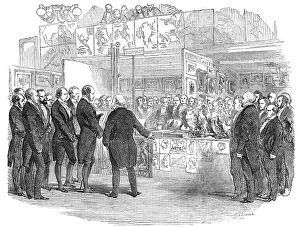
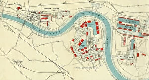
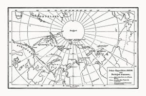
The Norway collection from Media Storehouse is a stunning assortment of wall art and framed prints that showcase the beauty of Norway's landscapes, coastlines, and cities. Our collection features vintage maps, nautical charts, topographic maps, and aerial views of various regions in Norway. These pieces are perfect for anyone who loves geography or has an interest in Norwegian culture. Our collection includes high-quality reproductions of historical maps dating back to the 17th century as well as contemporary designs that capture the country's modernity. Each print is carefully crafted using archival-grade paper and ink to ensure longevity and vibrancy. Whether you're looking to decorate your home or office with beautiful artwork or searching for a unique gift for someone special, the Norway collection from Media Storehouse offers something for everyone. With its diverse range of styles and sizes available at affordable prices, our collection is sure to impress any art lover or history buff.
+
What are Norway (Maps and Charts) art prints?
Norway art prints are a collection of high-quality, visually stunning prints that showcase the beauty and intricacies of Norway's geography. These prints feature detailed maps and charts that highlight the country's diverse landscapes, including its rugged coastlines, majestic fjords, towering mountains, and lush forests. The Norway art print collection is perfect for anyone who loves exploring new places or has an interest in geography. These prints are produced using state-of-the-art printing technology to ensure that every detail is captured with precision. They are available in a range of sizes to suit any space or decor style. Whether you're looking for a statement piece for your living room or office or simply want to add some visual interest to your home decor, these art prints are sure to impress. Norway art prints offer a unique way to appreciate the natural beauty of this incredible country while also adding a touch of sophistication and elegance to any space.
+
What Norway (Maps and Charts) art prints can I buy from Media Storehouse?
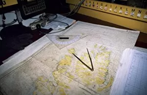
We offer a wide range of Norway maps and charts art prints that are perfect for those who love the beauty of this Scandinavian country. You can choose from a variety of styles, including vintage maps, modern designs, and detailed topographical charts. These prints showcase the stunning landscapes and landmarks of Norway, such as its fjords, mountains, cities, and cultural sites. Some popular options include antique-style maps that show the historical regions or cities of Norway in intricate detail. There are also contemporary designs that feature bold colors and abstract shapes inspired by Norwegian nature or culture. For those interested in outdoor activities like hiking or skiing, there are topographic charts that display elevation levels and terrain features. Whether you're looking to decorate your home with beautiful artwork or want to gift someone who loves travel or geography-related themes, we have plenty of high-quality Norway map and chart art prints to choose from.
+
How do I buy Norway (Maps and Charts) art prints?
To purchase Norway art prints from Media Storehouse, you can browse our extensive collection of prints online. Once you have found the print that you would like to purchase, simply add it to your cart and proceed to checkout. You will be prompted to enter your shipping information and payment details. We offer a variety of sizes for their art prints, so be sure to select the size that best fits your needs. We also offer framing options for an additional fee if you would like your print ready-to-hang upon arrival. When purchasing from Media Storehouse, rest assured that all of their products are high-quality and made with premium materials. Their Norway art prints are no exception - they are printed on archival paper using state-of-the-art printing technology. Buying Norway art prints from Media Storehouse is a simple process that allows you to bring beautiful artwork into your home or office space.
+
How much do Norway (Maps and Charts) art prints cost?
We offer a wide range of Norway Maps and Charts art prints that are available at various prices. Our collection includes high-quality prints featuring detailed maps and charts of the beautiful country of Norway. These prints are perfect for anyone who loves geography or wants to add some unique artwork to their home or office. Our pricing varies depending on the size and type of print you choose. We have options ranging from small posters to large canvas prints, so there is something for every budget. Additionally, our Norway Maps and Charts art prints come in a variety of styles, including vintage maps and modern designs. We take pride in offering affordable yet high-quality art prints that will last for years to come. Whether you're looking for a gift or want to decorate your own space with stunning artwork, our selection of Norway Maps and Charts art prints has something for everyone.
+
How will my Norway (Maps and Charts) art prints be delivered to me?
We understand that receiving your Norway art prints in perfect condition is important to you. That's why we take great care in packaging and delivering your order. Your art prints will be carefully rolled into a sturdy tube for safe transportation. We use high-quality materials to ensure that your artwork arrives undamaged and ready for framing or display. We work with trusted delivery partners who have years of experience in handling delicate items like artwork. They will deliver your package directly to the address you provide during checkout. You can track the progress of your delivery online using the tracking number provided. Once you receive your Norway art prints, we recommend unrolling them immediately and laying them flat on a clean surface to allow any creases from shipping to relax naturally before framing or displaying. If you have any questions about our delivery process, please don't hesitate to contact us.