
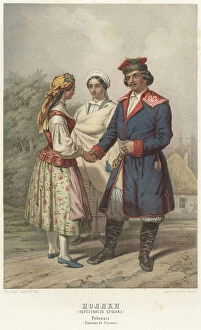
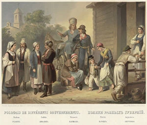
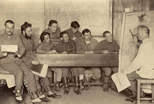
Poland Collection
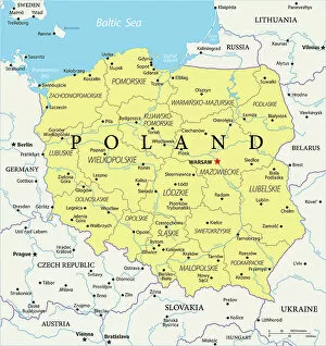
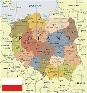
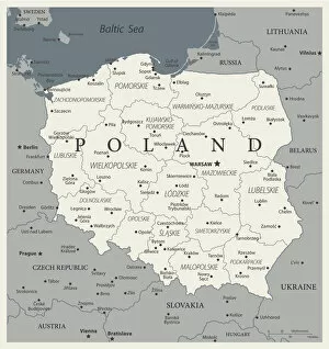
Poland is a country located in Central Europe, bordered by Germany to the west, the Czech Republic and Slovakia to the south, Ukraine and Belarus to the east
Choose a picture from our Poland Collection for your Wall Art and Photo Gifts
303 items
All Professionally Made to Order for Quick Shipping
-
Poland Collection
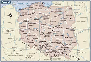
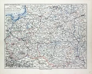
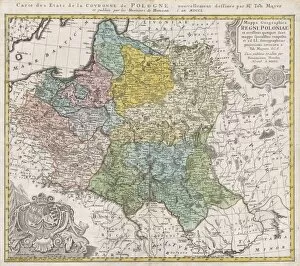
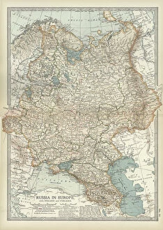
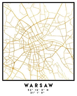
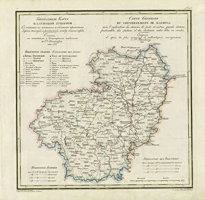
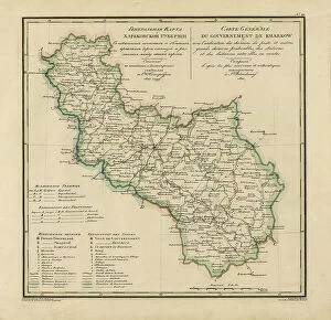
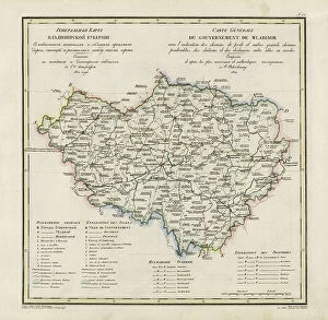
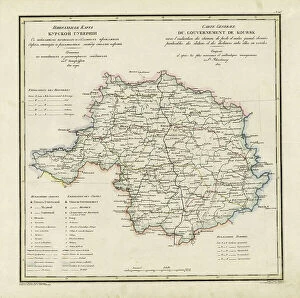
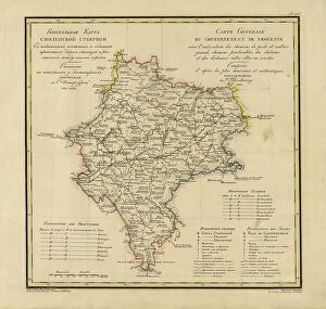
Poland is a country located in Central Europe, bordered by Germany to the west, the Czech Republic and Slovakia to the south, Ukraine and Belarus to the east, and Lithuania and Russia to the northeast. The country has a population of over 38 million people with Warsaw as its capital city. Poland's economy is one of the fastest-growing in Europe due to its skilled workforce, strategic location, and diversified industries such as agriculture, manufacturing, and services. The country also boasts numerous natural attractions including mountains, forests, lakes, rivers which make it an ideal destination for tourists seeking adventure or relaxation. Maps and charts are useful tools for navigating Poland's diverse landscapes while exploring its rich cultural heritage.
+
Our beautiful pictures are available as Framed Prints, Photos, Wall Art and Photo Gifts
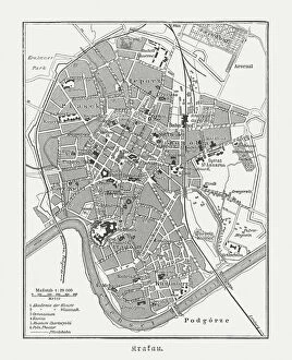
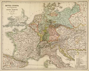
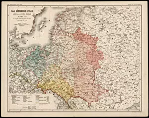
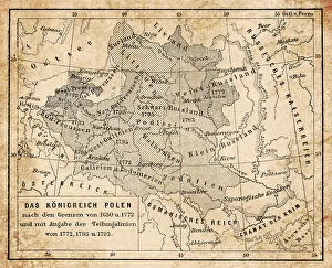
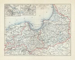
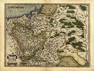
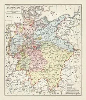
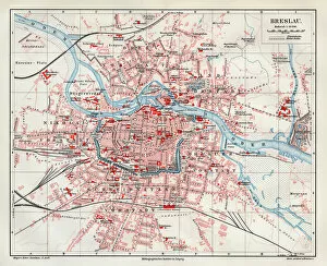
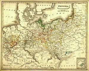
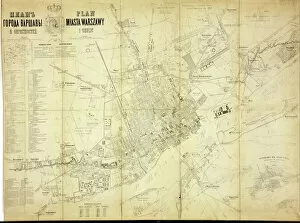
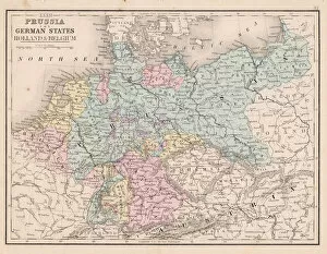
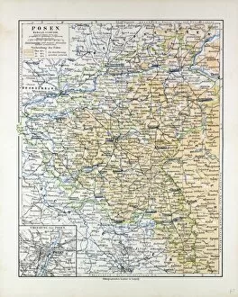
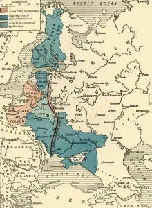
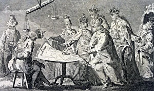
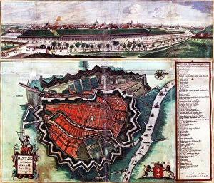
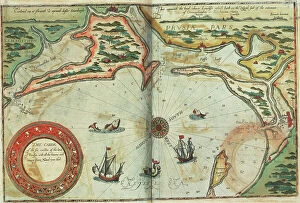
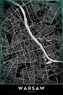
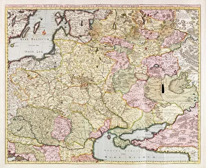
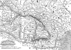
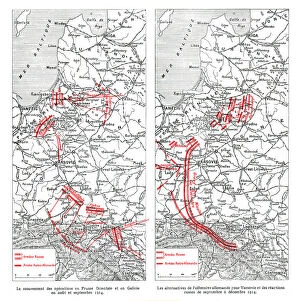
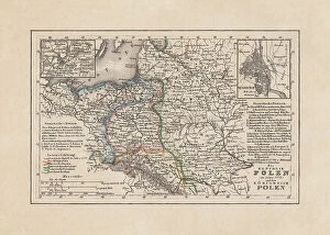
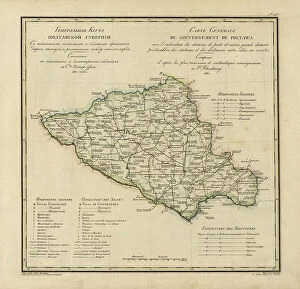
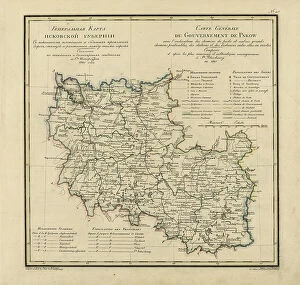
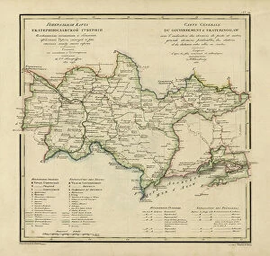
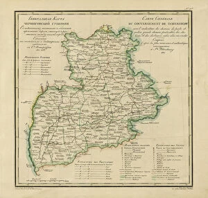
The Poland collection from Media Storehouse is a stunning compilation of vintage maps and charts that showcase the rich history, culture, and geography of Poland. Our collection features a wide range of maps and charts dating back to the 16th century, including detailed topographical maps, city plans, historical maps, and nautical charts. Each map or chart in our collection has been carefully selected for its artistic value as well as its historical significance. They are printed on high-quality paper using state-of-the-art printing technology to ensure that every detail is captured with precision. Whether you're looking to decorate your home or office with unique wall art or searching for an educational resource for students studying Polish history or geography, our collection offers something for everyone. From intricate city plans of Warsaw to colorful regional maps depicting the diverse landscapes of Poland's countryside, these prints are sure to impress anyone who appreciates fine art and cultural heritage.
+
What are Poland (Maps and Charts) art prints?
Poland art prints are a collection of high-quality, visually stunning prints that showcase the beauty and history of Poland. These prints feature detailed maps and charts that depict various regions, cities, landmarks, and historical events in Poland. They are perfect for anyone who loves Polish culture or wants to learn more about this fascinating country. The Poland art prints come in a variety of sizes and styles to suit any taste or decor. Whether you prefer vintage-style maps or modern abstract designs, there is something for everyone in this collection. These art prints are printed on premium quality paper using state-of-the-art printing technology to ensure vibrant colors and sharp details. They make great gifts for friends or family members who have an interest in Polish history or geography. If you're looking for beautiful artwork that celebrates the rich heritage of Poland, then the Poland art print collection is definitely worth checking out.
+
What Poland (Maps and Charts) art prints can I buy from Media Storehouse?
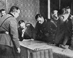
We offer a wide variety of Poland Maps and Charts art prints that are perfect for adding a touch of history and culture to your home or office decor. From vintage maps dating back centuries, to modern-day charts showcasing the country's topography, we have something for everyone. Some popular options include antique maps featuring the cities of Warsaw and Krakow, as well as detailed charts highlighting the natural beauty of Poland's forests, lakes, and mountains. Additionally, there are prints available that showcase important moments in Polish history such as the Battle of Grunwald or the Solidarity movement. Whether you're looking to add some historical flair to your living room or want to show off your love for all things Polish in your office space, we have plenty of options available. With high-quality printing techniques used on premium materials like fine art paper or canvas, these prints will be sure to impress anyone who sees them.
+
How do I buy Poland (Maps and Charts) art prints?
To purchase Poland art prints from Media Storehouse, you can browse our extensive collection of high-quality images online. Once you have found the print that you would like to purchase, simply select the size and framing options that suit your needs. We offer a range of different sizes for their art prints, so you can choose the perfect dimensions for your space. We also offer a variety of framing options to complement your decor style. Once you have made your selections, add the item to your cart and proceed to checkout. You will be prompted to enter your shipping information and payment details before completing your order. Buying Poland art prints from Media Storehouse is a simple process that allows you to bring beautiful artwork into your home or office with ease.
+
How much do Poland (Maps and Charts) art prints cost?
We offer a wide range of Poland art prints at varying prices. Our collection includes high-quality reproductions of vintage maps and charts that showcase the rich history and culture of Poland. The cost of each print depends on factors such as size, framing options, and printing materials. We take pride in providing our customers with affordable yet premium-quality art prints that are perfect for home or office decor. Whether you're looking to add a touch of elegance to your living space or want to give a unique gift to someone special, our Poland art prints are an excellent choice. Our team is committed to delivering exceptional customer service and ensuring that every purchase meets your expectations. So if you're interested in purchasing one of our beautiful Poland art prints, please browse through our collection today.
+
How will my Poland (Maps and Charts) art prints be delivered to me?
We take great care in delivering your Poland art prints to you. We use high-quality packaging materials to ensure that your print is protected during transit. Depending on the size of your order, we may ship it flat or rolled in a sturdy tube. When you receive your package, please inspect it carefully for any damage that may have occurred during shipping. If there are any issues with your order, please contact us immediately so we can assist you. We offer worldwide delivery options for our customers' convenience. Our team works hard to ensure that all orders are processed and shipped as quickly as possible. Please note that delivery times may vary depending on the destination country and shipping method selected at checkout. We hope you enjoy displaying your Poland art prints in your home or office.