
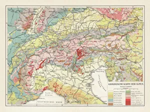
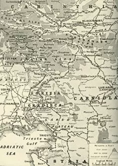
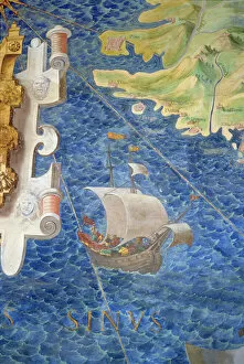
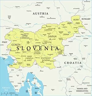
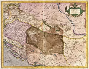
Slovenia Collection
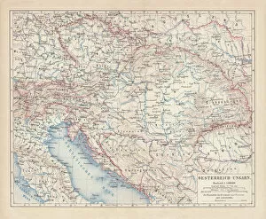
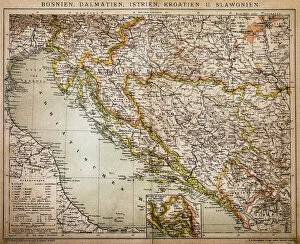
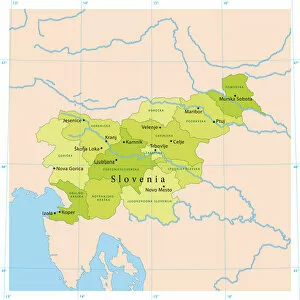
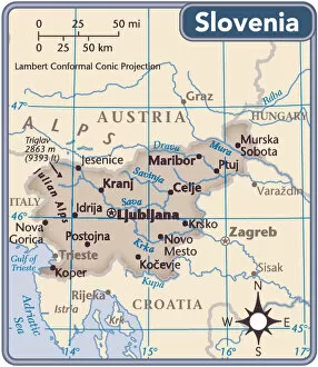
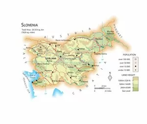
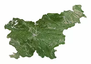
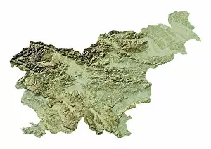
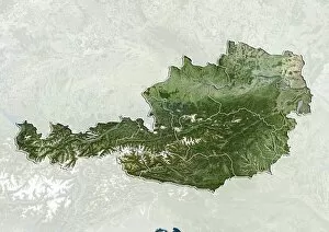
Slovenia is a small country located in Central Europe, bordered by Italy to the west, Austria to the north
Choose a picture from our Slovenia Collection for your Wall Art and Photo Gifts
30 items
All Professionally Made to Order for Quick Shipping
-
Slovenia Collection
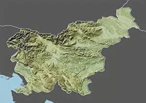
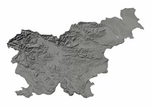
Slovenia is a small country located in Central Europe, bordered by Italy to the west, Austria to the north, Hungary to the northeast and Croatia to the south and southeast. The country has a population of approximately 2 million people and covers an area of 20,273 square kilometers. Slovenia's landscape is diverse with mountains, forests, lakes and rivers making up much of its terrain. The capital city is Ljubljana which lies at the center of Slovenia. The country has a strong economy based on manufacturing industries such as automotive parts production, pharmaceuticals and electronics. Slovenian culture is rich in tradition with folk music and dance being popular forms of expression among its people.
+
Our beautiful pictures are available as Framed Prints, Photos, Wall Art and Photo Gifts
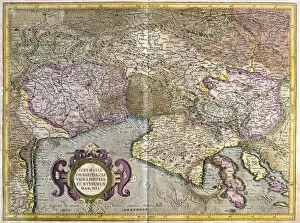
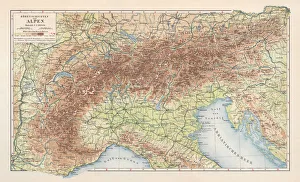
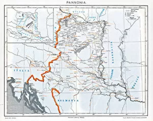
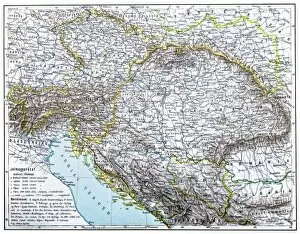
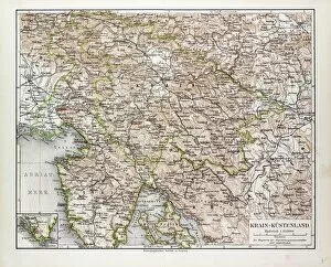
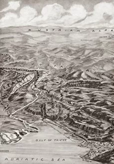
The Slovenia collection from Media Storehouse is a stunning assortment of wall art and framed prints that showcase the beautiful country of Slovenia. Our collection includes an array of maps, charts, and illustrations that capture the unique geography, culture, and history of this charming European nation. From detailed topographical maps to vintage travel posters, our collection offers something for everyone who loves Slovenia or wants to learn more about it. The artwork is printed on high-quality paper using state-of-the-art printing techniques to ensure vibrant colors and crisp details. Whether you're looking for a piece to decorate your home or office or searching for a thoughtful gift for someone who loves Slovenia, the Maps and Charts collection from Media Storehouse has plenty of options to choose from. With its diverse range of styles and sizes, our collection is sure to delight anyone with an appreciation for Slovenian culture and natural beauty.
+
What are Slovenia (Maps and Charts) art prints?
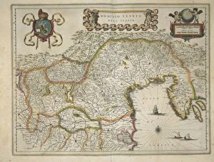
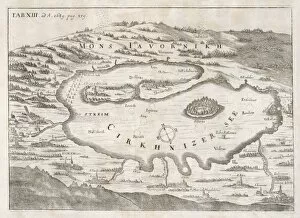
Slovenia art prints are high-quality reproductions of vintage maps and charts depicting the geography, topography, and history of Slovenia. These prints showcase the intricate details of Slovenia's landscapes, including its mountains, rivers, lakes, forests, cities, towns and villages. They also feature historical landmarks such as castles, churches and monuments that have shaped the country's rich cultural heritage. These art prints are perfect for anyone interested in Slovenian culture or history. They make great decorative pieces for homes or offices with a travel theme or those looking to add a touch of sophistication to their living spaces. The Maps and Charts collection offers a wide range of sizes to fit any space from small rooms to large hallways. Media Storehouse is proud to offer these beautiful art prints at affordable prices without compromising on quality. Each print is carefully crafted using premium materials ensuring they will last for years to come.
+
What Slovenia (Maps and Charts) art prints can I buy from Media Storehouse?
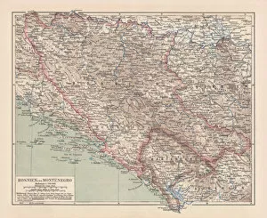
We offer a wide range of Slovenia art prints, including maps and charts. These prints showcase the stunning landscapes, architecture, and culture of this beautiful country. You can choose from a variety of styles and sizes to suit your preferences. One popular option is the vintage map print of Slovenia, which features intricate details and historical information about the country's regions and cities. Another great choice is the panoramic view of Lake Bled with its iconic island church and surrounding mountains. For those interested in Slovenian culture, there are also prints featuring traditional costumes, folk dances, and festivals. Additionally, you can find artistic interpretations of famous landmarks such as Ljubljana Castle or Predjama Castle. Whether you're looking for a unique piece to decorate your home or office or searching for a special gift for someone who loves Slovenia, we have plenty of options to choose from.
+
How do I buy Slovenia (Maps and Charts) art prints?
To buy Slovenia maps and charts art prints from Media Storehouse, you can browse our extensive collection of artwork online. You can search for specific keywords such as "Slovenia maps" or "Slovenia charts" to narrow down your options. Once you have found a print that you like, simply add it to your cart and proceed to checkout. We offer a variety of sizes and framing options for their prints, so be sure to select the one that best suits your needs. We also offer different paper types, including fine art paper and photographic paper. When purchasing from Media Storehouse, you can rest assured that you are getting high-quality artwork printed on premium materials. Their prints are perfect for adding a touch of sophistication to any room in your home or office. Buying Slovenia maps and charts art prints from Media Storehouse is an easy process that allows you to bring beautiful artwork into your life with just a few clicks of a button.
+
How much do Slovenia (Maps and Charts) art prints cost?
We offer a wide range of Slovenia maps and charts art prints at varying prices. Our collection includes high-quality prints featuring detailed maps and charts of Slovenia's regions, cities, landmarks, and natural wonders. The cost of our Slovenia art prints depends on the size and type of print you choose. We offer different sizes ranging from small to large format prints that can fit any space in your home or office. Our standard paper prints are affordable options for those who want to display their love for Slovenia without breaking the bank. For those looking for a more premium option, we also have canvas prints that provide a textured finish to your chosen artwork. No matter what type of print you choose, each one is produced using state-of-the-art printing technology to ensure exceptional quality and durability. With our vast selection of Slovenia maps and charts art prints available at various price points, there is something for everyone's budget at Media Storehouse.
+
How will my Slovenia (Maps and Charts) art prints be delivered to me?
We take pride in delivering your Slovenia art prints with the utmost care. Your order will be carefully packaged to ensure that it arrives at your doorstep in perfect condition. We use high-quality materials to protect your print during transit, including sturdy cardboard tubes for rolled prints and protective envelopes for flat-packed items. All of our deliveries are made through trusted courier services to ensure a safe and timely arrival. You can track your order online using the tracking number provided once your item has been dispatched. We understand how important it is for you to receive your artwork promptly, which is why we strive to dispatch all orders as quickly as possible. Once dispatched, delivery times may vary depending on your location. Rest assured that when you purchase from Media Storehouse, you can expect a hassle-free delivery experience that prioritizes the safety of your artwork above all else.