
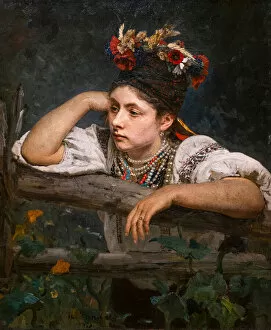
Ukraine Collection
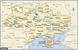
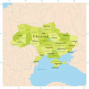
Ukraine is a country located in Eastern Europe, bordered by Russia to the east and northeast, Belarus to the north, Poland, Slovakia and Hungary to the west
Choose a picture from our Ukraine Collection for your Wall Art and Photo Gifts
198 items


All Professionally Made to Order for Quick Shipping
-
Ukraine Collection
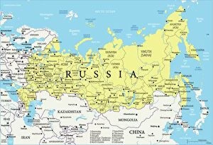
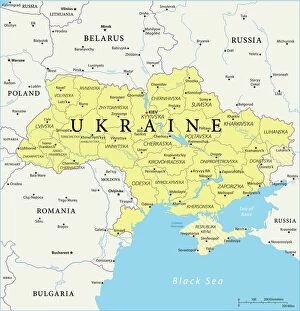
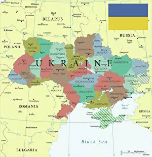
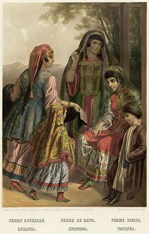
Ukraine is a country located in Eastern Europe, bordered by Russia to the east and northeast, Belarus to the north, Poland, Slovakia and Hungary to the west, and Romania and Moldova to the southwest and has an area of 603,628 square kilometers with a population of approximately 42 million people. The capital city is Kyiv (Kiev) which is also its largest city. Ukraine's economy relies heavily on agriculture as it has some of the most fertile soil in Europe. Other major industries include metallurgy, energy production, chemicals and machinery manufacturing. Ukraine has been facing political instability since 2014 due to conflict with Russia over Crimea annexation leading to economic sanctions imposed by Western countries against Russia affecting Ukrainian economy adversely.
+
Our beautiful pictures are available as Framed Prints, Photos, Wall Art and Photo Gifts
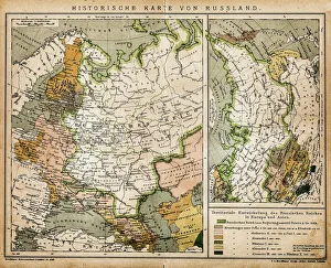
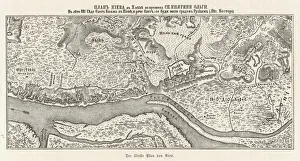
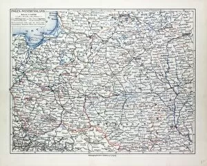
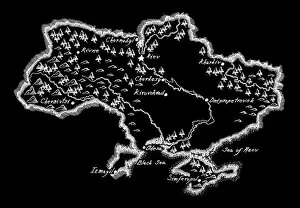
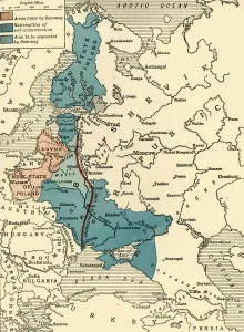
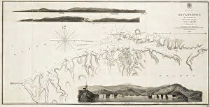
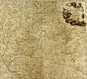
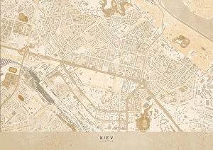
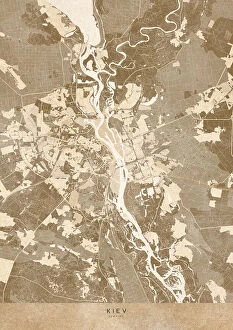
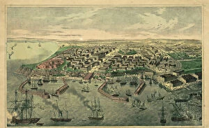
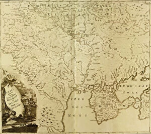
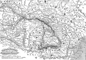
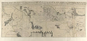
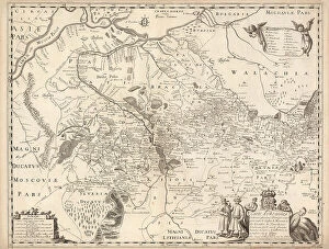
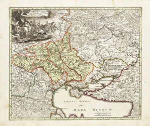
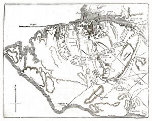
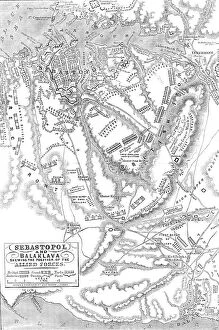
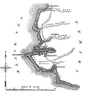
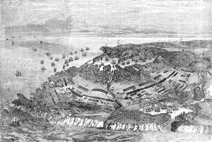
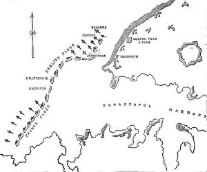
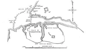
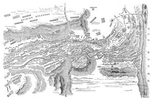
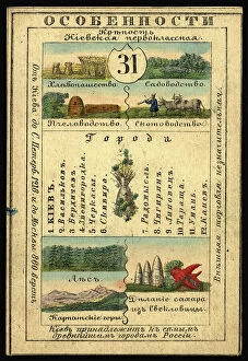
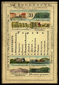
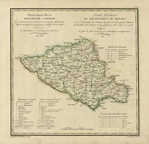
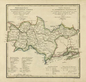
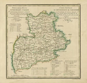
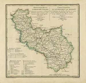
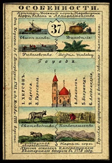
The Ukraine collection from Media Storehouse is a stunning compilation of historical maps and charts that depict the geography, topography, and political boundaries of Ukraine. Our collection features a wide range of maps dating back to the 16th century, including antique atlases, city plans, military maps, and nautical charts. These beautiful prints are perfect for anyone interested in Ukrainian history or geography. They make great wall art for homes or offices and can be framed to suit any decor style. Our collection includes detailed depictions of major cities like Kiev and Odessa as well as regional maps showing the country's diverse landscapes. Whether you're an avid collector or simply looking for a unique piece of artwork to add to your home or office decor, the Ukraine collection from Media Storehouse is sure to impress. With its rich history and stunning visuals, our collection offers something for everyone who loves Ukrainian culture.
+
What are Ukraine (Maps and Charts) art prints?
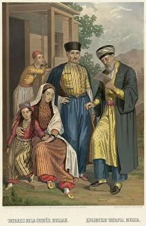
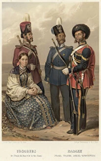
Ukraine art prints are high-quality reproductions of maps and charts depicting the geography, topography, and history of Ukraine. These prints showcase the intricate details of Ukraine's landscape, including its rivers, mountains, cities, and borders. They also highlight important historical events such as battles and political changes that have shaped the country over time. These art prints are perfect for anyone interested in Ukrainian culture or history. They can be used to decorate homes or offices with a unique touch that celebrates this fascinating country's past and present. The maps and charts featured in these prints are carefully selected by Media Storehouse to ensure accuracy and quality. Whether you're a collector looking for rare pieces or simply want to add some cultural flair to your decor, Ukraine art prints offer something special for everyone. With their stunning visuals and rich historical context, they make excellent conversation starters that will impress guests while showcasing your love for all things Ukrainian.
+
What Ukraine (Maps and Charts) art prints can I buy from Media Storehouse?
We offer a wide range of Ukraine maps and charts art prints that are perfect for those who love geography, history, or simply want to decorate their homes with unique pieces. You can find vintage maps of Ukraine from different periods in history, including the Soviet era and pre-World War II times. These maps showcase the country's borders, cities, rivers, and other landmarks. In addition to traditional maps, Media Storehouse also has artistic renditions of Ukraine's landscapes and cityscapes. These prints feature stunning views of Kiev's skyline at night or Lviv's charming streets lined with colorful buildings. They capture the essence of Ukrainian culture through vibrant colors and intricate details. Whether you're looking for educational or decorative purposes, we have something for everyone interested in Ukraine's rich history and geography. With high-quality printing techniques on premium paper stock options available too.
+
How do I buy Ukraine (Maps and Charts) art prints?
To purchase Ukraine art prints from Media Storehouse, you can browse our extensive collection of high-quality images online. Once you have found the print that you would like to buy, simply add it to your cart and proceed to checkout. During the checkout process, you will be prompted to enter your shipping and payment information. We offer a variety of sizes and framing options for their prints, so be sure to select the one that best suits your needs. We also offer a range of paper types, including fine art paper for a more traditional look or poster paper for a more affordable option. Once your order is placed, Media Storehouse will carefully package and ship your print directly to you. Whether you are looking for a unique piece of wall art or a thoughtful gift for someone special, buying Ukraine art prints from Media Storehouse is easy and convenient.
+
How much do Ukraine (Maps and Charts) art prints cost?
We offer a wide range of Ukraine maps and charts art prints that are available at varying prices. Our collection includes high-quality prints featuring different regions and cities in Ukraine, as well as historical maps and charts. The cost of our Ukraine maps and charts art prints depends on several factors such as the size of the print, the type of paper used, and whether it is framed or unframed. We offer a variety of sizes ranging from small to large to cater to different preferences. Our art prints are produced using state-of-the-art printing technology which ensures that they have vibrant colors and sharp details. Whether you're looking for a unique piece to add to your home decor or an educational tool for your classroom or office space, our Ukraine maps and charts art prints are sure to impress. We strive to provide affordable yet high-quality products that meet the needs of our customers.
+
How will my Ukraine (Maps and Charts) art prints be delivered to me?
We take great care in ensuring that your Ukraine art prints are delivered to you safely and securely. We use high-quality packaging materials to protect your artwork during transit, so it arrives at your doorstep in pristine condition. Your art prints will be carefully rolled up and placed inside a sturdy cardboard tube for shipping. This ensures that the print remains flat and undamaged during transport. The tube is then sealed with tape to prevent any moisture or dust from entering. Once your order has been dispatched, you will receive an email notification with tracking information so you can monitor its progress until it reaches you. We work with trusted delivery partners who have a proven track record of delivering packages on time and without damage. We understand how important it is for our customers to receive their orders quickly, which is why we strive to dispatch all orders as soon as possible after they are received.