
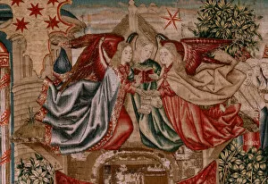
Maps Collection
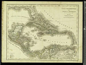
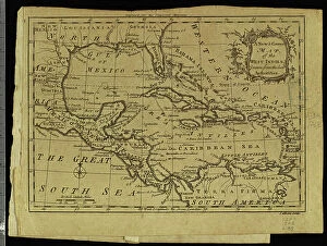
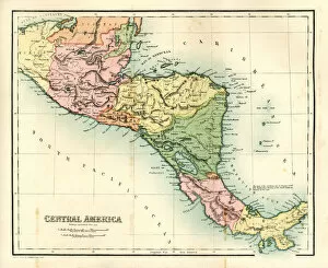
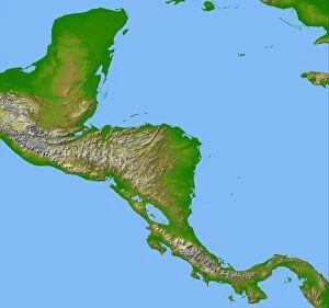
El Salvador is a small country located in Central America
Choose a picture from our Maps Collection for your Wall Art and Photo Gifts
37 items

All Professionally Made to Order for Quick Shipping
-
Maps Collection
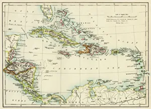
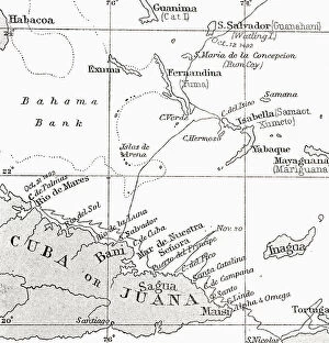
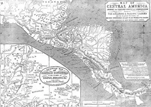
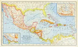
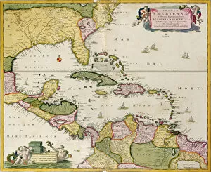
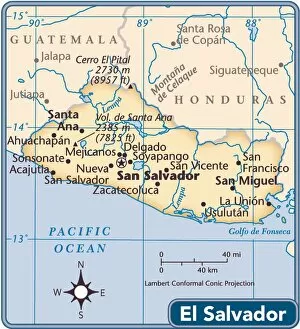
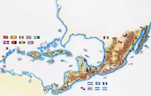
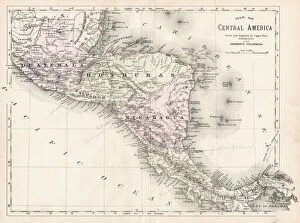
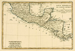
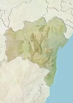
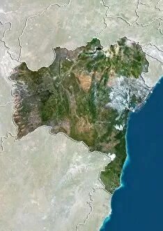
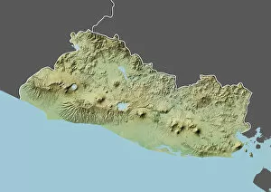
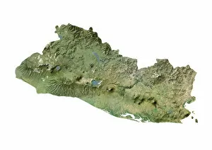
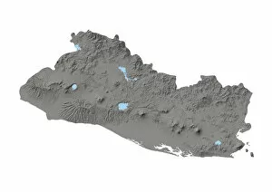
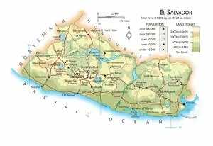
El Salvador is a small country located in Central America, bordered by Guatemala to the west and Honduras to the north and east and has a population of approximately 6.3 million people, making it the most densely populated country in Central America. Maps of El Salvador North America show its location relative to other countries in the region, as well as its physical features such as mountains, rivers and lakes. they also show major cities such as San Salvador, Santa Ana and San Miguel; important roads; national parks; airports; ports; archaeological sites; and other points of interest. Additionally, they provide information on climate zones, vegetation types and population density across El Salvador's territory. Maps of El Salvador North America are essential for anyone travelling or doing business in this beautiful country.
+
Our beautiful pictures are available as Framed Prints, Photos, Wall Art and Photo Gifts
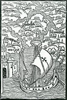
The Maps of El Salvador North America collection from Media Storehouse is a stunning compilation of vintage and contemporary maps that showcase the beauty and history of this Central American country. Our collection features an array of colorful, detailed maps that depict various regions, cities, and landmarks in El Salvador. From antique hand-drawn maps to modern satellite imagery, each piece offers a unique perspective on the country's geography and culture. These high-quality prints are perfect for anyone who loves travel or has an interest in cartography. They make great wall art for homes, offices, or classrooms and can be framed to suit any decor style. Whether you're looking for a gift for someone special or want to add some visual interest to your own space, the Maps of El Salvador North America collection is sure to impress. With its wide selection of maps and affordable prices, it's easy to find something that suits your taste and budget.
+
What are Maps of El Salvador North America art prints?
Maps of El Salvador North America art prints are high-quality reproductions of maps that depict the geography, topography, and political boundaries of El Salvador. These prints are created using advanced printing technology and archival-grade materials to ensure their longevity and durability. These maps provide a detailed view of the landscape and terrain of El Salvador, including its rivers, mountains, forests, and cities. They also show important landmarks such as national parks, historical sites, and cultural attractions. Maps of El Salvador North America art prints can be used for educational purposes in schools or universities or as decorative pieces in homes or offices. We offer a unique way to explore the beauty and complexity of this Central American country while providing valuable information about its history and culture. Whether you're an avid traveler looking to commemorate your trip to El Salvador or simply interested in learning more about this fascinating country, Maps of El Salvador North America art prints are an excellent choice for anyone seeking a beautiful and informative piece of wall décor.
+
What Maps of El Salvador North America art prints can I buy from Media Storehouse?
We offer a wide range of Maps of El Salvador North America art prints that you can purchase. These maps are available in various sizes and styles, including vintage, antique, and modern designs. You can choose from different types of maps such as political maps, topographical maps, roadmaps, and more. These art prints feature detailed cartography with accurate depictions of the country's geography, landmarks, cities and towns. They also showcase the cultural heritage of El Salvador through its indigenous communities' artwork. Whether you're looking for a unique gift or want to decorate your home or office space with something meaningful and informative about this Central American nation; Media Storehouse has got you covered. With their vast collection of Maps of El Salvador North America art prints available online at your convenience - it's easy to find the perfect piece that suits your style preferences.
+
How do I buy Maps of El Salvador North America art prints?
To buy Maps of El Salvador North America art prints from Media Storehouse, you can follow a few simple steps. Firstly, visit the Media Storehouse website and search for "Maps of El Salvador North America" in the search bar. This will bring up a range of options to choose from. Once you have found the print that you like, select it and proceed to checkout. You will be prompted to enter your shipping details and payment information. We offer various payment methods such as credit card, PayPal or Amazon Pay so choose whichever is most convenient for you. After completing your purchase, your Maps of El Salvador North America art print will be shipped directly to your chosen address within an estimated timeframe provided by Media Storehouse. Buying Maps of El Salvador North America art prints from Media Storehouse is a straightforward process that can be completed online with ease.
+
How much do Maps of El Salvador North America art prints cost?
The cost of Maps of El Salvador North America art prints varies depending on the size, material, and framing options selected. We offer a wide range of high-quality prints that can fit any budget. You can choose from different sizes ranging from small to large and select their preferred paper type such as matte or glossy. Additionally, they have the option to add a frame to their print for an extra fee. We provide affordable prices without compromising quality. Our collection includes unique and stunning maps that capture the beauty of El Salvador's landscape in North America. These prints make great gifts for anyone who loves geography or wants to decorate their home with beautiful artwork. You can expect reasonable prices for Maps of El Salvador North America art prints at Media Storehouse while still receiving excellent quality products that will last for years to come.
+
How will my Maps of El Salvador North America art prints be delivered to me?
Your Maps of El Salvador North America art prints will be delivered to you through a reliable and secure shipping service. The company takes great care in ensuring that your order is packaged properly to prevent any damage during transit. Your prints will be carefully rolled and placed inside a sturdy tube for protection. The delivery process may vary depending on your location, but rest assured that Media Storehouse works with trusted carriers to ensure timely and safe delivery of your order. You can track the progress of your shipment using the tracking number provided by the carrier. Upon receiving your package, it is recommended that you inspect the contents for any signs of damage before opening it. If there are any issues with your order, please contact customer support immediately so they can assist you in resolving the problem. You can expect a hassle-free delivery experience when ordering Maps of El Salvador North America art prints from Media Storehouse.