
Maps Collection
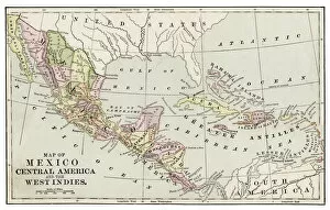
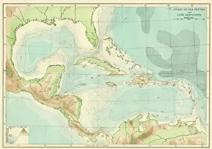
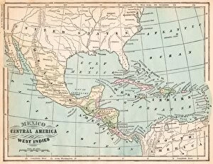
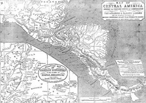
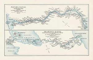
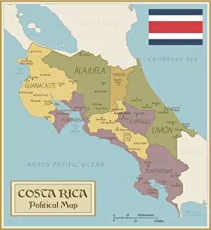
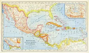
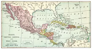
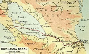
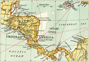
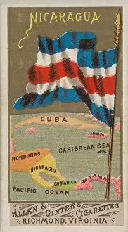
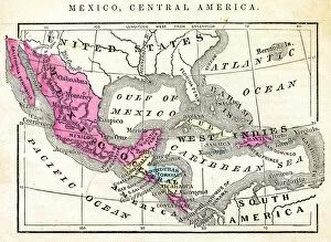
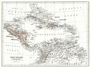
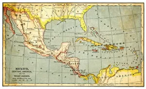
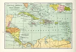
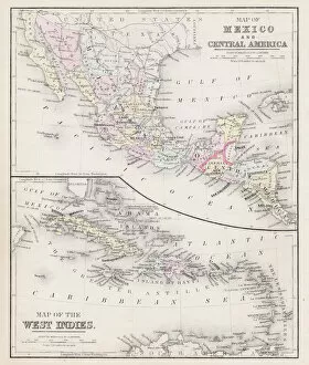
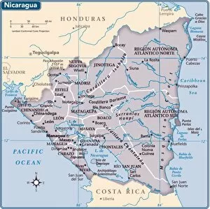
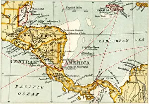
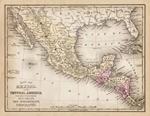
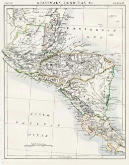
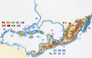
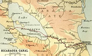
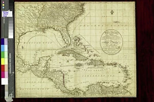
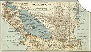
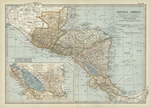
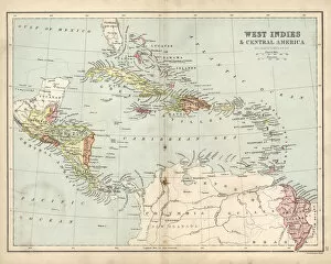
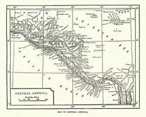
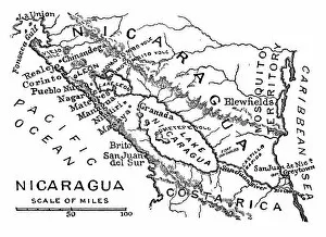
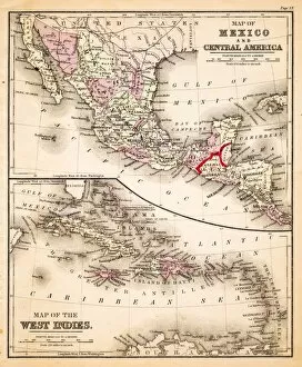
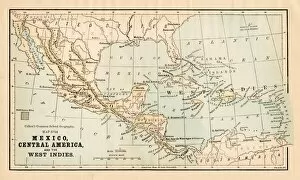
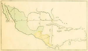
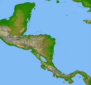
Nicaragua is a country in Central America, bordered by Honduras to the north and Costa Rica to the south
Choose a picture from our Maps Collection for your Wall Art and Photo Gifts
54 items
All Professionally Made to Order for Quick Shipping
-
Maps Collection
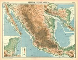
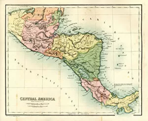
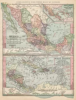
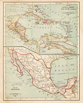
Nicaragua is a country in Central America, bordered by Honduras to the north and Costa Rica to the south, and is located between 11° and 15°N latitude and 85° and 92°W longitude. Nicaragua covers an area of 50,193 square miles (129,494 sq km). The terrain of Nicaragua consists mainly of coastal plains in the west, mountains in the interior, and two large lakes: Lake Managua (also known as Lake Xolotlan) and Lake Nicaragua. The capital city is Managua. The population of Nicaragua is estimated at 6 million people with a majority living in rural areas. The official language is Spanish although many indigenous languages are still spoken by some communities. Agriculture remains an important sector for economic growth with coffee being one of the main exports from this region.
+
Our beautiful pictures are available as Framed Prints, Photos, Wall Art and Photo Gifts
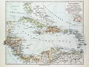
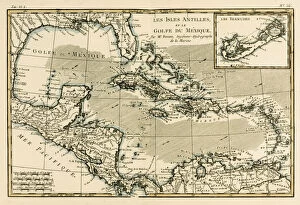
The Maps of Nicaragua North America collection from Media Storehouse offers a stunning range of wall art and framed prints that showcase the intricate cartography of Nicaragua. Our collection features an array of maps, ranging from historical depictions to modern interpretations, highlighting the country's geography and topography. The maps are beautifully rendered with vibrant colors and intricate details, making them perfect for adding a touch of sophistication to any room. Whether you're looking for a unique piece to add to your home decor or seeking an educational tool for students studying Nicaraguan history or geography, our collection has something for everyone. These high-quality prints are available in various sizes and framing options, ensuring that they fit seamlessly into any space. The Maps of Nicaragua North America collection is an excellent choice for anyone interested in exploring the rich history and culture of this beautiful Central American country through its cartography.
+
What are Maps of Nicaragua North America art prints?
Maps of Nicaragua North America art prints are high-quality reproductions of vintage and contemporary maps that depict the geography, topography, and landmarks of Nicaragua. These prints showcase the intricate details of Nicaraguan cities, towns, rivers, mountains, and other natural features in a visually appealing way. They are perfect for those who love history or geography or want to add an artistic touch to their home decor. These art prints come in various sizes and styles to suit different preferences. Some feature colorful illustrations while others have a more traditional look with black-and-white designs. Regardless of the style chosen, these maps offer a unique perspective on Nicaragua's past and present. Whether you're looking for a gift for someone who loves travel or simply want to decorate your own space with something meaningful and beautiful, Maps of Nicaragua North America art prints are an excellent choice.
+
What Maps of Nicaragua North America art prints can I buy from Media Storehouse?
We offer a wide range of Maps of Nicaragua North America art prints for purchase. These prints are perfect for those who love to explore and learn about the geography, history, and culture of this beautiful country. The collection includes vintage maps that showcase the various regions, cities, rivers, lakes, mountains, and other landmarks in Nicaragua. You can also find topographical maps that provide detailed information on the terrain and elevation levels across the country. In addition to traditional paper prints, we offer canvas prints that add an artistic touch to your home or office decor. These high-quality reproductions are printed using archival inks that ensure long-lasting color vibrancy and sharpness. Whether you're looking for a unique gift or want to enhance your personal collection of wall art, we have something for everyone interested in Maps of Nicaragua North America art prints.
+
How do I buy Maps of Nicaragua North America art prints?
To buy Maps of Nicaragua North America art prints from Media Storehouse, you can browse our online collection of artwork and select the print that catches your eye. Once you have found the desired map, click on it to view its details and choose the size and format that suits your needs. You can then add it to your cart and proceed to checkout. We offer a variety of payment options, including credit card payments through secure gateways. After completing your purchase, you will receive an order confirmation email with details about your order. If you encounter any issues during the purchasing process or have questions about their products or services, We provide customer support via phone or email. They are committed to providing high-quality products and excellent customer service to ensure a smooth buying experience for all customers.
+
How much do Maps of Nicaragua North America art prints cost?
We offer a wide range of Maps of Nicaragua North America art prints at varying prices. The cost depends on the size, quality, and type of print you choose. You can select from different sizes such as small, medium or large to fit your budget and preference. Additionally, there are various printing options available including canvas prints, framed prints or unframed prints. The price for each print is determined by the materials used in production and the complexity of the design. Some designs may be more intricate than others which could affect the overall cost. However, Media Storehouse ensures that all their products are reasonably priced without compromising on quality. If you're looking for high-quality Maps of Nicaragua North America art prints that will add character to your home or office space then Media Storehouse has got you covered with a variety of affordable options to choose from.
+
How will my Maps of Nicaragua North America art prints be delivered to me?
Your Maps of Nicaragua North America art prints will be delivered to you in a safe and secure manner. The prints are carefully packaged to ensure that they arrive at your doorstep without any damage. Media Storehouse uses high-quality packaging materials such as cardboard tubes, bubble wrap, and sturdy boxes to protect the artwork during transit. The delivery method used by Media Storehouse depends on your location and the size of the print. Small prints may be shipped via standard mail while larger ones require special handling and may be sent through a courier service. Once your order is processed, you will receive an email confirmation with tracking information so that you can monitor its progress until it arrives at your address. If there are any issues or concerns regarding the delivery of your Maps of Nicaragua North America art prints, please do not hesitate to contact customer support for assistance.