
Maps Collection
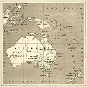
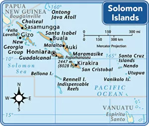
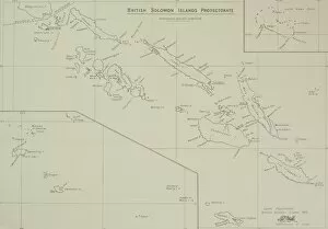
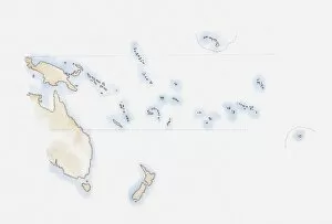
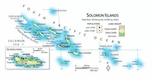
The Solomon Islands are a nation of islands located in the South Pacific Ocean, east of Papua New Guinea
Choose a picture from our Maps Collection for your Wall Art and Photo Gifts
14 items

All Professionally Made to Order for Quick Shipping
-
Maps Collection
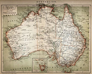
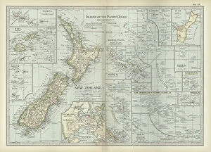
The Solomon Islands are a nation of islands located in the South Pacific Ocean, east of Papua New Guinea. The archipelago consists of six major islands and over 900 smaller ones. Maps ofprovide an overview of the country's geography, showing its capital city Honiara, as well as its many bays, rivers and other features. They also show the various provinces that make up the nation, including Guadalcanal, Malaita and Western Province. Additionally they depict some of the main attractions such as beaches and coral reefs which draw tourists from around the world to explore this beautiful part of Oceania. With detailed maps available online or in print form, visitors can easily plan their trip to experience all that Solomon Islands has to offer.
+
Our beautiful pictures are available as Framed Prints, Photos, Wall Art and Photo Gifts
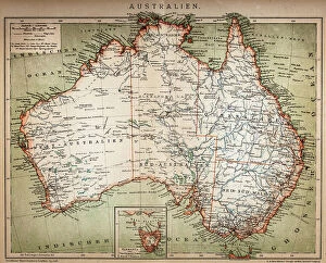
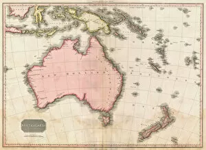
The Maps of Solomon Islands Oceania collection from Media Storehouse is a stunning compilation of vintage maps that showcase the beauty and history of the Solomon Islands. Our collection features a variety of maps, including nautical charts, topographical maps, and political maps from different periods in history. Each map is carefully selected for its unique details and artistic qualities. These high-quality prints are perfect for anyone who loves geography or history. They make great wall art for homes, offices, or classrooms. The Maps of Solomon Islands Oceania collection captures the essence of this beautiful region with its intricate details and vibrant colors. Whether you're looking to add some character to your living space or want to give a thoughtful gift to someone special, these framed prints are an excellent choice. With their timeless appeal and historical significance, they are sure to be cherished for years to come.
+
What are Maps of Solomon Islands Oceania art prints?
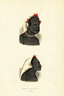
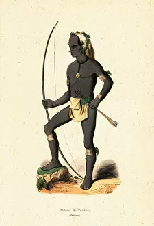
Maps of Solomon Islands Oceania art prints are high-quality reproductions of vintage maps that depict the geography and topography of the Solomon Islands, a group of islands located in Oceania. These maps were originally created by explorers, cartographers, and geographers during different periods in history. These art prints showcase intricate details such as coastlines, rivers, mountains, settlements, and other landmarks that provide an accurate representation of the region's physical features. They also include historical information about the islands' indigenous people and their culture. Maps of Solomon Islands Oceania art prints are perfect for those who appreciate history or have an interest in geography. They can be used to decorate homes or offices with a unique touch while also serving as educational tools for students or researchers. These art prints offer a glimpse into the past while celebrating the natural beauty and cultural richness of this fascinating part of the world.
+
What Maps of Solomon Islands Oceania art prints can I buy from Media Storehouse?
We offer a wide range of Maps of Solomon Islands Oceania art prints that are perfect for decorating your home or office. These maps showcase the beauty and diversity of the Solomon Islands, featuring detailed topographical information, political boundaries, and other geographical features. You can choose from a variety of styles and sizes to suit your needs, including vintage-style maps with an antique look and feel, modern designs with bold colors and graphics, or more traditional representations that capture the natural beauty of this stunning region. Whether you're looking for a large wall hanging to make a statement in your living room or a smaller print to add some color to your bedroom or study, we have something for everyone. So why not explore our collection today and discover the perfect Maps of Solomon Islands Oceania art print for you?
+
How do I buy Maps of Solomon Islands Oceania art prints?
To buy Maps of Solomon Islands Oceania art prints from Media Storehouse, you can browse through our extensive collection of artwork online. Once you have found the print that you like, simply add it to your cart and proceed to checkout. You will be prompted to enter your shipping and payment information before finalizing your purchase. We offer a variety of sizes for their art prints, so make sure to select the size that best fits your needs. Additionally, we offer different framing options if you prefer a framed print. Their Maps of Solomon Islands Oceania art prints are high-quality reproductions of original maps and are perfect for adding a touch of history or culture to any room in your home or office. Buying Maps of Solomon Islands Oceania art prints from Media Storehouse is easy and convenient with their user-friendly website and secure checkout process.
+
How much do Maps of Solomon Islands Oceania art prints cost?
We offer a wide range of Maps of Solomon Islands Oceania art prints at varying prices. Our collection includes both vintage and contemporary maps that showcase the beauty and diversity of this stunning region. Each print is carefully crafted using high-quality materials to ensure longevity and durability. The cost of our Maps of Solomon Islands Oceania art prints varies depending on the size, style, and finish you choose. We have options for every budget, from affordable poster prints to premium canvas or framed pieces. Our goal is to provide customers with access to beautiful artwork that captures the essence of their favorite places around the world. Whether you're looking for a unique piece to add character to your home or office space, or want a thoughtful gift for a loved one who has an affinity for Solomon Islands Oceania, we have something perfect for everyone's taste and budget.
+
How will my Maps of Solomon Islands Oceania art prints be delivered to me?
We take pride in delivering your Maps of Solomon Islands Oceania art prints with the utmost care and efficiency. Your order will be carefully packaged and shipped to you using our trusted delivery partners. We offer a range of shipping options to suit your needs, including standard and express delivery services. Our packaging is designed to protect your artwork during transit, ensuring that it arrives in perfect condition. We use high-quality materials such as sturdy cardboard tubes or flat cardboard envelopes depending on the size and type of print you have ordered. Once your order has been dispatched, we will provide you with tracking information so that you can monitor its progress until it reaches you. If there are any issues with delivery or if you have any questions about your order, our friendly customer service team is always available to assist you. Rest assured that when ordering from Media Storehouse, your Maps of Solomon Islands Oceania art prints will be delivered safely and securely right to your doorstep.