
Maps Collection
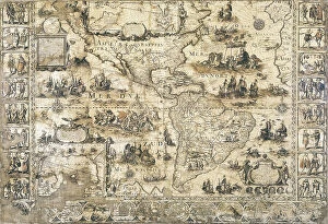
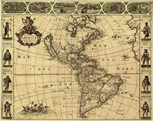
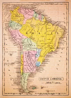
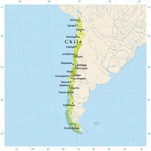
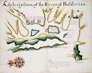
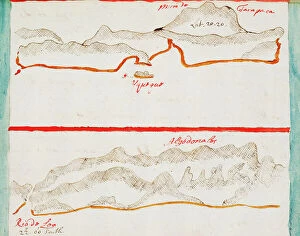
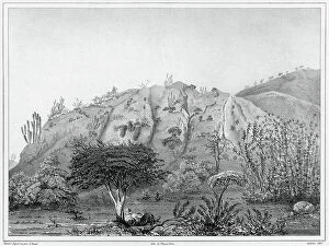
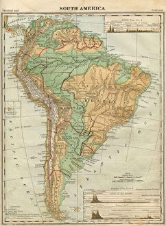
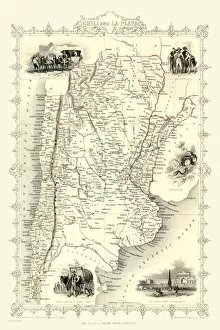
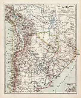
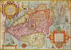
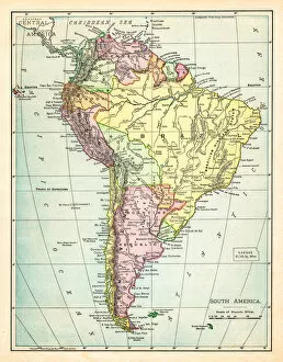
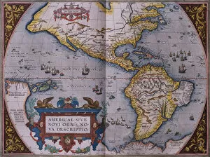
Chile is a long, narrow country located in South America, and is bordered by the Pacific Ocean to the west and the Andes Mountains to the east
Choose a picture from our Maps Collection for your Wall Art and Photo Gifts
147 items


All Professionally Made to Order for Quick Shipping
-
Maps Collection
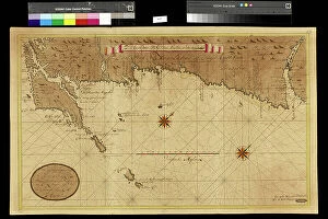
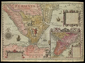
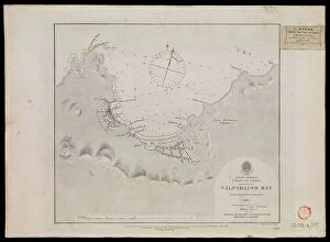
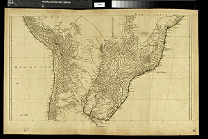
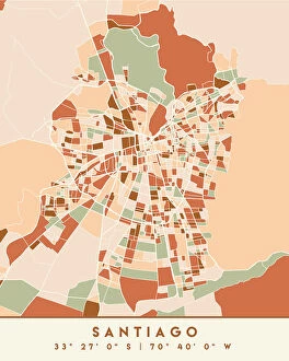
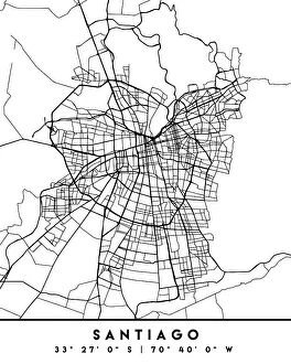
Chile is a long, narrow country located in South America, and is bordered by the Pacific Ocean to the west and the Andes Mountains to the east. The country has a diverse geography, ranging from deserts in the north to glaciers in the south. Chile also has an extensive coastline, with many islands off its coast. Maps of Chile show its varied terrain and coastline, as well as its major cities and towns. The capital city of Santiago is located near the center of Chile's mainland, while other important cities include Valparaiso on the coast and Concepcion further south. They also show that Chile has numerous national parks and reserves throughout its territory, making it a great destination for nature lovers looking for adventure or relaxation.
+
Our beautiful pictures are available as Framed Prints, Photos, Wall Art and Photo Gifts
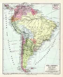
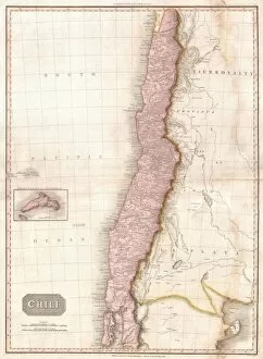
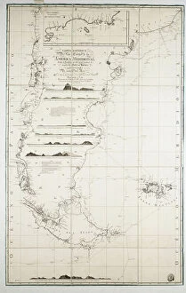
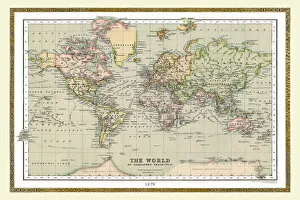
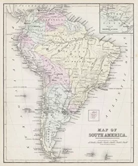
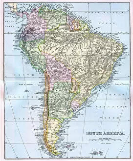
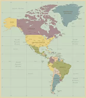
Media Storehouse offers a collection of Maps of Chile South America, featuring an array of vintage and contemporary maps that showcase the country's diverse geography. Our collection includes detailed topographical maps, political maps highlighting regions and cities, antique world atlases with hand-drawn illustrations, and satellite imagery showcasing natural wonders such as the Atacama Desert and Patagonia. These high-quality prints are available in various sizes to suit any space or decor style. The Maps of Chile South America collection is perfect for history buffs, geographers, travelers, or anyone who appreciates the beauty and complexity of cartography. Whether you're looking to decorate your home or office with a unique piece of wall art or seeking educational resources for schools or libraries, Media Storehouse has something for everyone. With easy online ordering and fast delivery options available worldwide, exploring the rich history and geography of Chile has never been easier.
+
What are Maps of Chile South America art prints?
Maps of Chile South America art prints are high-quality reproductions of maps that depict the geography, topography, and landmarks of Chile. These prints showcase the intricate details and features of the country's landscape, including its mountains, rivers, lakes, forests, deserts, and coastline. They also highlight major cities and towns as well as important historical sites. These art prints are perfect for anyone who has an interest in geography or history or who simply wants to add a unique decorative touch to their home or office. They can be framed and hung on walls or displayed on shelves or desks. Maps of Chile South America art prints come in a variety of sizes and formats to suit different preferences and needs. Some are printed on high-quality paper while others are produced using advanced printing techniques that create stunning acrylic prints with vibrant colors and sharp details. Maps of Chile South America art prints offer a fascinating glimpse into one of the most beautiful countries in South America while also serving as stylish decor pieces for any space.
+
What Maps of Chile South America art prints can I buy from Media Storehouse?
We offer a wide range of Maps of Chile South America art prints that you can buy. These maps are available in various sizes and styles, including antique, vintage, and modern designs. You can choose from different types of maps such as topographic, political, physical or satellite imagery. The collection includes detailed maps that showcase the diverse geography and terrain of Chile. From the Andes Mountains to the Pacific Ocean coastline, these maps provide an accurate representation of this beautiful country's landscape. Whether you're looking for a map to hang in your living room or office space or want to gift it to someone who loves geography or history, we have got you covered. With high-quality printing techniques used on premium quality paper stock ensures that every detail is captured perfectly. So if you're interested in purchasing Maps of Chile South America art prints from Media Storehouse then browse our extensive collection today.
+
How do I buy Maps of Chile South America art prints?
To buy Maps of Chile South America art prints from Media Storehouse, you can browse our extensive collection online. Simply search for "Maps of Chile South America" in the search bar and select the print that catches your eye. Once you have found a print you like, click on it to view more details about the product. From there, you can choose the size and framing options that best suit your needs. You will then be prompted to add the item to your cart and proceed with checkout. During checkout, make sure to enter all necessary shipping and payment information. We offer a wide range of high-quality art prints featuring stunning landscapes, cityscapes, wildlife, and more from around the world. Our easy-to-use website makes it simple to find exactly what you're looking for and purchase it securely online.
+
How much do Maps of Chile South America art prints cost?
We offer a wide range of Maps of Chile South America art prints at varying prices. Our collection includes high-quality prints that are perfect for adding a touch of elegance to any room in your home or office. The cost of our Maps of Chile South America art prints depends on the size and type of print you choose. We have options ranging from small posters to large canvas prints, so there is something for every budget. Our selection features different styles and designs, including vintage maps and modern interpretations. Whether you're looking for a colorful map with detailed topography or a simple outline with major cities marked, we've got you covered. Our Maps of Chile South America art prints make great gifts for anyone who loves travel or geography. The cost of our Maps of Chile South America art prints is reasonable and competitive compared to other online retailers offering similar products.
+
How will my Maps of Chile South America art prints be delivered to me?
Your Maps of Chile South America art prints will be delivered to you in a secure and timely manner. We take great care in packaging your order so that it arrives to you undamaged. The prints are carefully rolled and placed into a sturdy tube for shipping. This ensures that the artwork remains protected during transit, preventing any creases or tears from occurring. We work with trusted delivery partners who offer reliable services to ensure your package is delivered safely and on time. You can track your order online using the tracking number provided once your package has been dispatched. We pride ourselves on providing high-quality products and excellent customer service. If for any reason you are not satisfied with your purchase, please do not hesitate to contact us and we will do our best to resolve any issues promptly.