
Maps Collection
Ecuador is a small country located in South America, bordered by Colombia to the north and Peru to the south and east and has a diverse landscape
Choose a picture from our Maps Collection for your Wall Art and Photo Gifts
100 items


All Professionally Made to Order for Quick Shipping
-
Maps Collection
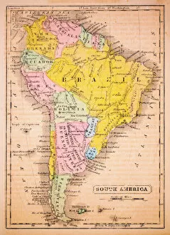
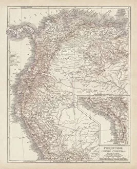
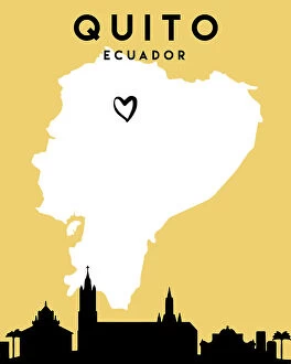
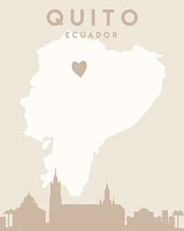
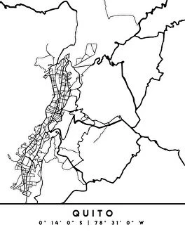
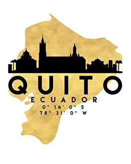
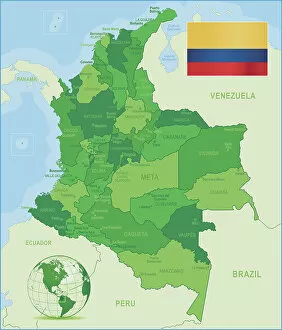
Ecuador is a small country located in South America, bordered by Colombia to the north and Peru to the south and east and has a diverse landscape, ranging from the Amazon rainforest in the east to the Andes mountains in the west. Maps of Ecuador show its varied terrain, including its many rivers and lakes, as well as its coastal regions. The capital city of Quito is located high in the Andes Mountains at an altitude of 9,350 feet above sea level. Other major cities include Guayaquil on the coast and Cuenca in central Ecuador. The Galapagos Islands are also part of Ecuador's territory and can be found off its western coast. Maps of Ecuador provide an excellent overview of this beautiful country's geography and culture.
+
Our beautiful pictures are available as Framed Prints, Photos, Wall Art and Photo Gifts
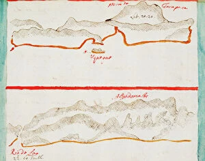
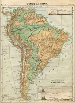
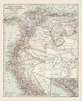
Media Storehouse offers a collection of Maps of Ecuador South America wall art and framed prints. Our collection features detailed maps that showcase the geography, topography, and landmarks of Ecuador. These maps are perfect for those who want to explore the country's diverse landscapes or learn more about its history. The Maps of Ecuador South America collection includes vintage maps from the 19th century as well as modern-day satellite imagery. Each map is printed on high-quality paper using advanced printing techniques to ensure clarity and durability. These prints come in various sizes and framing options, making them suitable for any room in your home or office. Whether you're an avid traveler or simply appreciate beautiful artwork, these Maps of Ecuador South America will add a touch of sophistication to any space. Our Maps of Ecuador South America collection provides an excellent opportunity to discover the beauty and complexity of this fascinating country through stunning visual representations.
+
What are Maps of Ecuador South America art prints?
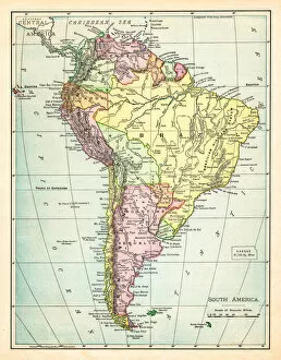
Maps of Ecuador South America art prints are high-quality reproductions of maps that depict the geography, topography, and political boundaries of Ecuador. These prints showcase the stunning landscapes and diverse regions of this beautiful country in South America. They are perfect for anyone who loves travel or has an interest in cartography. These art prints come in a variety of sizes and formats to suit any space or decor style. They can be framed for display on walls or used as educational tools in classrooms or offices. Maps of Ecuador South America art prints are also great gifts for friends and family members who have visited or plan to visit this fascinating country. Whether you're a collector, traveler, educator, or simply appreciate the beauty and complexity of maps, these art prints offer a unique way to experience Ecuador's rich cultural heritage and natural wonders.
+
What Maps of Ecuador South America art prints can I buy from Media Storehouse?
We offer a wide range of Maps of Ecuador South America art prints that are perfect for anyone looking to add some unique and interesting decor to their home or office. These maps feature detailed depictions of the country, including its major cities, landmarks, and natural features. Some of the most popular options include vintage-style maps that offer a glimpse into Ecuador's rich history and culture, as well as more modern designs that showcase the country's current geography. In addition to traditional paper prints, Media Storehouse also offers a variety of other formats such as canvas prints and framed wall art. Whether you're an avid traveler or simply appreciate beautiful artwork, these Maps of Ecuador South America art prints are sure to impress. So why not browse our selection today and find the perfect piece for your space?
+
How do I buy Maps of Ecuador South America art prints?
To buy Maps of Ecuador South America art prints from Media Storehouse, you can browse our vast collection of maps and select the one that catches your eye. Once you have found the map you want to purchase, simply add it to your cart and proceed to checkout. You will be prompted to provide your shipping information and payment details before finalizing your order. We offer a range of high-quality print options for their maps, including canvas prints, framed prints, and poster prints. Each print is produced using state-of-the-art printing technology to ensure exceptional clarity and detail. Whether you are looking for a decorative piece for your home or office or need a map for educational purposes, we have something for everyone. With our easy-to-use website and secure online ordering system, buying Maps of Ecuador South America art prints has never been easier.
+
How much do Maps of Ecuador South America art prints cost?
We offer a wide range of Maps of Ecuador South America art prints at varying prices. Our selection includes different sizes and styles to fit any budget or decor preference. Each print is made with high-quality materials to ensure that the image is sharp and vibrant. Our Maps of Ecuador South America art prints are perfect for those who love geography, travel, or simply want to add some color and interest to their walls. They make great gifts for friends and family members who have an interest in this beautiful country. We take pride in offering affordable yet high-quality products that our customers will love. Whether you're looking for a small print to hang on your wall or a larger one as the centerpiece of your room, we've got you covered. Check out our selection today.
+
How will my Maps of Ecuador South America art prints be delivered to me?
Your Maps of Ecuador South America art prints will be delivered to you in a safe and secure manner. We take great care in packaging your order so that it arrives at your doorstep undamaged. Our team uses high-quality materials to ensure that your artwork is protected during transit. We offer various delivery options depending on your location, including standard shipping and expedited shipping for those who need their orders quickly. Once your order has been processed, we will provide you with a tracking number so that you can keep an eye on its progress. Our goal is to make sure that you receive your Maps of Ecuador South America art prints as quickly and efficiently as possible while ensuring the safety of the artwork during transit. If you have any questions or concerns about the delivery process, please do not hesitate to contact our customer service team who are always happy to help.