
Maps Collection
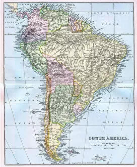
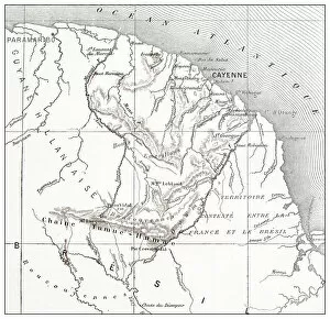
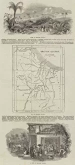
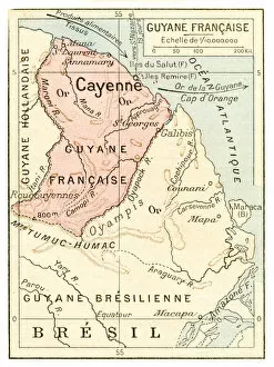
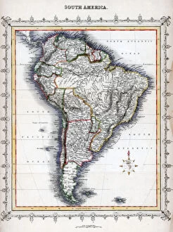
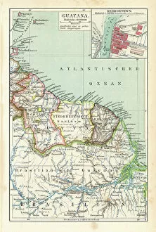
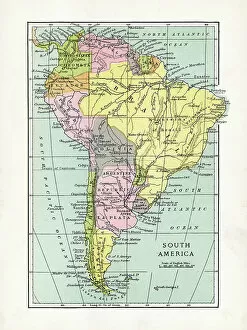
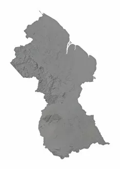
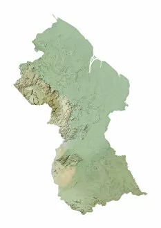
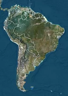
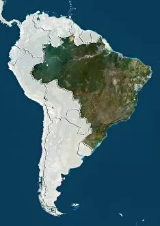
Guyana is a small country located on the northern coast of South America, bordered by Venezuela to the west, Brazil to the south and Suriname to the east
Choose a picture from our Maps Collection for your Wall Art and Photo Gifts
37 items

All Professionally Made to Order for Quick Shipping
-
Maps Collection
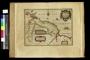
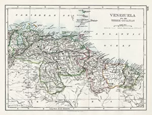
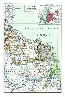
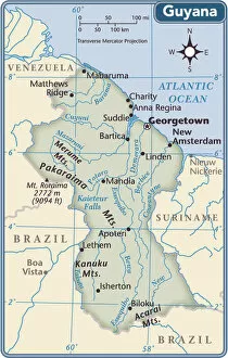
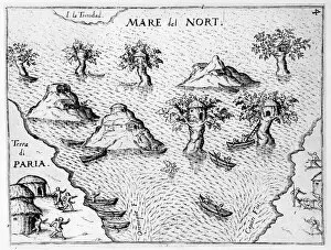
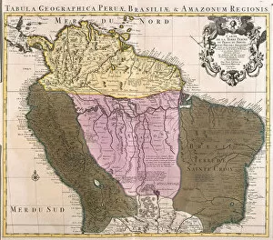
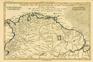
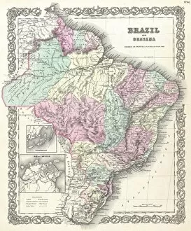
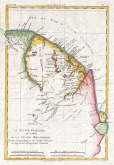
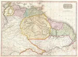
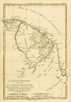
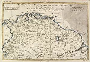
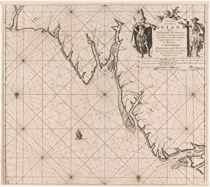
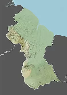
Guyana is a small country located on the northern coast of South America, bordered by Venezuela to the west, Brazil to the south and Suriname to the east, and is one of only two English-speaking countries in South America. Maps of Guyana show its diverse landscape, from tropical rainforests and savannas in the north to mangrove swamps and coastal plains in the south. The Essequibo River forms much of its western border with Venezuela while its eastern border with Suriname follows several rivers including Courantyne River. The capital city Georgetown lies on a large bay at the mouth of Demerara River. Other major cities include Linden, New Amsterdam and Bartica. Guyana's terrain also includes mountains such as Roraima which rises over 2,800 metres above sea level near its borders with Brazil and Venezuela.
+
Our beautiful pictures are available as Framed Prints, Photos, Wall Art and Photo Gifts
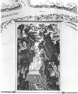
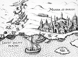
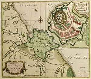
The Maps of Guyana South America collection is a unique and fascinating collection of vintage maps that showcase the geography, history, and culture of this beautiful country. Our collection features a wide range of maps from different eras, including antique hand-drawn maps, colorful illustrated maps, and detailed topographical maps. Each map offers a glimpse into the past and provides valuable insights into the development of Guyana over time. These stunning wall art prints are available in various sizes and formats to suit any decor style or budget. Whether you're looking for a statement piece for your living room or office or want to add some historical charm to your home decor, these framed prints are sure to impress. The Maps of Guyana South America collection is an excellent choice for anyone interested in history, geography, or travel. With its rich cultural heritage and diverse landscapes, Guyana is truly one-of-a-kind destination that deserves to be celebrated through these beautiful works of art.
+
What are Maps of Guyana South America art prints?
Maps of Guyana South America art prints are high-quality reproductions of maps that depict the geography, topography, and political boundaries of the country. These prints are created using advanced printing techniques to ensure that every detail is captured accurately, making them perfect for educational or decorative purposes. These art prints showcase the beauty and diversity of Guyana's landscape, from its lush rainforests to its sprawling savannas. They also provide valuable information about the country's history and culture, including its colonial past and indigenous communities. Whether you're a student looking to learn more about this fascinating region or an art lover seeking unique wall decor, Maps of Guyana South America art prints are a great choice. With their vibrant colors and intricate details, these prints offer a stunning visual representation of one of South America's most captivating countries.
+
What Maps of Guyana South America art prints can I buy from Media Storehouse?
We offer a wide range of Maps of Guyana South America art prints that are perfect for anyone who loves geography or wants to add some unique decor to their home or office. These maps come in various sizes and styles, including vintage, antique, and modern designs. You can choose from different types of maps such as topographic, road, political and physical maps. Media Storehouse also provides custom framing options for your chosen map print. This allows you to select the perfect frame that complements your interior design style while protecting your artwork from damage. Whether you're looking for a detailed map of Guyana's rivers and mountains or an artistic representation of its cities and towns, we have got you covered. With high-quality printing technology used on premium paper stock material, these Maps of Guyana South America art prints will last a lifetime with proper care.
+
How do I buy Maps of Guyana South America art prints?
To buy Maps of Guyana South America art prints from Media Storehouse, you can browse our online collection of maps and select the one that catches your eye. Once you have found a map that you like, click on it to view its details page where you will find various options for purchasing the print. You can choose between different sizes and formats such as canvas or framed prints. To complete your purchase, simply add the item to your cart and proceed to checkout. You will be prompted to enter your shipping information and payment details before submitting your order. We offer high-quality art prints featuring maps of Guyana South America that are perfect for decorating any space in your home or office. Whether you're looking for a vintage-style map or a more modern interpretation, they have a wide selection of options available to suit all tastes and preferences.
+
How much do Maps of Guyana South America art prints cost?
We offer a wide range of Maps of Guyana South America art prints at varying prices. Our collection includes vintage maps, contemporary designs and everything in between. The cost of each print depends on factors such as the size, type of paper or canvas used, and the complexity of the design. We understand that our customers have different budgets and preferences when it comes to artwork, which is why we strive to provide options that cater to everyone's needs. Our Maps of Guyana South America art prints are perfect for adding a touch of elegance and sophistication to any space. Whether you're looking for something bold and colorful or more subtle and understated, we've got you covered. With our high-quality printing techniques and premium materials, you can be sure that your chosen print will look stunning for years to come.
+
How will my Maps of Guyana South America art prints be delivered to me?
Your Maps of Guyana South America art prints will be delivered to you in a safe and secure manner. We take great care in packaging our products so that they arrive at your doorstep undamaged. Our standard delivery method is through postal services, but we also offer express courier options for those who require faster delivery times. Once your order has been processed and dispatched, you will receive a tracking number which allows you to monitor the progress of your shipment. If there are any issues with the delivery or if you have any questions about your order, our customer service team is always available to assist you. We understand how important it is for our customers to receive their orders promptly and in perfect condition, which is why we strive to provide the best possible service when it comes to delivering our products. You can trust us to handle your Maps of Guyana South America art prints with care and professionalism from start to finish.