
Maps Collection
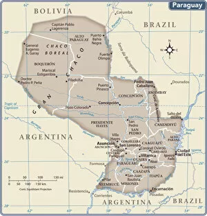
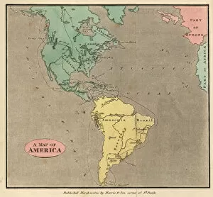
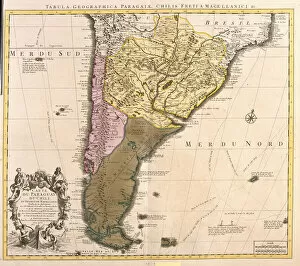
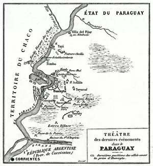
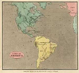
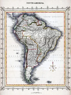
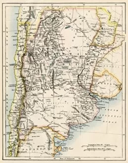
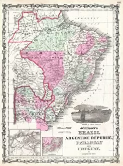
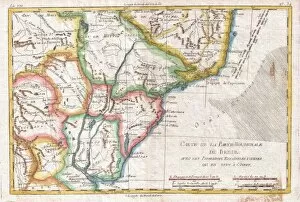
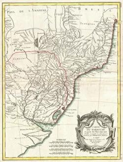
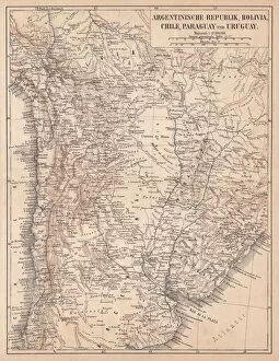
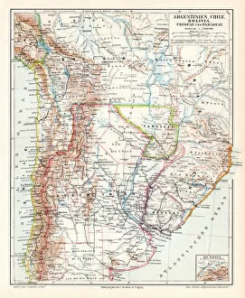
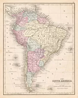
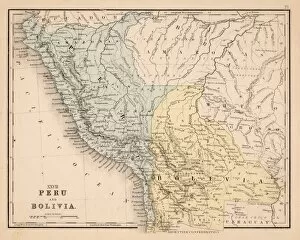
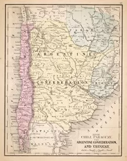
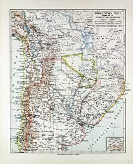
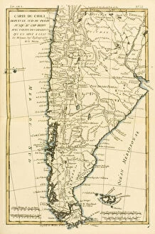
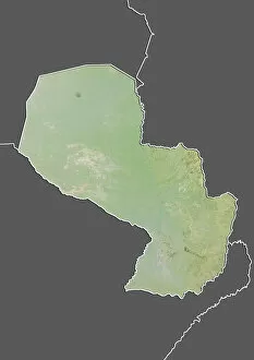
Paraguay is a landlocked country located in the heart of South America, and is bordered by Argentina, Bolivia and Brazil
Choose a picture from our Maps Collection for your Wall Art and Photo Gifts
60 items
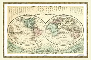

All Professionally Made to Order for Quick Shipping
-
Maps Collection
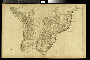
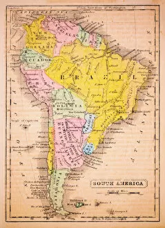
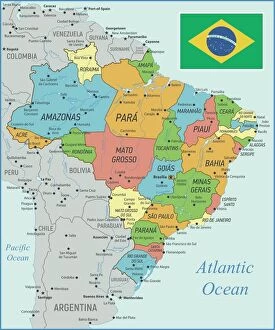
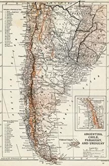
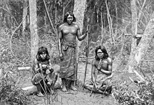
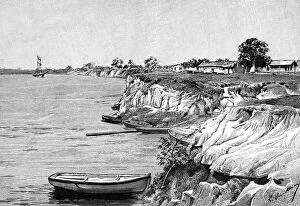
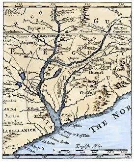
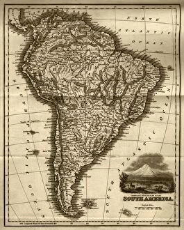
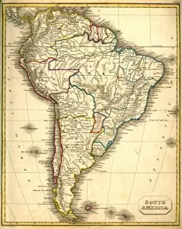
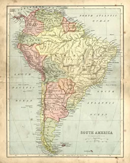
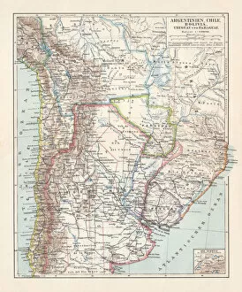
Paraguay is a landlocked country located in the heart of South America, and is bordered by Argentina, Bolivia and Brazil. Paraguay has a diverse landscape, ranging from subtropical rainforests to grasslands and wetlands. The country's terrain consists of low-lying plains, hills and rivers. Maps of Paraguay show its main cities such as Asuncion, Ciudad del Este and Encarnacion; its main rivers including the Parana River; its national parks such as Cerro Cora National Park; and its border with neighboring countries. Other features found on maps include airports, roads, railways, lakes and dams. With an area of 406,752 square kilometers (157,048 sq mi), Paraguay is one of the smaller countries in South America but it still offers plenty to explore for those who are willing to venture off the beaten path.
+
Our beautiful pictures are available as Framed Prints, Photos, Wall Art and Photo Gifts
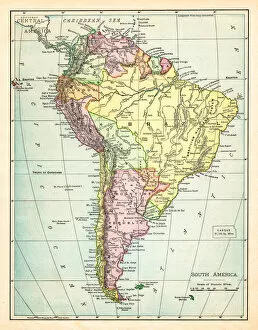
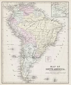
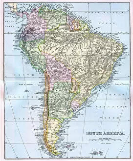
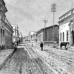
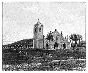
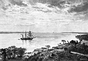
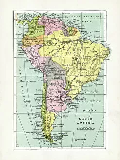
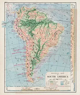
Media Storehouse offers a stunning collection of Maps of Paraguay South America, featuring vintage and contemporary maps that showcase the country's rich history and geography. Our collection includes detailed topographical maps, political maps, antique maps from the 19th century, and modern satellite images. These high-quality prints are available in various sizes and formats such as canvas prints or framed wall art. The Maps of Paraguay South America collection is an excellent choice for anyone interested in exploring the country's diverse landscapes, including its rivers, mountains, forests, and cities. The vintage maps provide a glimpse into Paraguay's past while the contemporary ones offer up-to-date information on its current state. Whether you're looking to decorate your home or office space with unique artwork or seeking educational resources for students studying geography or history courses - Media Storehouse has got you covered with their impressive selection of Maps of Paraguay South America.
+
What are Maps of Paraguay South America art prints?
Maps of Paraguay South America art prints are high-quality reproductions of maps that depict the geography and topography of Paraguay, a landlocked country in South America. These art prints showcase the intricate details and features of the region, including its rivers, mountains, forests, and cities. These maps are not only useful for navigational purposes but also serve as beautiful decorative pieces for homes or offices. We offer an interesting glimpse into the history and culture of Paraguay while providing a unique perspective on its landscape. Maps of Paraguay South America art prints come in various sizes to suit different spaces and preferences. They are printed using advanced printing technology on premium quality paper to ensure their longevity and durability. Whether you're a collector or simply looking for an eye-catching piece to adorn your walls, Maps of Paraguay South America art prints are sure to impress with their stunning detail and accuracy.
+
What Maps of Paraguay South America art prints can I buy from Media Storehouse?
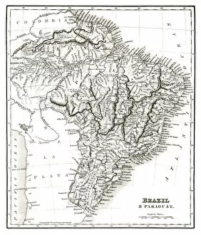
We offer a wide range of Maps of Paraguay South America art prints that are perfect for those who love geography and history. These maps showcase the different regions, cities, rivers, and other important landmarks in Paraguay. You can choose from vintage or modern styles to suit your taste. One popular option is the antique map of Paraguay created by John Arrowsmith in 1842. This beautifully detailed map shows the country's borders during that time period and includes illustrations of indigenous people, animals, and plants. Another great choice is the political map of Paraguay which displays all its states with their respective capitals. It also highlights major roads, airports, and bodies of water within the country. Whether you're looking for a decorative piece for your home or office or an educational tool for students or travelers, we have a variety of Maps of Paraguay South America art prints to choose from.
+
How do I buy Maps of Paraguay South America art prints?
To purchase Maps of Paraguay South America art prints from Media Storehouse, you can browse our extensive collection of high-quality images online. Simply search for "Maps of Paraguay South America" in the search bar and select the print that catches your eye. Once you have found the perfect image, click on it to view its details and choose your preferred size and framing options. We offer a range of sizes and framing styles to suit any taste or budget. You can choose from traditional frames, canvas wraps, or even unframed prints if you prefer to frame them yourself. Once you have made your selection, simply add it to your cart and proceed to checkout. We accept various payment methods including credit cards and PayPal. Buying Maps of Paraguay South America art prints from Media Storehouse is a simple process that allows you to bring beautiful artwork into your home or office with ease.
+
How much do Maps of Paraguay South America art prints cost?
We offer a wide range of Maps of Paraguay South America art prints at varying prices. The cost depends on the size and type of print you choose, as well as any additional framing or mounting options you may select. We have a variety of sizes available to suit your needs, from small prints suitable for home decor to larger pieces that make a statement in an office or public space. Our Maps of Paraguay South America art prints are created using high-quality materials and printing techniques to ensure that they look great for years to come. Whether you're looking for a vintage-style map or something more modern and colorful, we have plenty of options available in our collection. We take pride in offering affordable pricing without compromising on quality, so you can be sure that you're getting the best value for your money when purchasing one of our Maps of Paraguay South America art prints.
+
How will my Maps of Paraguay South America art prints be delivered to me?
We take great care in delivering your Maps of Paraguay South America art prints to you. We use high-quality packaging materials to ensure that your print arrives in perfect condition. Your print will be carefully rolled and placed inside a sturdy cardboard tube for protection during transit. We work with trusted shipping partners who provide reliable delivery services worldwide. Once your order is processed, we will send you an email confirmation along with tracking information so that you can keep track of the progress of your shipment. Please note that our standard delivery service does not include any framing or mounting options. However, if you would like to have your print framed or mounted, please contact us and we will be happy to assist you with this request. Our goal is to provide a seamless and hassle-free experience when it comes to delivering your Maps of Paraguay South America art prints straight to your doorstep.