
Maps Collection
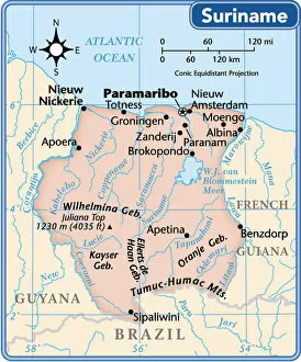
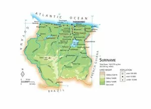
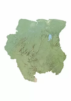
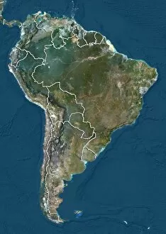
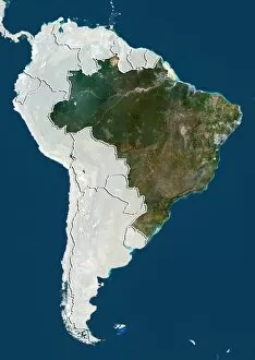
Suriname is a small country in South America
Choose a picture from our Maps Collection for your Wall Art and Photo Gifts
22 items

All Professionally Made to Order for Quick Shipping
-
Maps Collection
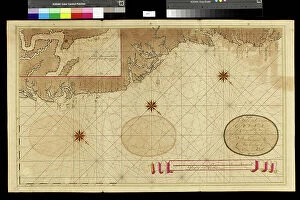
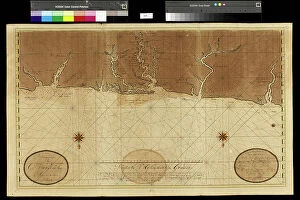
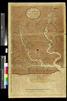
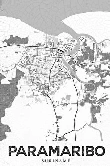
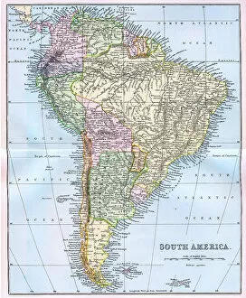
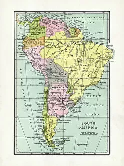
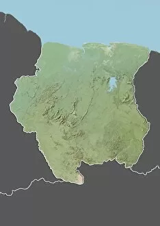
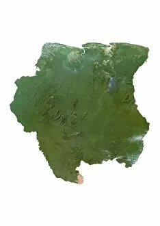
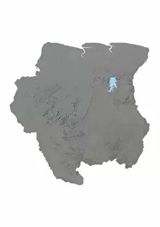
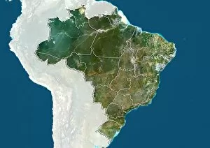
Suriname is a small country in South America, located between Guyana and French Guiana and has an area of 63,000 square miles and a population of about 600,000 people. The terrain is mostly tropical rainforest with some savanna in the south. The capital city is Paramaribo. Suriname has many rivers and streams that flow through it, including the Suriname River which forms part of its western border with Guyana. Maps of Suriname show its main cities, roads and highways as well as its natural features such as mountains, rivers and lakes. Its coastline along the Atlantic Ocean provides access to the Caribbean Sea to the north and east while its borders with French Guiana are marked by several mountain ranges including Tafelberg Mountain which rises to 1,286 meters above sea level at its highest point.
+
Our beautiful pictures are available as Framed Prints, Photos, Wall Art and Photo Gifts
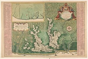
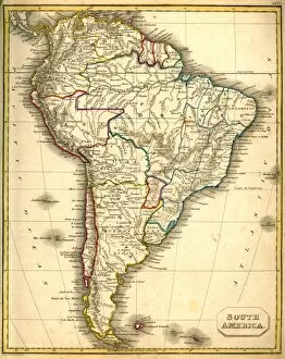
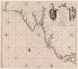
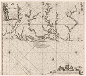
The Maps of Suriname South America collection from Media Storehouse is a stunning compilation of vintage and contemporary maps that depict the geography, topography, and political boundaries of Suriname. Our collection features a diverse range of maps, including hand-drawn sketches, lithographs, engravings, and digital renderings that showcase the country's rich history and cultural heritage. From detailed city plans to panoramic views of the Amazon rainforest, each map offers a unique perspective on Suriname's landscape and its people. Some highlights include rare 17th-century maps by Dutch cartographers like Joan Blaeu and Willem Janszoon Blaeu as well as modern satellite imagery that captures the country's natural beauty. Whether you're an art collector or a history buff, these maps make for beautiful wall art or framed prints that add character to any room. With high-quality printing techniques used in their production process, these pieces are sure to impress anyone who lays eyes on them.
+
What are Maps of Suriname South America art prints?
Maps of Suriname South America art prints are high-quality reproductions of maps depicting the country of Suriname, located in South America. These maps showcase the intricate details and features of Suriname's geography, including its rivers, mountains, forests, and cities. These art prints are perfect for anyone interested in history or geography as they provide a visual representation of how the country has evolved over time. They can also be used as educational tools to teach students about different regions around the world. Maps of Suriname South America art prints come in a variety of sizes and styles to suit any decor or personal preference. Whether you're looking for a vintage-style map or a more modern interpretation, there is something for everyone. Maps of Suriname South America art prints offer an excellent way to appreciate the beauty and complexity of this fascinating region while adding an interesting conversation piece to your home or office decor.
+
What Maps of Suriname South America art prints can I buy from Media Storehouse?
We offer a wide range of Maps of Suriname South America art prints that are perfect for anyone who loves geography, travel or history. These maps showcase the beauty and diversity of Suriname's landscape, highlighting its rivers, mountains and forests. You can choose from vintage maps that capture the country's colonial past or modern maps that show its current political boundaries. Media Storehouse also offers different sizes and styles to suit your needs. Whether you want a small print to add some color to your home office or a large canvas print to make a statement in your living room, there is something for everyone at Media Storehouse. In addition to traditional paper prints, Media Storehouse also offers framed prints and stretched canvases so you can display your map in any way you like. With such a great selection available, it's easy to find the perfect Maps of Suriname South America art print at Media Storehouse.
+
How do I buy Maps of Suriname South America art prints?
To buy Maps of Suriname South America art prints from Media Storehouse, you can browse our extensive collection of maps and select the one that catches your eye. Once you have found the map you want to purchase, simply click on it to view more details about the product. You will be able to choose from a variety of sizes and framing options for your print. To complete your purchase, add the item to your cart and proceed to checkout. At this point, you will need to provide your shipping information and payment details. We accept various forms of payment including credit cards and PayPal. Once your order has been processed, it will be shipped directly to you in a timely manner. Whether you are looking for a unique piece of wall art or a gift for someone special, Maps of Suriname South America art prints from Media Storehouse are sure to impress.
+
How much do Maps of Suriname South America art prints cost?
We offer a wide range of Maps of Suriname South America art prints at varying prices. Our collection includes vintage maps, topographical maps, and satellite imagery prints that showcase the beauty and diversity of Suriname's landscapes. The cost of these art prints depends on various factors such as size, framing options, and printing materials used. We pride ourselves on offering high-quality products that are affordable for everyone without compromising on quality. Our Maps of Suriname South America art prints are perfect for anyone who loves to travel or has an interest in geography. They make great gifts for friends and family members who have visited or plan to visit this beautiful country. Whether you're looking for a small print to display in your home or office or a large statement piece to hang in your living room, we have something that will suit your needs and budget.
+
How will my Maps of Suriname South America art prints be delivered to me?
We take great care in delivering your Maps of Suriname South America art prints to you. We use high-quality packaging materials to ensure that your artwork arrives in pristine condition. Depending on the size and quantity of your order, we may ship it using a variety of methods such as standard mail or courier services. We understand how important it is for you to receive your artwork promptly and safely, which is why we work with trusted shipping partners who have a proven track record of delivering packages securely and efficiently. Once your order has been shipped, you will receive an email notification with tracking information so that you can monitor its progress. Whether you're purchasing our Maps of Suriname South America art prints for personal use or as a gift for someone special, rest assured that they will be delivered to you with the utmost care and attention to detail.