mail_outline sales@mediastorehouse.com
Choose from 953 items in our 
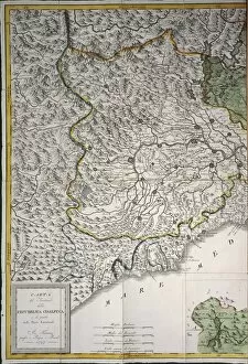
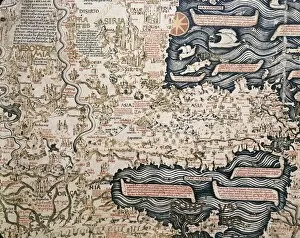
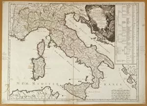
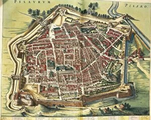
Cartography Collection
Mappa Mundi by Sawley or Enrico di Magonza, ink and colors on parchment, 12th CenturyCartography, 12th century. Mappa Mundi, Medieval world map by Sawley or Enrico di Magonza, from the end of the 12th century. Ink and colors on parchment, 29.5 x 20.5 cm
Vinland Map, oldest map of Greenland and Northern America areas discovered by Norse, Vikings during their explorationsCartography, 15th century. Vinland Map (circa 1440). Oldest map of Greenland and Northern America areas discovered by Norse (Vikings) during their explorations
Map of ancient Abruzzo, by Giovan Battista Pacichelli, engraving, 1702Cartography, Italy, 18th century. Ancient Abruzzo. From The Kingdom of Naples in perspective by Giovan Battista Pacichelli, 1702. Engraving
Map of Scandinavia, from Carta Marina, Sea Map by Olaus Magnus, 1539Cartography, 16th century. Map of Scandinavia. From Carta Marina (Sea Map) by Olaus Magnus, 1539
Italy, City of Castellaneta (Taranto) by Giovan Battista Pacichelli from Il Regno di Napoli in prospettivaCartography, Italy, 18th century. The City of Castellaneta (Taranto). Engraving from Il Regno di Napoli in prospettiva (The Kingdom of Naples in Perspective), by Giovan Battista Pacichelli, 1702
Cantino planisphere by Alberto Cantino, 1502Cartography, 16th century. Cantino planisphere, by Alberto Cantino, 1502
Map of Italy, From Geographiae Opus Novissima by Martin Waldseemueller, Woodcut, 1513Cartography, 16th century. Map of Italy. From Geographiae Opus Novissima by Martin Waldseemueller, 1513. Woodcut
Map of Mediterranean Sea by Francois Ollive, Marseille, 1664Cartography, 17th century. Map of the Mediterranean Sea by Francois Ollive, Marseille, 1664
Map of The Kingdom of Naples, by Giovan Battista Pacichelli, engraving, 1702Cartography, Italy, 18th century. The Kingdom of Naples. From The Kingdom of Naples in perspective by Giovan Battista Pacichelli, 1702. Engraving
The Maghreb and the Middle East, Ottoman miniatureCartography, late 16th century. The Maghreb and the Middle East. Ottoman miniature
Map of America by Gerardo Mercatore, 1512-1594Cartography, 16th century. Map of America by Gerardo Mercatore (1512-1594)
Map of Bristol from Civitates Orbis Terrarum by Georg Braun, 1541-1622 and Franz Hogenberg, 1540-1590, engravingCartography, Great Britain, 16th century. Map of Bristol. From Civitates Orbis Terrarum by Georg Braun (1541-1622) and Franz Hogenberg (1540-1590), Cologne. Engraving
Map of the Horn of Africa, oil painting by Stefano Buonsignori 1575-1584Italy - Tuscany region - Florence. Palazzo Vecchio, Hall of the Geographical Maps. Map of the Horn of Africa, oil painting by Stefano Buonsignori 1575-1584
Map of Nueva Galicia, historic territory of Mexico, 1550Cartography, Mexico, 16th century. Map of Nueva Galicia, historic territory of Mexico, 1550
Map of Bologna from Civitates Orbis Terrarum by Georg Braun, 1541-1622 and Franz Hogenberg, 1540-1590, engravingCartography, Italy, 16th century. Map of Bologna. From Civitates Orbis Terrarum by Georg Braun (1541-1622) and Franz Hogenberg (1540-1590), Cologne. Engraving
Italy, Map of Milan in 1600Cartography, Italy, 17th century. Map of Milan in 1600
Nova totius Terrarum Orbis Geographica ac hydrographica tabula, by Henricus Hondius, AmsterdamCartography, 17th century. Nova totius Terrarum Orbis Geographica ac hydrographica tabula, by Henricus Hondius, Amsterdam, 1630. Illustrated copperplate, 38 x 54 cm
Map of Medieval Treviso, from Medieval Treviso by Angelo Marchesan, engravingCartography, Italy. Map of Medieval Treviso. From Medieval Treviso by Angelo Marchesan. Engraving
Map of Cathay, China, from Catalan Atlas created for Charles V, King of FranceCartography, 14th century. Map of Cathay (China). From Catalan Atlas created for Charles V, King of France, attributed to Abraham and Jafuda Cresques Maiorca (circa 1375)
Map of Sicily region, by Joan BlaeuCartography, Italy, 17th century. Map of Sicily region, by Joan Blaeu
Map of Jamaica, Port Royal before earthquake in 1692, From Journal by Edward BarlowCartography, Jamaica, 17th century. Port Royal before the earthquake in 1692. From the Journal by Edward Barlow
Duchies of Milan, Mantua, Modena and Parma; Republic of Venice and Genoa, Map by Justus Danckerts, AmsterdamCartography, Italy, 18th century. Duchies of Milan, Mantua, Modena and Parma; Republic of Venice and Genoa. Map by Justus Danckerts, Amsterdam, early 1700. Copper engraving
Map of the Kingdom of Naples, Italy, from Theatrum Orbis Terrarum by Abraham Ortelius, 1528-1598, 1570Cartography, Italy, 16th century. Map of the Kingdom of Naples, from Theatrum Orbis Terrarum by Abraham Ortelius (1528-1598), Antwerp, 1570
Map of the Iberian peninsula, from Theatrum Orbis Terrarum by Abraham Ortelius, 1528-1598, Antwerp, 1570Cartography, 16th century. Map of the Iberian peninsula, from Theatrum Orbis Terrarum by Abraham Ortelius (1528-1598), Antwerp, 1570
Republic of Genoa, Map by Tobia Corrado Lotterio with view of Genoa by F. B. Weber, Augsburg, Copper engraving, 1770Cartography, Italy, 18th century. Republic of Genoa. Map by Tobia Corrado Lotterio with view of Genoa by F.B. Weber. Augsburg, 1770. Copper engraving
Map of Gallo Island and adjoining coastCartography, South America, 15th century. Gallo Island and the adjoining coast
Eastern Europe and Central Asia, from Atlas of the World in thirty-three Maps, by Battista Agnese, 1553Cartography, 16th century. Eastern Europe and Central Asia, from Atlas of the World in thirty-three Maps, by Battista Agnese, 1553
Map of China, from World map by Camaldolese monk Fra Mauro, 1449Cartography, 15th century. Map of China. From World map by Camaldolese monk Fra Mauro, 1449. Detail
Map of the city of Como, Italy, 1570Cartography, Italy, 16th century. Map of the city of Como, 1570
Map of Santo Domingo city showing the citys defensive wall, watercolor, 1619Cartography, Dominican Republic, 17th century. Map of Santo Domingo city showing the citys defensive wall, 1619. Watercolor
World map by Giorgio Sideri, known as Callapoda or Calopodio da Candia, details of AfricaCartography, 16th century. World map by Giorgio Sideri, known as Callapoda or Calopodio da Candia. Details of Africa
Plan of Crema, ItalyCartography, Italy. Plan of Crema
Cisalpine Republic, 1st part. Florence, Copper engraving. 1797Cartography, Italy, 18th century. Cisalpine Republic (1st part). Florence, 1797. Copper engraving
World map by Camaldolese monk Fra Mauro, 1449, detail: Asian Turkey and MesopotamiaCartography, 15th century. World map by Camaldolese monk Fra Mauro, 1449. Detail: Asian Turkey and Mesopotamia
Map of Italy in 1743Cartography, 18th century. Map of Italy in 1743
Italy, Map of Pesaro, from Theatrum civitatum et admirandorum Italiae by Joan Blaeu, engravingCartography, Italy, 17th century. Map of Pesaro, from Theatrum civitatum et admirandorum Italiae by Joan Blaeu. Engraving
Military division of Genoa, plan of Sarzana, La Spezia and Chiavari. Map by Attilio Zuccagni-OrlandiniCartography, Italy, 19th century. Military division of Genoa, plan of Sarzana, La Spezia and Chiavari. Map by Attilio Zuccagni-Orlandini, taken from the Geographic Atlas of Italian States
Map of Portugal, from Theatrum Orbis Terrarum by Abraham Ortelius, 1528-1598, Antwerp, 1570Cartography, 16th century. Map of Portugal, from Theatrum Orbis Terrarum by Abraham Ortelius (1528-1598), Antwerp, 1570
World map from Treatise of Geography by Al Idrisi, circa 1099-1165, manuscriptCartography, Asia, 11th century. World map from Treatise of Geography by Al Idrisi (circa 1099-1165), manuscript
Detail of Portuguese planisphere, 1550Cartography, 16th century. Europe and Africa, detail of a Portuguese planisphere, 1550. Facsimile of an original located in the Biblioteca Vallicelliana in Rome
Map of Mediterranean Islands, from Theatrum Orbis Terrarum by Abraham Ortelius, 1528-1598, 1570Cartography, 16th century. Map of Mediterranean Islands, from Theatrum Orbis Terrarum by Abraham Ortelius (1528-1598), Antwerp, 1570
Map of central and southern America and Cuba, Hispaniola and Puerto Rico islands, by Lazaro Luis, from the Atlas, 1563Cartography, 16th century. Map of central and southern America and Cuba, Hispaniola and Puerto Rico islands. From the Atlas by Lazaro Luis, 1563
Perspective map of the city of Turin, Piedmont region by Joan Blaeu, 1596-1673Cartography, Italy, 17th century. Perspective map of the city of Turin, Piedmont region by Joan Blaeu (1596-1673)
Territory of Nice. Map by Jean Baptiste Raymond from military topographic map of Alps. Paris, engraving on copper. 1820Cartography, France, 19th century. Territory of Nice. Map by Jean Baptiste Raymond from a military topographic map of the Alps. Paris 1820. Engraving on copper
Map of the territory of Crema, ItalyCartography, Italy. Map of the territory of Crema
Map of Genoa, Italy with new city walls by Ludovico di Lespine, engraving, 1695Cartography, Italy, 17th century. Map of Genoa with the new city walls by Ludovico di Lespine, 1695. Engraving
Map of Turin citadel, Piedmont regionCartography, Italy, 19th century. Map of Turin citadel, Piedmont region
Caravel in ocean, from, Atlas of Universe by Lazaro Luis, detail, 1563Cartography, 16th century. A caravel in the ocean. From " Atlas of the Universe", by Lazaro Luis, 1563. Detail
Choose your image, Select your licence and Download the media