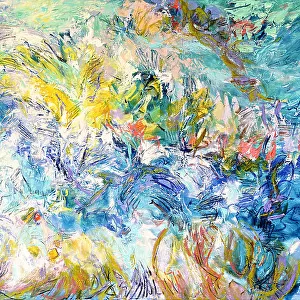
Home > Abstract Art > Painting > Related Images
Governances of French Flanders, Artois, Picardy and Boulonois, engraving by G. Zuliani taken from Tome I of the "Newest Atlas" published in Venice in 1776 by Antonio Zatta, Private Collection

![]()
Wall Art and Photo Gifts from Fondazione Alinari per la Fotografia
Governances of French Flanders, Artois, Picardy and Boulonois, engraving by G. Zuliani taken from Tome I of the "Newest Atlas" published in Venice in 1776 by Antonio Zatta, Private Collection
Governances of French Flanders, Artois, Picardy and Boulonois, engraving by G. Zuliani taken from Tome I of the "Newest Atlas" published in Venice in 1776 by Antonio Zatta, Private Collection Florence Engraving Eighteenth Century, Renaissance-Baroque styles and periods, Europe, First and Second Millennium A.D.. Date of Photograph:2009. Date of Artwork:1776. Artist:Zuliani G
Alinari
PDP-A-ZATTA1-0032
Media ID 33185773
© Alinari Archives, Florence
Cartography Drawing And Graphics Geography Graphics Instrument And Document Scene Means Of Communication Territory Abstract Concept And Symbol Concept Or Subject Expressed
FEATURES IN THESE COLLECTIONS
> Abstract Art
> Painting
> Related Images
> Abstract Art
> Related Images
> Arts
> Abstract art
> Arts
> Art Movements
> Baroque
> Arts
> Art Movements
> Renaissance Art
> Arts
> Still life artwork
> Abstract art
> Fine art
> Arts
> Minimalist artwork
> Abstract art
> Fine art
> Arts
> Modern art pieces
> Abstract art
> Fine art
> Arts
> Portraits
> Abstract art
> Abstract art gallery
> Arts
> Portraits
> Abstract art
> Abstract paintings
EDITORS COMMENTS
This print showcases an exquisite engraving by G. Zuliani, taken from Tome I of the "Newest Atlas" published in Venice in 1776 by Antonio Zatta. The artwork, now part of a private collection in Florence, beautifully depicts the governances of French Flanders, Artois, Picardy, and Boulonois. Created during the Renaissance-Baroque styles and periods of the eighteenth century, this piece is a testament to the intricate craftsmanship and attention to detail prevalent during that era. It transports us back to a time when cartography was not only a means of communication but also an art form. The artist's skillful use of graphics and drawing brings forth an allegorical representation of these territories. Through abstract concepts and symbols, Zuliani captures the essence and significance of each region depicted on this geographical or topographical map. As we delve into this artwork further, it becomes evident that it serves as both an instrument and document for understanding European history. Its depiction spans across two millennia – from the first millennium A. D. , through medieval times up until its creation date in 1776. This photograph was taken in 2009 by Alinari - renowned for their expertise in capturing historical artworks with precision. Their meticulousness ensures that every minute detail is preserved faithfully so that viewers can appreciate not just the subject matter but also gain insight into how communication methods have evolved over time. In summary, this print offers us a glimpse into Europe's past while highlighting significant aspects such as territory delineation, symbolism within maps, and artistic styles prevalent during different periods. It stands as a remarkable example of renaissance-baroque artistry merged with cartographic excellence – truly deserving its place among esteemed collections worldwide.
MADE IN THE USA
Safe Shipping with 30 Day Money Back Guarantee
FREE PERSONALISATION*
We are proud to offer a range of customisation features including Personalised Captions, Color Filters and Picture Zoom Tools
SECURE PAYMENTS
We happily accept a wide range of payment options so you can pay for the things you need in the way that is most convenient for you
* Options may vary by product and licensing agreement. Zoomed Pictures can be adjusted in the Cart.