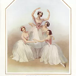
Home > Europe > United Kingdom > England > London > Art > Venues > Greenwich Theatre
New description of Ireland, the British Isles, 1573 (copperplate engraving on paper)
")
![]()
Wall Art and Photo Gifts from Fine Art Finder
New description of Ireland, the British Isles, 1573 (copperplate engraving on paper)
7340125 New description of Ireland, the British Isles, 1573 (copperplate engraving on paper) by Ortelius, Abraham (1527-98); 42x53 cm; National Maritime Museum, London, UK; (add.info.: Creator: Abraham Ortelius
Eryn. Hiberniae Britannicae Insulae Nova Descriptio. Irlandt. An atlas sheet from an edition of Theatrum Orbis Terrarum, (theatre of the world), with Latin text, published in 1573 and is a hand coloured copperplate engraving. North at 90 degrees, scale approximately 1:1, 000, 000 and the bar scale in English miles. This map of Ireland shows a row of fictitious islands between Wexford and Dublin, a text panel refers to the plantation of Ulster by Sir Thomas Smith, Part of this island was given to the English to settle by Queen Elizabeth and the colony was led by Sir Smith the golden knight in 1572.'); © National Maritime Museum, Greenwich, London
Media ID 38515872
© © National Maritime Museum, Greenwich, London / Bridgeman Images
FEATURES IN THESE COLLECTIONS
> Animals
> Mammals
> Cricetidae
> Golden Mouse
> Arts
> Artists
> H
> Thomas Hand
> Arts
> Artists
> N
> Thomas North
> Arts
> Artists
> O
> Abraham Ortelius
> Europe
> Republic of Ireland
> Dublin
> Europe
> Republic of Ireland
> Maps
> Europe
> United Kingdom
> England
> London
> Art
> Theatre
> Europe
> United Kingdom
> England
> London
> Art
> Venues
> Greenwich Theatre
> Europe
> United Kingdom
> England
> London
> Art
> Venues
> National Theatre
> Europe
> United Kingdom
> England
> London
> Boroughs
> Greenwich
> Fine Art Finder
> Artists
> Abraham Ortelius
EDITORS COMMENTS
This stunning copperplate engraving from 1573 offers a new description of Ireland and the British Isles, showcasing the intricate detail and artistry of cartographer Abraham Ortelius. The map, part of an edition of Theatrum Orbis Terrarum, features Latin text and vibrant hand coloring that brings the landscape to life.
As we delve into this historical piece, we are transported back to a time when exploration and colonization were shaping the world as we know it. The map reveals fascinating details such as fictitious islands between Wexford and Dublin, shedding light on the myths and misconceptions of the era.
One particular highlight is the reference to Sir Thomas Smith's plantation of Ulster in 1572, where part of Ireland was given to English settlers by Queen Elizabeth I. This significant event is captured in exquisite detail on this map, with a text panel providing valuable context for viewers.
Overall, this print serves as a captivating window into 16th-century cartography and European history. Its rich colors, intricate engravings, and detailed annotations offer a glimpse into a world that was both familiar yet vastly different from our own. It stands as a testament to Ortelius's skill as an engraver and his contribution to our understanding of geography during this pivotal period in time.
MADE IN THE USA
Safe Shipping with 30 Day Money Back Guarantee
FREE PERSONALISATION*
We are proud to offer a range of customisation features including Personalised Captions, Color Filters and Picture Zoom Tools
SECURE PAYMENTS
We happily accept a wide range of payment options so you can pay for the things you need in the way that is most convenient for you
* Options may vary by product and licensing agreement. Zoomed Pictures can be adjusted in the Cart.