Home > Europe > United Kingdom > England > Maps
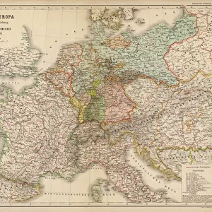
Map of the British Empire in the 10th and 11th centuries showing the counts and vassalite domain of the kingdom. Colouring engraving of the 19th century
![]()

Wall Art and Photo Gifts from Fine Art Finder
Map of the British Empire in the 10th and 11th centuries showing the counts and vassalite domain of the kingdom. Colouring engraving of the 19th century
NWI4874308 Map of the British Empire in the 10th and 11th centuries showing the counts and vassalite domain of the kingdom. Colouring engraving of the 19th century.; (add.info.: Map of the British Empire in the 10th and 11th centuries showing the counts and vassalite domain of the kingdom. Colouring engraving of the 19th century.); Photo © North Wind Pictures
Media ID 38166456
© © North Wind Pictures / Bridgeman Images
1 1st I Ist Century 1 Century 10 10th 10th X 10th Century 10 10th X Xth Century 10 Century 10 X X X X X 10th Century 11 11th 11th Xi 11th 11th Century 11 11th Xi Xith Century 11 Century 11th Century 1st 1st 1st Century 1st Century 1st Century Ad C10th C11th C1st Eleventh Century First Century First Christian Century I Century Ist Century Sec Xi Tenth Century X Century Xi Century Xith Century Xth Century Geographical Map
FEATURES IN THESE COLLECTIONS
> Europe
> United Kingdom
> England
> Maps
> Europe
> United Kingdom
> Maps
> Fine Art Finder
> Artists
> Artist Unknown
> Maps and Charts
> British Empire Maps
> Maps and Charts
> Related Images
EDITORS COMMENTS
This stunning print of a Map of the British Empire in the 10th and 11th centuries offers a glimpse into the intricate counts and vassalite domains of the kingdom during this period. Created as a colouring engraving in the 19th century, this historical map showcases the vast territories and political structure of the British Empire at that time.
The detailed depiction highlights the various regions under different counts and vassals, providing valuable insight into the governance and administration of the kingdom during this pivotal era. From England to Germany, from Europe to Great Britain, each area is meticulously outlined with precision and care.
As we study this map, we are transported back in time to an age where power dynamics were constantly shifting and alliances were crucial for survival. The intricate network of relationships between rulers and their subjects is laid bare before us, offering a fascinating look at how society was organized in medieval times.
Whether you are a history buff or simply appreciate fine artistry, this print is sure to captivate your imagination and spark curiosity about our shared past. Let it serve as a reminder of how far we have come as a civilization, while also honoring those who came before us and shaped the world we live in today.
MADE IN THE USA
Safe Shipping with 30 Day Money Back Guarantee
FREE PERSONALISATION*
We are proud to offer a range of customisation features including Personalised Captions, Color Filters and Picture Zoom Tools
SECURE PAYMENTS
We happily accept a wide range of payment options so you can pay for the things you need in the way that is most convenient for you
* Options may vary by product and licensing agreement. Zoomed Pictures can be adjusted in the Cart.


