Home > Asia > Israel > Maps
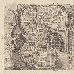
Historical Map of the Holy Land 1849 (Map of Holy land in 1849) Engraving from "" Atlas Universale"" by Houze 1851 Private collection
![]()

Wall Art and Photo Gifts from Fine Art Finder
Historical Map of the Holy Land 1849 (Map of Holy land in 1849) Engraving from "" Atlas Universale"" by Houze 1851 Private collection
ELD4921886 Historical Map of the Holy Land 1849 (Map of Holy land in 1849) Engraving from "" Atlas Universale"" by Houze 1851 Private collection; (add.info.: Historical Map of the Holy Land 1849 (Map of Holy land in 1849) Engraving from "" Atlas Universale"" by Houze 1851 Private collection); Photo © The Holbarn Archive
Media ID 38267516
© Photo © The Holbarn Archive / Bridgeman Images
Chypre Geographical Map Israel Israeli
FEATURES IN THESE COLLECTIONS
> Asia
> Israel
> Related Images
> Fine Art Finder
> Artists
> Pasquier (workshop of) Grenier
> Maps and Charts
> Early Maps
EDITORS COMMENTS
This stunning historical map of the Holy Land from 1849, engraved by Houze in 1851, offers a fascinating glimpse into the geography and history of the region during the 19th century. The intricate details and vibrant colors bring to life the lands of Israel, Cyprus, and other parts of the Middle East as they were known at that time.
As we study this map, we can imagine travelers and explorers navigating through ancient cities, deserts, mountains, and seas depicted with precision and artistry. Each line and symbol on the map tells a story of trade routes, religious sites, political boundaries, and natural landmarks that shaped the landscape of this sacred region.
The engraving captures not only geographical features but also cultural connections between different civilizations that have inhabited these lands throughout history. It serves as a valuable resource for historians, scholars, and enthusiasts seeking to understand the complex tapestry of human civilization in this part of the world.
This print from "Atlas Universale" is a treasure trove of knowledge waiting to be explored further. Its presence in private collections speaks to its enduring significance as a work of art and historical documentation. Let us marvel at this masterpiece from the past and appreciate its timeless beauty.
MADE IN THE USA
Safe Shipping with 30 Day Money Back Guarantee
FREE PERSONALISATION*
We are proud to offer a range of customisation features including Personalised Captions, Color Filters and Picture Zoom Tools
SECURE PAYMENTS
We happily accept a wide range of payment options so you can pay for the things you need in the way that is most convenient for you
* Options may vary by product and licensing agreement. Zoomed Pictures can be adjusted in the Cart.


