Home > Historic > Ancient civilizations > Roman Empire > Roman art
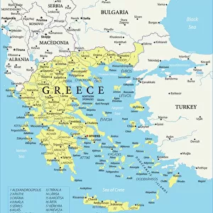
Map of the Byzantine Empire at the times of Justinian I and Ostrogothic Kingdom founded by Theoderic the Great) Engraving from Houze's "Atlas Universale", 1851 Private collection
![]()

Wall Art and Photo Gifts from Fine Art Finder
Map of the Byzantine Empire at the times of Justinian I and Ostrogothic Kingdom founded by Theoderic the Great) Engraving from Houze's "Atlas Universale", 1851 Private collection
ELD4928064 Map of the Byzantine Empire at the times of Justinian I and Ostrogothic Kingdom founded by Theoderic the Great) Engraving from Houze's "Atlas Universale", 1851 Private collection; (add.info.: Map of the Byzantine Empire at the times of Justinian I and Ostrogothic Kingdom founded by Theoderic the Great) Engraving from Houze's "Atlas Universale", 1851 Private collection); Photo © The Holbarn Archive
Media ID 38418548
© © The Holbarn Archive / Bridgeman Images
6 6th Vi Vith Century 6th 6th 6th Vi Vith Vith Century 6th Century C6th Mediterranean Sea Ostrogoth Sixth Century Ad Vi Century Vith Century Geographical Map Grece Greece Greek Isadora
FEATURES IN THESE COLLECTIONS
> Arts
> Artists
> R
> Roman Roman
> Europe
> Greece
> Related Images
> Fine Art Finder
> Artists
> School African
> Historic
> Ancient civilizations
> Ancient Greece
> Greek history
> Historic
> Ancient civilizations
> Roman Empire
> Roman art
> Maps and Charts
> Italy
> Maps and Charts
> Related Images
EDITORS COMMENTS
This stunning engraving from Houze's "Atlas Universale" captures the intricate details of the Map of the Byzantine Empire at the times of Justinian I and Ostrogothic Kingdom founded by Theoderic the Great. Dating back to 1851, this historical piece is a true testament to the rich history and geographical significance of these ancient empires.
The vibrant colors and precise detailing bring to life the vast territories controlled by both Justinian I and Theoderic the Great during their respective reigns in the 6th century. From Greece to Italy, this map showcases the extent of their power and influence over Europe at that time.
As you study this engraving, you can't help but be transported back in time to an era filled with political intrigue, military conquests, and cultural exchanges between different civilizations. The Roman Empire's legacy is evident in every corner of this map, highlighting its lasting impact on European history.
Whether you're a history buff or simply appreciate fine art, this print from Bridgeman Images is sure to captivate your imagination and spark your curiosity about these fascinating periods in world history. Display it proudly in your home or office as a reminder of our shared past and how it continues to shape our present-day world.
MADE IN THE USA
Safe Shipping with 30 Day Money Back Guarantee
FREE PERSONALISATION*
We are proud to offer a range of customisation features including Personalised Captions, Color Filters and Picture Zoom Tools
SECURE PAYMENTS
We happily accept a wide range of payment options so you can pay for the things you need in the way that is most convenient for you
* Options may vary by product and licensing agreement. Zoomed Pictures can be adjusted in the Cart.


