Home > Europe > Romania > Maps
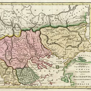
Portulan: maritime map representing the Aegean Sea surrounded by Romania (West), Natalie (North) and Macedonia (South). Watercolour by Augustin Roussin, 1630. Municipal library of Marseille
![]()

Wall Art and Photo Gifts from Fine Art Finder
Portulan: maritime map representing the Aegean Sea surrounded by Romania (West), Natalie (North) and Macedonia (South). Watercolour by Augustin Roussin, 1630. Municipal library of Marseille
JEB4878443 Portulan: maritime map representing the Aegean Sea surrounded by Romania (West), Natalie (North) and Macedonia (South). Watercolour by Augustin Roussin, 1630. Municipal library of Marseille; (add.info.: Portulan: maritime map representing the Aegean Sea surrounded by Romania (West), Natalie (North) and Macedonia (South). Watercolour by Augustin Roussin, 1630. Municipal library of Marseille); © Jean Bernard. All rights reserved 2024
Media ID 38265808
© © Jean Bernard. All rights reserved 2024 / Bridgeman Images
17th Centuries Geographical Map
FEATURES IN THESE COLLECTIONS
> Europe
> Macedonia
> Posters
> Europe
> Macedonia
> Related Images
> Europe
> North Macedonia
> Maps
> Europe
> North Macedonia
> Related Images
> Europe
> Romania
> Related Images
> Fine Art Finder
> Artists
> Spanish School (after)
> Maps and Charts
> Early Maps
> Maps and Charts
> North Macedonia
EDITORS COMMENTS
This stunning watercolour print of a Portulan maritime map, created by Augustin Roussin in 1630, showcases the beauty and intricacy of cartography during the 17th century. The map represents the Aegean Sea surrounded by Romania to the West, Natalie to the North, and Macedonia to the South. Each detail is meticulously hand-drawn, capturing not only geographical accuracy but also artistic flair.
Displayed in the Municipal Library of Marseille, this piece is a true testament to the skill and dedication of early mapmakers. The vibrant colors and delicate lines transport viewers back in time to an era when exploration and discovery were at their peak.
As you study this map closely, you can almost feel yourself sailing through these ancient waters, navigating your way through unknown territories with nothing but a compass and sheer determination. It serves as a reminder of how far we have come in terms of navigation technology while also highlighting the importance of preserving historical artifacts like this for future generations.
Overall, this Portulan maritime map is not just a visual representation of land and sea; it is a window into our past that allows us to appreciate both the artistry and scientific precision that went into creating such masterpieces centuries ago.
MADE IN THE USA
Safe Shipping with 30 Day Money Back Guarantee
FREE PERSONALISATION*
We are proud to offer a range of customisation features including Personalised Captions, Color Filters and Picture Zoom Tools
SECURE PAYMENTS
We happily accept a wide range of payment options so you can pay for the things you need in the way that is most convenient for you
* Options may vary by product and licensing agreement. Zoomed Pictures can be adjusted in the Cart.


