Home > Europe > United Kingdom > England > London > Sport > Sailing
Map of Nagasaki, Japan, c.1868 (coloured woodcut)
")
![]()
Wall Art and Photo Gifts from Fine Art Finder
Map of Nagasaki, Japan, c.1868 (coloured woodcut)
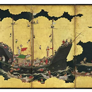
7339464 Map of Nagasaki, Japan, c.1868 (coloured woodcut) by Japanese School, (19th century); 44x65 cm; National Maritime Museum, London, UK; (add.info.: Creator: Koju do
Translation: Nagasaki is surrounded by mountains to the east, south and north. To the west there is a bay and over to the southwest there is a harbour. From the Ganki era many red haired [westerners] people's boats came in and the land is prosperous. After two centuries of restriction on foreign trade, Nagasaki gradually reopened during the 1850s. Local craft, western sailing ships and a paddle steamer depicted.); © National Maritime Museum, Greenwich, London
Media ID 38516550
© © National Maritime Museum, Greenwich, London / Bridgeman Images
Boat Dock Coast Line Harbor Area Harbour Area Harbours Nagasaki Port Area Seawater Asiae Geographer
FEATURES IN THESE COLLECTIONS
> Arts
> Artists
> J
> Japanese School Japanese School
> Europe
> France
> Canton
> Landes
> Europe
> United Kingdom
> England
> London
> Boroughs
> Greenwich
> Europe
> United Kingdom
> England
> London
> Museums
> Greenwich Heritage Centre
> Europe
> United Kingdom
> England
> London
> Museums
> National Maritime Museum
> Europe
> United Kingdom
> England
> London
> Sport
> Sailing
> Europe
> United Kingdom
> England
> London
> Towns
> Greenwich
> Europe
> United Kingdom
> Heritage Sites
> Maritime Greenwich
> Europe
> United Kingdom
> Maps
> Fine Art Finder
> Artists
> Japanese School
> Fine Art Finder
> Artists
> Sydney Hall
EDITORS COMMENTS
This beautifully detailed coloured woodcut print of a Map of Nagasaki, Japan from around 1868 offers a glimpse into the bustling port city during a time of transition. Surrounded by mountains to the east, south, and north, Nagasaki's bay and harbour to the west welcomed red-haired Westerners' boats during the Ganki era, contributing to its prosperity.
After two centuries of restricted foreign trade, Nagasaki began to gradually reopen in the 1850s as depicted in this map. The fusion of local craft with Western sailing ships and a paddle steamer showcases the evolving maritime landscape of the city.
The intricate cartography highlights not only Nagasaki's geographical features but also its importance as a hub for international trade and cultural exchange. The vibrant colours used in this woodcut bring life to the coastal scene, capturing the essence of Nagasaki's dynamic port area.
As you study this historical map, you can imagine ships coming and going from distant lands, carrying goods and ideas that shaped Nagasaki into a thriving cosmopolitan center. This print is not just an artistic representation but a window into a pivotal moment in Nagasaki's history as it embraced new connections with the world beyond its shores.
MADE IN THE USA
Safe Shipping with 30 Day Money Back Guarantee
FREE PERSONALISATION*
We are proud to offer a range of customisation features including Personalised Captions, Color Filters and Picture Zoom Tools
SECURE PAYMENTS
We happily accept a wide range of payment options so you can pay for the things you need in the way that is most convenient for you
* Options may vary by product and licensing agreement. Zoomed Pictures can be adjusted in the Cart.