Home > Europe > United Kingdom > England > London > Museums > National Maritime Museum
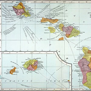
Chart of the Island Otaheite (Tahiti) by James Cook, 1769, 1773 (engraving)
 by James Cook, 1769, 1773 (engraving)")
![]()
Wall Art and Photo Gifts from Fine Art Finder
Chart of the Island Otaheite (Tahiti) by James Cook, 1769, 1773 (engraving)
7339404 Chart of the Island Otaheite (Tahiti) by James Cook, 1769, 1773 (engraving) by Cook, James (1728-79); 24x41 cm; National Maritime Museum, London, UK; (add.info.: Creator: James Cook
Cook's Endeavour voyage began as an expedition to observe the transit of Venus from Tahiti, which had recently been discovered by Wallis. Cook stayed at Tahiti from April to July 1769.); © National Maritime Museum, Greenwich, London
Media ID 38408982
© © National Maritime Museum, Greenwich, London / Bridgeman Images
Dom Tom French Polynesia Islands Isles Polynesia Polynesians Polynesisch Tahiti
FEATURES IN THESE COLLECTIONS
> Arts
> Artists
> P
> Polynesian Polynesian
> Europe
> United Kingdom
> England
> London
> Boroughs
> Greenwich
> Europe
> United Kingdom
> England
> London
> Museums
> Greenwich Heritage Centre
> Europe
> United Kingdom
> England
> London
> Museums
> National Maritime Museum
> Europe
> United Kingdom
> England
> London
> Towns
> Greenwich
> Europe
> United Kingdom
> Heritage Sites
> Maritime Greenwich
> Europe
> United Kingdom
> Maps
> Fine Art Finder
> Artists
> James Cook
> Fine Art Finder
> Artists
> Unknown Artist
> Maps and Charts
> Early Maps
EDITORS COMMENTS
This stunning engraving by James Cook captures the beauty and intricacies of the island of Otaheite (Tahiti) during his famous voyages in 1769 and 1773. Cook's meticulous attention to detail is evident in this chart, showcasing the geography and topography of Tahiti with precision.
The vibrant colors used in this engraving bring Tahiti to life, highlighting its lush landscapes and crystal-clear waters. The map serves as a testament to Cook's exploration and discovery of new lands, providing valuable insights into the Polynesian region.
Cook's 'Endeavour' voyage was initially intended to observe the transit of Venus from Tahiti, but it resulted in so much more. His time spent on the island allowed him to interact with the local Polynesian people and study their culture, making significant contributions to our understanding of Oceania.
As you gaze upon this print, you can't help but be transported back in time to an era of exploration and adventure. The Chart of the Island Otaheite (Tahiti) is not just a map; it is a window into history, offering a glimpse into Cook's remarkable journey through uncharted territories.
MADE IN THE USA
Safe Shipping with 30 Day Money Back Guarantee
FREE PERSONALISATION*
We are proud to offer a range of customisation features including Personalised Captions, Color Filters and Picture Zoom Tools
SECURE PAYMENTS
We happily accept a wide range of payment options so you can pay for the things you need in the way that is most convenient for you
* Options may vary by product and licensing agreement. Zoomed Pictures can be adjusted in the Cart.