Home > Europe > United Kingdom > Heritage Sites > Maritime Greenwich
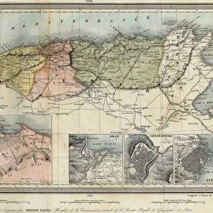
Chart of New Holland, Virginia and New England, 1660 (engraving)
![]()

Wall Art and Photo Gifts from Fine Art Finder
Chart of New Holland, Virginia and New England, 1660 (engraving)
7340064 Chart of New Holland, Virginia and New England, 1660 (engraving) by Doncker, Hendrick (c.1626-99); 46.5x57 cm; National Maritime Museum, London, UK; (add.info.: Creator: Hendrik Doncker
'Pas caert van Nieu Nederland, Virginia en Nieu Engelant'. The borders are graduated for latitude and longitude, the bar scales are in Dutch, Spanish and French and English miles, actually leagues). Additional places are Cape Cod, Nantucket Shoals, Long Island, Delaware and Chesapeake. It's bound in 'De Zee-Atlas ofte Water-wareld', a sea atlas published by Doncker in 1661.); © National Maritime Museum, Greenwich, London
Media ID 38410176
© © National Maritime Museum, Greenwich, London / Bridgeman Images
FEATURES IN THESE COLLECTIONS
> Europe
> United Kingdom
> Heritage Sites
> Maritime Greenwich
> Fine Art Finder
> Artists
> Hendrick Doncker
> Fine Art Finder
> Artists
> Unknown Artist
EDITORS COMMENTS
This stunning print showcases the intricate and detailed "Chart of New Holland, Virginia and New England" from 1660, engraved by Hendrick Doncker. The map measures 46.5x57 cm and is housed in the National Maritime Museum in London, UK.
The borders of this historic chart are graduated for latitude and longitude, with bar scales provided in Dutch, Spanish, French, and English miles (leagues). It includes important locations such as Cape Cod, Nantucket Shoals, Long Island, Delaware, and Chesapeake Bay.
Originally published in Doncker's 'De Zee-Atlas ofte Water-wareld' sea atlas in 1661, this map offers a glimpse into the early exploration and cartography of North America during the 17th century. It provides valuable insight into the geographical knowledge of that time period.
The vibrant colors used to bring this engraving to life add an extra layer of beauty to its historical significance. This piece serves as a testament to the artistry and skill involved in creating maps during this era.
Overall, this print captures a moment in history when exploration was at its peak and new lands were being discovered. It stands as a reminder of our past adventures and discoveries that have shaped the world we know today.
MADE IN THE USA
Safe Shipping with 30 Day Money Back Guarantee
FREE PERSONALISATION*
We are proud to offer a range of customisation features including Personalised Captions, Color Filters and Picture Zoom Tools
SECURE PAYMENTS
We happily accept a wide range of payment options so you can pay for the things you need in the way that is most convenient for you
* Options may vary by product and licensing agreement. Zoomed Pictures can be adjusted in the Cart.


