Home > Europe > United Kingdom > England > London > Museums > National Maritime Museum
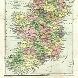
Chart of Scilly Isles, c.1693 (print)
")
![]()
Wall Art and Photo Gifts from Fine Art Finder
Chart of Scilly Isles, c.1693 (print)
7340689 Chart of Scilly Isles, c.1693 (print) by Collins, Greenvile (1643-94); National Maritime Museum, London, UK; (add.info.: Creator: Greenvile Collins
The Islands of Scilly, from Great Britain's Coasting Pilot, by Greenvile
Collins.); © National Maritime Museum, Greenwich, London
Media ID 38177732
© © National Maritime Museum, Greenwich, London / Bridgeman Images
Isles Of Scilly Scilly Scilly Islands Scilly Isles The Scilly Isles
FEATURES IN THESE COLLECTIONS
> Europe
> Republic of Ireland
> Maps
> Europe
> United Kingdom
> England
> London
> Boroughs
> Greenwich
> Europe
> United Kingdom
> England
> London
> Museums
> British Museum
> Europe
> United Kingdom
> England
> London
> Museums
> Greenwich Heritage Centre
> Europe
> United Kingdom
> England
> London
> Museums
> National Maritime Museum
> Europe
> United Kingdom
> England
> London
> Sights
> British Museum
> Europe
> United Kingdom
> England
> London
> Towns
> Greenwich
> Europe
> United Kingdom
> Heritage Sites
> Maritime Greenwich
> Europe
> United Kingdom
> Maps
> Europe
> United Kingdom
> Northern Ireland
> Maps
> Fine Art Finder
> Artists
> Greenvile Collins
> Fine Art Finder
> Artists
> Unknown Artist
EDITORS COMMENTS
This stunning print of the Chart of Scilly Isles, dating back to circa 1693, offers a fascinating glimpse into the cartography of the 17th century. Created by Greenvile Collins as part of his work 'The Islands of Scilly' for Great Britain's Coasting Pilot, this intricate map showcases the beauty and complexity of the Scilly Isles.
The black and white depiction highlights the detailed geography and topography of these British isles, known for their rugged coastlines and picturesque landscapes. The careful attention to detail in this print reflects Collins' dedication to accurately representing these islands for navigational purposes.
As we gaze upon this historical artifact, we are transported back in time to an era when exploration and discovery were at the forefront of maritime endeavors. The Chart of Scilly Isles serves as a reminder of the importance of maps in guiding sailors safely through treacherous waters and unknown territories.
Whether you have a personal connection to these islands or simply appreciate fine cartography, this print is sure to captivate your imagination and spark curiosity about the history and significance of mapping in centuries past. Displayed proudly on your wall, it will serve as both a decorative piece and a conversation starter for all who admire its beauty.
MADE IN THE USA
Safe Shipping with 30 Day Money Back Guarantee
FREE PERSONALISATION*
We are proud to offer a range of customisation features including Personalised Captions, Color Filters and Picture Zoom Tools
SECURE PAYMENTS
We happily accept a wide range of payment options so you can pay for the things you need in the way that is most convenient for you
* Options may vary by product and licensing agreement. Zoomed Pictures can be adjusted in the Cart.