Home > Maps and Charts > Related Images
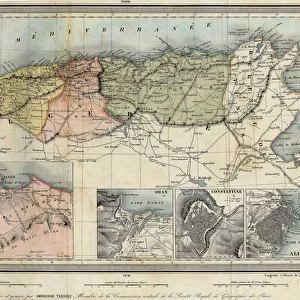
Geographic map of Europe during the Crusades between the years 1000 and 1200. Colour lithography
![]()

Wall Art and Photo Gifts from Fine Art Finder
Geographic map of Europe during the Crusades between the years 1000 and 1200. Colour lithography
NWI4871138 Geographic map of Europe during the Crusades between the years 1000 and 1200. Colour lithography; (add.info.: Geographic map of Europe during the Crusades between the years 1000 and 1200. Colour lithography); Photo © North Wind Pictures
Media ID 38166698
© © North Wind Pictures / Bridgeman Images
1 1st I Ist Century 1 Century 11 11th 11th Xi 11th 11th Century 11 11th Xi Xith Century 11 Century 11th Century 12 12th Xii Xiith Century 12 Century 13 13th Xiii Xiiith Thirteenth Century 1st 1st 1st Century 1st Century 1st Century A 1st Century Ad C11th C12th C1st Christianity Religion Crusade Eleventh Century First Century First Century Ad First Christian Century I Century Ist Century Sec Xi The 13th Century Twelfth Century Xi Century Xii Century Xiith Century Xith Century 12 12th 12th Xii 12th 13th Century 13 13th Xiii Xiiith Century 13 Century C13th Catholic Religion Christendom Geographical Map Thirteenth Century Xiii Century Xiiith Century
FEATURES IN THESE COLLECTIONS
> Fine Art Finder
> Artists
> Unknown Artist
> Maps and Charts
> Related Images
> Popular Themes
> Religious Images
EDITORS COMMENTS
This stunning Geographic map of Europe during the Crusades between the years 1000 and 1200 captures a pivotal period in history with intricate detail and vibrant colors. The lithography print showcases the vast territories and strategic locations that played a significant role in the religious conflicts of the time.
From the Byzantine Empire to Western Europe, this map provides a visual representation of the complex political landscape during this era. The Crusades, marked by military campaigns and religious fervor, are depicted through symbols and labels that highlight key cities, regions, and battle sites.
As you study this historical artifact, you can't help but be transported back in time to an age of knights, kings, and holy wars. The meticulous craftsmanship of the engraving brings each element to life, inviting viewers to explore every corner of Europe as it was over a thousand years ago.
Whether you're a history buff or simply appreciate fine art, this Geographic map is sure to captivate your imagination and spark curiosity about one of the most fascinating periods in European history. Displayed proudly on your wall, it serves as both a decorative piece and an educational tool for understanding the complexities of medieval society.
MADE IN THE USA
Safe Shipping with 30 Day Money Back Guarantee
FREE PERSONALISATION*
We are proud to offer a range of customisation features including Personalised Captions, Color Filters and Picture Zoom Tools
SECURE PAYMENTS
We happily accept a wide range of payment options so you can pay for the things you need in the way that is most convenient for you
* Options may vary by product and licensing agreement. Zoomed Pictures can be adjusted in the Cart.


