Home > Europe > United Kingdom > England > County Durham > Durham
OS map, 1922: Northumberland, Solway Firth, Cumberland, Durham (colour litho)
")
![]()
Wall Art and Photo Gifts from Fine Art Finder
OS map, 1922: Northumberland, Solway Firth, Cumberland, Durham (colour litho)
8651669 OS map, 1922: Northumberland, Solway Firth, Cumberland, Durham (colour litho) by English School, (20th century); Private Collection; (add.info.: Northumberland, Solway Firth, Cumberland, Durham. Illustration for the Ordnance Survey Map of England and Wales, Quarter Inch to the Mile (1922).); © Look and Learn
Media ID 38381494
© © Look and Learn / Bridgeman Images
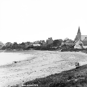
County Durham County Of Durham Durham Northumberland Northumbria Northumbrian Stereoscopic Card Stereoscopy 1920s 20s 20s
FEATURES IN THESE COLLECTIONS
> Arts
> Artists
> I
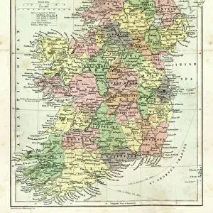
> Irish School Irish School
> Europe
> Republic of Ireland
> Maps
> Europe
> United Kingdom
> England
> County Durham
> Durham
> Europe
> United Kingdom
> England
> Cumberland
> Europe
> United Kingdom
> England
> Durham
> Durham
> Europe
> United Kingdom
> England
> Maps
> Europe
> United Kingdom
> England
> Northumberland
> Related Images
> Europe
> United Kingdom
> Maps
> Europe
> United Kingdom
> Northern Ireland
> Maps
> Europe
> United Kingdom
> Northern Ireland
> Posters
> Fine Art Finder
> Artists
> English School
> Fine Art Finder
> Schools
> German School
EDITORS COMMENTS
This stunning color lithograph print of an OS map from 1922 showcases the beautiful regions of Northumberland, Solway Firth, Cumberland, and Durham in intricate detail. The English School artist has captured the essence of these historic areas with precision and artistry.
The Ordnance Survey Map of England and Wales is depicted in this piece, providing a snapshot of the landscape during the early twentieth century. The vibrant colors bring to life the counties of Durham and Northumberland, highlighting their unique features and topography.
As you gaze upon this vintage map print, you are transported back to a time when cartography was both functional and artistic. The intricate details on display offer a glimpse into the past while also serving as a reminder of how far we have come in terms of mapping technology.
Whether you have a personal connection to these regions or simply appreciate historical maps, this print is sure to captivate your imagination. It serves as a testament to the beauty and complexity of our world, inviting viewers to explore its depths with curiosity and wonder.
MADE IN THE USA
Safe Shipping with 30 Day Money Back Guarantee
FREE PERSONALISATION*
We are proud to offer a range of customisation features including Personalised Captions, Color Filters and Picture Zoom Tools
SECURE PAYMENTS
We happily accept a wide range of payment options so you can pay for the things you need in the way that is most convenient for you
* Options may vary by product and licensing agreement. Zoomed Pictures can be adjusted in the Cart.