Home > Europe > United Kingdom > England > Manchester > Northern Ireland
Map of England and Wales, c.1900 (engraving)
")
![]()
Wall Art and Photo Gifts from Fine Art Finder
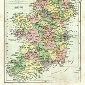
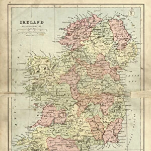
Map of England and Wales, c.1900 (engraving)
532903 Map of England and Wales, c.1900 (engraving); (add.info.: Map showing the historical boundaries of northern England and Wales, including insets of Liverpool, Manchester and Vicinity, circa 1902, from the 10th edition of Encyclopaedia Britannica.); Encyclopaedia Britannica/UIG
Media ID 38406646
© Encyclopaedia Britannica/UIG / Bridgeman Images
1902 19th Century Style Guidance Illustration Technique Liverpool Liverpudlian Manchester Meridian Navigational Equipment Old Fashioned Part Of Physical Geography The Past Welsh Western Script
FEATURES IN THESE COLLECTIONS
> Europe
> Republic of Ireland
> Maps
> Europe
> Republic of Ireland
> Paintings
> Europe
> United Kingdom
> England
> Liverpool
> Europe
> United Kingdom
> England
> Manchester
> Manchester
> Europe
> United Kingdom
> England
> Manchester
> Northern Ireland
> Europe
> United Kingdom
> England
> Maps
> Europe
> United Kingdom
> England
> Paintings
> Europe
> United Kingdom
> Maps
> Europe
> United Kingdom
> Northern Ireland
> Maps
> Europe
> United Kingdom
> Northern Ireland
> Paintings
> Fine Art Finder
> Temp Classification
EDITORS COMMENTS
This engraving from c.1900 showcases a detailed Map of England and Wales, providing a glimpse into the historical boundaries of northern England and Wales. The intricate design includes insets of Liverpool, Manchester, and Vicinity, offering a closer look at these bustling cities during that time period.
As part of the 10th edition of Encyclopaedia Britannica, this map serves as both a navigational tool and a piece of art. The Western script used for labeling adds to its old-fashioned charm, while the inclusion of meridians and seas highlights its importance in exploration and geographical understanding.
The rich history embedded within this map is evident through its depiction of Great Britain's regions and landmarks. From the industrial hubs like Liverpool and Manchester to the picturesque landscapes of Wales, every detail on this print tells a story about the past.
Whether you're an enthusiast for cartography or simply appreciate historical artifacts, this Map of England and Wales is sure to captivate your imagination. It stands as a testament to the craftsmanship and precision that went into creating maps before modern technology took over.
MADE IN THE USA
Safe Shipping with 30 Day Money Back Guarantee
FREE PERSONALISATION*
We are proud to offer a range of customisation features including Personalised Captions, Color Filters and Picture Zoom Tools
SECURE PAYMENTS
We happily accept a wide range of payment options so you can pay for the things you need in the way that is most convenient for you
* Options may vary by product and licensing agreement. Zoomed Pictures can be adjusted in the Cart.