Home > Animals > Mammals > Didelphidae > Formosa
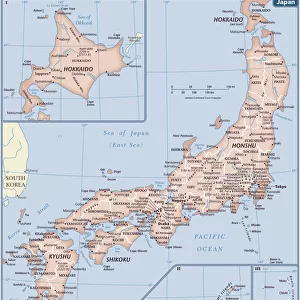
Map of Japan and Korea, c.1900 (engraving)
")
![]()
Wall Art and Photo Gifts from Fine Art Finder
Map of Japan and Korea, c.1900 (engraving)
533031 Map of Japan and Korea, c.1900 (engraving); (add.info.: Map of Japan and Korea, with insets of Kurile Islands, Liu-Kiu Islands and Formosa, circa 1902, from the 10th edition of Encyclopaedia Britannica.); Encyclopaedia Britannica/UIG
Media ID 38406670
© Encyclopaedia Britannica/UIG / Bridgeman Images
1902 19th Century Style Boundary Formosa Geographical Border Guidance Illustration Technique Korea Korean Koreans Meridian Navigational Equipment Old Fashioned Physical Geography The Past Western Script Kurile Islands
FEATURES IN THESE COLLECTIONS
> Animals
> Mammals
> Didelphidae
> Formosa
> Fine Art Finder
> Temp Classification
EDITORS COMMENTS
This stunning engraving of a Map of Japan and Korea from around 1900 is a true masterpiece of cartography. The intricate details and precise lines showcase the skill and artistry of the mapmaker, capturing the essence of these two countries in a bygone era.
The inclusion of insets featuring the Kurile Islands, Liu-Kiu Islands, and Formosa adds an extra layer of depth to this historical piece. Each island is carefully labeled, providing valuable geographical information for explorers and navigators alike.
As we gaze upon this map, we are transported back in time to an age when Western script was used to delineate boundaries and meridians. The coastline is meticulously drawn, highlighting the physical geography of these lands with accuracy and precision.
This print serves as a reminder of the rich history and cultural heritage that Japan and Korea possess. It evokes a sense of nostalgia for a time when exploration was at its peak, guiding travelers across seas with its detailed guidance.
Overall, this Map of Japan and Korea is not just a mere illustration; it is a window into the past, offering us insight into how these countries were perceived over a century ago. Its timeless beauty continues to captivate viewers today, making it an invaluable addition to any collection or display.
MADE IN THE USA
Safe Shipping with 30 Day Money Back Guarantee
FREE PERSONALISATION*
We are proud to offer a range of customisation features including Personalised Captions, Color Filters and Picture Zoom Tools
SECURE PAYMENTS
We happily accept a wide range of payment options so you can pay for the things you need in the way that is most convenient for you
* Options may vary by product and licensing agreement. Zoomed Pictures can be adjusted in the Cart.