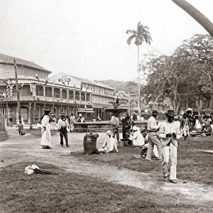
Home > Fine Art Storehouse > The Magical World of Illustration > Palmer Illustrated Collection
West Indies map 1869

![]()
Wall Art and Photo Gifts from Fine Art Storehouse
West Indies map 1869
Cornells Grammars-School Geography - S.S. Cornell - New York D. Appleton and Company 1869
Unleash your creativity and transform your space into a visual masterpiece!
THEPALMER
Media ID 13668821
© Roberto A Sanchez
Antilles Bahamas Barbados Bermuda Caribbean Sea Cuba Florida Us State Florida Usa Gulf Coast States Haiti Island Puerto Rico Textured Effect Trinidad And Tobago West Indies Obsolete
FEATURES IN THESE COLLECTIONS
> Fine Art Storehouse
> The Magical World of Illustration
> Palmer Illustrated Collection
> Fine Art Storehouse
> Map
> Historical Maps
EDITORS COMMENTS
This print takes us back in time to the year 1869, showcasing a beautifully detailed map of the West Indies. The antique charm of this piece is evident through its engraved image and textured effect, giving it an old-world allure that transports us to a bygone era. The map encompasses various islands and regions within the Caribbean Sea, including Trinidad and Tobago, Haiti, Bermuda, Puerto Rico, Cuba, Barbados, and the Bahamas. It also extends towards Florida in the United States. This comprehensive depiction offers insights into both physical geography and cartography during that period. As we examine this historic artwork closely, we can appreciate the intricate craftsmanship involved in creating such a detailed representation of landmasses and bodies of water. Every contour is meticulously etched onto paper with precision. While this particular map may be considered obsolete today due to changes in political boundaries or geographical features over time, it serves as a valuable historical artifact preserving our understanding of past landscapes. Its horizontal orientation allows for easy study and analysis. "The West Indies Map 1869" by THEPALMER invites viewers on a journey through time while celebrating the artistry behind early cartography. Whether you are fascinated by history or simply captivated by vintage aesthetics, this print promises to add character and intrigue to any space it graces.
MADE IN THE USA
Safe Shipping with 30 Day Money Back Guarantee
FREE PERSONALISATION*
We are proud to offer a range of customisation features including Personalised Captions, Color Filters and Picture Zoom Tools
SECURE PAYMENTS
We happily accept a wide range of payment options so you can pay for the things you need in the way that is most convenient for you
* Options may vary by product and licensing agreement. Zoomed Pictures can be adjusted in the Cart.