Home > Arts > Contemporary art > Digital artwork > Street art
MA Berkshire West Stockbridge Vector Road Map

![]()
Wall Art and Photo Gifts from Fine Art Storehouse
MA Berkshire West Stockbridge Vector Road Map
MA Berkshire West Stockbridge Vector Road Map. All source data is in the public domain. U.S. Census Bureau Census Tiger. Used Layers: areawater, linearwater, roads, rails, cousub, pointlm, uac10
Unleash your creativity and transform your space into a visual masterpiece!
Frank Ramspott
Media ID 20688711
© Frank Ramspott, all rights reserved
Berkshire City Map Computer Graphic County Digital Composite District Geographical Border Massachusetts Road Map Text Vector Digitally Generated Image Stockbridge
FEATURES IN THESE COLLECTIONS
> Animals
> Mammals
> Cats (Wild)
> Tiger
> Animals
> Mammals
> Muridae
> Water Mouse
> Arts
> Contemporary art
> Digital artwork
> Street art
> Arts
> Landscape paintings
> Waterfall and river artworks
> River artworks
> Arts
> Portraits
> Pop art gallery
> Street art portraits
> Arts
> Street art graffiti
> Digital art
> Digital paintings
> Europe
> United Kingdom
> England
> Berkshire
> Related Images
> Fine Art Storehouse
> Map
> Reference Maps
> Maps and Charts
> Related Images
> Popular Themes
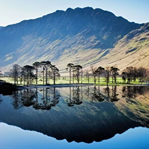
> Lake District
EDITORS COMMENTS
This print showcases the MA Berkshire West Stockbridge Vector Road Map, a stunning piece of cartography artistry. Created by Frank Ramspott, this digitally generated image is a testament to his exceptional design skills and attention to detail. The map encompasses various layers of information sourced from the U. S. Census Bureau Census Tiger, all of which are in the public domain. From its vibrant colors to its precise vector lines, every element has been meticulously crafted to provide an accurate representation of the region's physical geography. While devoid of people, this visually striking composition highlights key features such as rivers, lakes, roads, rails, and towns. Notable landmarks like Maple Hill, Stockbridge, Pinnacle Point, Mahkeenac Heights, Larrywaug, Tom Ball Mountain, and Williamsville can be identified within this comprehensive city map. With text labels enhancing legibility and geographical borders demarcating different areas seamlessly integrated into the composition, this artwork effortlessly combines aesthetics with functionality. It serves as both a beautiful decorative piece for any space and a practical tool for navigation or exploration. As an impressive digital composite that celebrates Massachusetts' natural beauty and urban landscape alike, this color image invites viewers on a visual journey through MA Berkshire West Stockbridge's enchanting surroundings.
MADE IN THE USA
Safe Shipping with 30 Day Money Back Guarantee
FREE PERSONALISATION*
We are proud to offer a range of customisation features including Personalised Captions, Color Filters and Picture Zoom Tools
SECURE PAYMENTS
We happily accept a wide range of payment options so you can pay for the things you need in the way that is most convenient for you
* Options may vary by product and licensing agreement. Zoomed Pictures can be adjusted in the Cart.