1500s Collection (#27)

The 1500s were a time of exploration, innovation, and cultural transformation

Background image1500s Collection: EVNT2A-00073

EVNT2A-00073
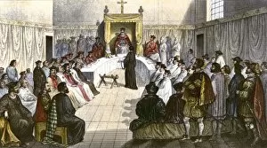
Trial for heresy during the Spanish Inquisition. Hand-colored engraving of a 19th century illustration

Background image1500s Collection: EVNT2A-00282

EVNT2A-00282
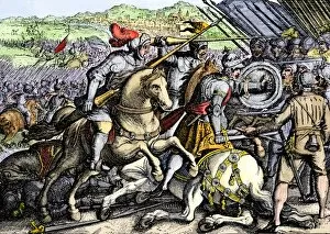
French king Francis I taken prisoner at Pavia during war with the Holy Roman Empire, 1525. Hand-colored 19th century reproduction of an earlier engraving

Background image1500s Collection: EVNT2A-00281

EVNT2A-00281
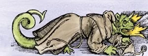
Dragon of Heresy, from Guidius " Dialogy" printed in Switzerland, 1521. Hand-colored woodcut of a 19th-century reproduction of the illustration

Background image1500s Collection: EXPL2A-00232

EXPL2A-00232
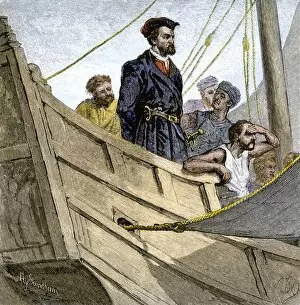
Jacques Cartier aboard ship arriving on the shore of Canada, 1534. Hand-colored woodcut of a 19th-century illustration

Background image1500s Collection: EXPL2A-00247

EXPL2A-00247
Jacques Cartier embraced by Donnacona, a native Canadian Huron chief, Gaspee Peninsula, 1535. Hand-colored woodcut of a 19th-century illustration

Background image1500s Collection: EXPL2A-00251

EXPL2A-00251
Title page of the London edition of Jacques Cartiers book about his discoveries in Canada, printed in 1580. Watercolor wash over a 19th-century printed halftone reproduction

Background image1500s Collection: EXPL2A-00087

EXPL2A-00087
Jacques Cartier on the summit of Mont Real, now Montreal, Canada, 1535. Hand-colored woodcut of a 19th-century illustration

Background image1500s Collection: Cartier monument on the St Lawrence, Quebec

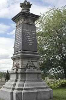
Cartier monument on the St Lawrence, Quebec
Monument marking Jacques Cartiers landing place on the St Lawrence River in Quebec. Digital photograph

Background image1500s Collection: Cartiers landing place on the St Lawrence, Quebec

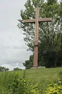
Cartiers landing place on the St Lawrence, Quebec
Replica cross marking Jacques Cartiers landing place on the St Lawrence River in Quebec. Digital photograph

Background image1500s Collection: PEXP2A-00052

PEXP2A-00052
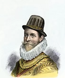
Sir John Hawkins, English explorer and naval commander against the Spanish Armada, 1588. Hand-colored 19th-century woodcut reproduction of an earlier illustration

Background image1500s Collection: PROY2A-00081

PROY2A-00081
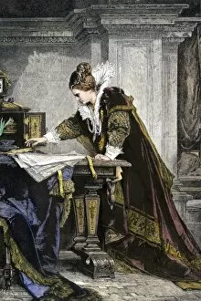
Elizabeth I signing the death warrant to execute Mary, Queen of Scots. Hand-colored woodcut of a 19th-century illustration

Background image1500s Collection: PEXP2A-00007

PEXP2A-00007
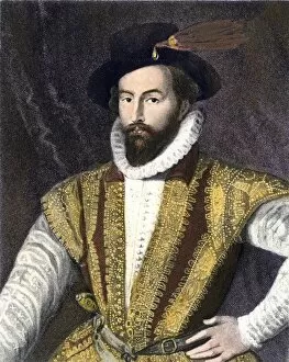
Sir Walter Raleigh. Hand-colored engraving of a painting

Background image1500s Collection: PEXP2A-00010

PEXP2A-00010
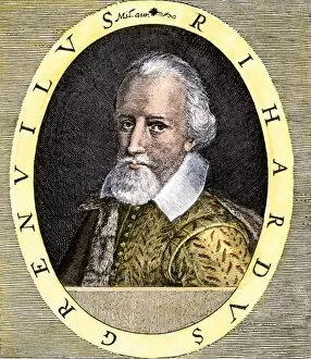
Richard Grenville, English naval commander, portrait. Hand-colored engraving

Background image1500s Collection: GGBR2A-00020

GGBR2A-00020
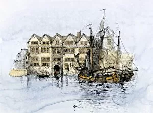
Sailing-ships in Cold Harbor, Thames Street, London, about 1600. Hand-colored 19th-century woodcut reproduction of an earlier illustration

Background image1500s Collection: GGBR2A-00037

GGBR2A-00037
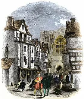
Street in London during the reign of Mary I, early 1500s. Hand-colored woodcut of a 19th-century illustration

Background image1500s Collection: Two judges in Elizabethan England

Two judges in Elizabethan England
English judges in their robes during Elizabeths reign, 1500s. Color lithograph reproduction

Background image1500s Collection: English awaiting the Spanish Armadas approach, 1588

English awaiting the Spanish Armadas approach, 1588
English naval officers playing a game of bowls before attacking the Spanish Armada, 1588. Hand-colored woodcut of a 19th-century illustration

Background image1500s Collection: EVNT2A-00098

EVNT2A-00098
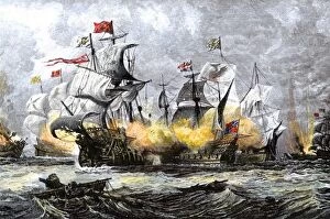
English warship " Vanguard" attacking the Spanish Armada, 1588. Hand-colored woodcut of a 19th-century illustration

Background image1500s Collection: EXPL2A-00244

EXPL2A-00244
Possibly the earliest engraving of an American buffalo, 1558 - first mentioned by Cabeza de Vaca. Hand-colored 19th-century woodcut reproduction of the original 16th-century engraving

Background image1500s Collection: Map of the Americas, 1550

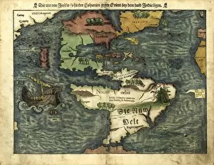
Map of the Americas, 1550
16th century map of the Americas. Published in 1550, this German map shows a rudimentary geography of the newly-discovered Americas

Background image1500s Collection: That Luang Stupa

That Luang Stupa, constructed in 1566 by King Setthathirat, Vientiane, Laos, Indochina, Southeast Asia, Asia

Background image1500s Collection: Moldovita Monastery from the southeast, exterior walls painted by Toma of Suceava in 1537

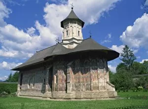
Moldovita Monastery from the southeast, exterior walls painted by Toma of Suceava in 1537, UNESCO World Heritage Site, North West Moldavia (South Bucovina), Romania, Europe

Background image1500s Collection: The famous Old Bridge of Mostar built in 1566, destroyed in 1993

The famous Old Bridge of Mostar built in 1566, destroyed in 1993, rebuilt in 2004 as the New Old Bridge, Mostar, Herzegovina, Bosnia and Herzegovina, Balkans, Europe

Background image1500s Collection: The chapel of La Balbanera dating from 1534, the oldest church in the country

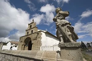
The chapel of La Balbanera dating from 1534, the oldest church in the country, rebuilt after the 1797 earthquake, near Colta Lake, south west of Riobamba, Chimborazo Province, Central Highlands

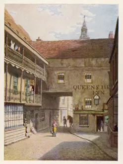
Background image1500s Collection: Queens Head, Southwark

Queens Head, Southwark
Built in the early 1500s, this inn was later owned by John Harvard of Emmanuel College, Cambridge, who migrated to America and gave his name to Harvard University, MA

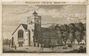
Background image1500s Collection: Willesden Church

Willesden Church
Willsdon Church, Middlesex. The church was first mentioned in 1181 but wasn t recorded as St. Marys until around 1280. By 1500s was known for its shrine to the Virgin Mary


For sale as Licensed Images

Choose your image, Select your licence and Download the media

The 1500s were a time of exploration, innovation, and cultural transformation. In the realm of art and science, geniuses like Leonardo da Vinci left their mark with groundbreaking works such as "Skull anatomy, " revealing the intricacies of human anatomy. Meanwhile, cartographers like Gerardus Mercator (GGBR2A-00076) created maps that expanded our understanding of the world. Orteliuss map of the Ottoman Empire in 1570 showcased the vast territories under its rule, while Durer's world map from 1515 provided a glimpse into how people perceived Earth at that time. These maps painted a picture of an ever-expanding global landscape. In Florence during this era, architects and urban planners crafted detailed plans for cities like never before seen. The 16th Century Plan of Florence exemplified this meticulous approach to city design. Oronce Fine's world map from 1531 furthered geographical knowledge by incorporating new discoveries made during expeditions around the globe. It was through these maps that Europeans began to comprehend just how vast our planet truly is. The use of firearms also revolutionized warfare during this period. Arquebusses became prevalent on battlefields across Europe in the 16th century, changing military tactics forever. Religion played a significant role in shaping society during this time as well. Figures like John Calvin emerged as influential theologians whose ideas would have lasting impacts on Protestantism and beyond. Maps continued to evolve throughout the century; one notable example being Map of Palestine in 1588 which depicted important biblical sites within its borders. Similarly, a detailed map showcasing British Isles shed light on England's growing influence over neighboring lands. By the turn of the century, Europe had undergone immense changes politically and culturally - reflected by Map of Europe from 1600 which captured shifting borders and emerging nation-states.