
1527 1598 Collection
"Abraham Ortelius (1527-1598): The Master Cartographer of the Renaissance" Abraham Ortelius, also known as Orthellius


For sale as Licensed Images
Choose your image, Select your licence and Download the media
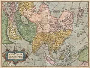
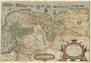
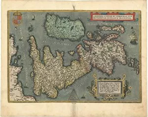
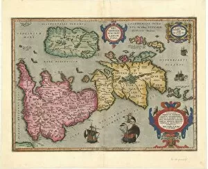
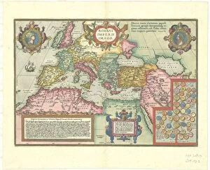
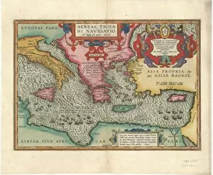
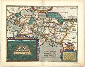
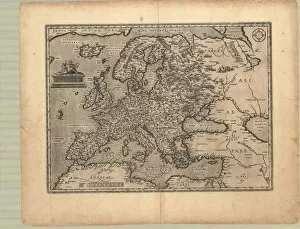
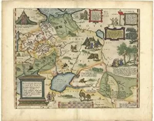
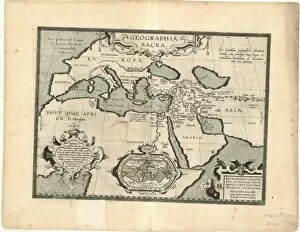
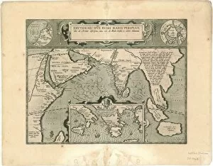
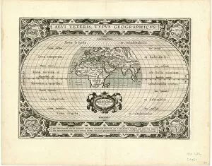
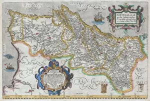
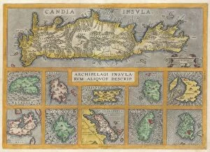
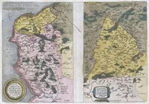
"Abraham Ortelius (1527-1598): The Master Cartographer of the Renaissance" Abraham Ortelius, also known as Orthellius, was a renowned Flemish cartographer who lived from 1527 to 1598. His contributions to the field of mapmaking were truly remarkable and continue to be celebrated today. One of his most notable works is the "Ortelius Map of Asia, " which was first published in 1570. This masterpiece provided an incredibly detailed and accurate representation of the Asian continent during that time period. It showcased Ortelius' meticulous attention to detail and his commitment to creating maps that were both visually stunning and informative. In addition to his famous map of Asia, Ortelius created numerous other noteworthy pieces throughout his career. One such example is the "Map Oost ende West Vrieslandts beschrAovinghe, " which depicted the regions of East and West Friesland in great detail. Ortelius also ventured into mapping Britain with his creation titled "Map Angliae Scotiae et Hiberniae sive Britannicar. " This map showcased England, Scotland, Ireland, and other British islands with incredible precision. Another significant work by Ortelius was the "Map Romani Imperii imago, " which portrayed the Roman Empire during its height. This particular piece demonstrated not only Ortelius' skill in cartography but also his deep understanding of historical geography. Furthermore, he delved into mythology with maps like "Map Aeneae Troiani Navigatio Ad Virgilij sex priores Aeneidos, " illustrating Aeneas' legendary journey as described in Virgil's epic poem. Ortelius did not limit himself geographically; he explored various parts of Europe through maps such as "Map Evropae. " These copperplate prints captured Europe's diverse landscapes and served as valuable resources for travelers during that era.