
1618 1679 Collection
"Exploring the Cartographic Treasures: 1618-1679" Step into a world of intricate maps and historical wonders with these captivating cartographic masterpieces


For sale as Licensed Images
Choose your image, Select your licence and Download the media
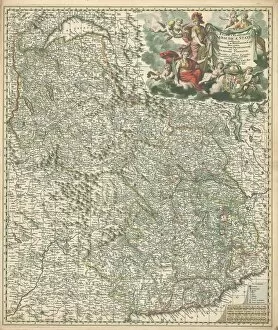
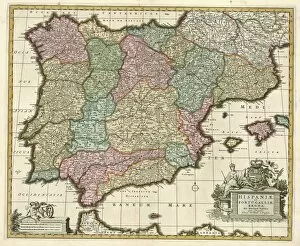
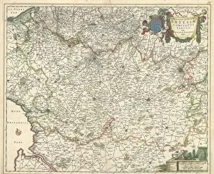
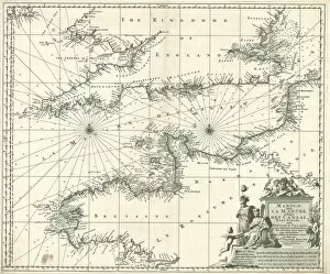
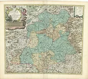
"Exploring the Cartographic Treasures: 1618-1679" Step into a world of intricate maps and historical wonders with these captivating cartographic masterpieces. From the "Map Insularum MelitA┼á vulgo MaltA┼á et GozA┼á novissima delineatio" to the "Map Regiae celsitudinis Sabaudicae Status consistens, " each map offers a glimpse into different regions and their unique characteristics. Discover the precision of the "Map Exactissima Helvetiae Rhaetiae Valesiae caeterorumq" as it showcases Switzerland, Rhätia, Valais, and other neighboring areas in stunning detail. Marvel at Nicolaes Jansz's creation, the "Map Hispaniae et Portugalliae regna, " which beautifully depicts Spain and Portugal with all their grandeur. Travel through time with the "Map Geographica Artesiae Comitatus tabula Nicolaes Jansz, " immersing yourself in the geography of Artois County. Explore both prominent prefectures and hidden gems on the "Map Comitatus Burgundiae tam praecipuas ejus praefecturas quam. " Experience France like never before on the comprehensive masterpiece titled "Map Galliae seu Franciae tabula qua omnes provinciae. " Delve deeper into Normandy and Brittany as they come alive on the detailed canvas of "Map Tabula nova complectens praefecturas Normanniae et Britanniae. " Witness how La Manche captivates both Frenchmen (La Manche) and Belgians (Het Canaal) on an enchanting map aptly named "Map Manica Gallis La Manche et Belgis Het Canaal. " Immerse yourself in Bavarian history through two distinct maps.