
1630 1706 Collection
"1630-1706: Exploring the World through Frederick de Wit's Maps" Step into the past with Frederick de Wit's exquisite maps


For sale as Licensed Images
Choose your image, Select your licence and Download the media
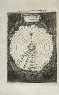
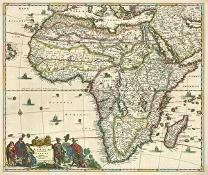
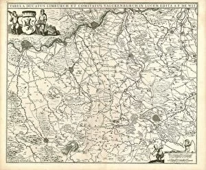
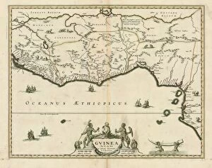
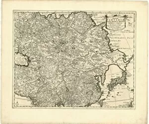
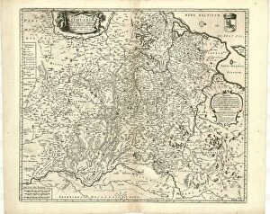
"1630-1706: Exploring the World through Frederick de Wit's Maps" Step into the past with Frederick de Wit's exquisite maps, which provide a captivating glimpse into the world from 1630 to 1706. Known for his exceptional cartographic skills, de Wit created masterpieces that showcased both accuracy and artistry. One such masterpiece is "Systeme de l vnivers Description de l univers, " a map that beautifully depicts the celestial bodies and their intricate connections. With meticulous detail, it transports us to an era when understanding the universe was still a mystery waiting to be unraveled. Delve further into geographical wonders with "Map Comitatus Zelandiae tabula. " This stunning piece showcases Zeeland, Netherlands' westernmost province, highlighting its cities, rivers, and coastlines. It serves as a testament to de Wit's dedication in accurately representing regions for navigational purposes. Traveling southward brings us to Africa through "Map Totius Africae accuratissima tabula. " De Wit's expertise shines as he intricately illustrates this vast continent with its diverse landscapes and kingdoms. The map offers valuable insights into Africa during this period of exploration and colonization. Continuing our African journey is "Map Nova Africa descriptio, " another remarkable creation by de Wit. Its detailed depiction of trade routes and coastal settlements provides invaluable historical context about European interactions on this richly varied continent. Turning our attention closer to home, we encounter "Map Ducatus Geldriae et Comitatus Zutphaniae. " This map showcases Gelderland Province in the Netherlands along with its neighboring region of Zutphen. It allows us to appreciate how boundaries were defined during this time while also showcasing natural features like rivers and forests. Venturing westwards takes us to Utrecht with "Map Dominii Ultraiectini tabula. " Here we witness Utrecht's strategic location along major waterways depicted flawlessly by de Wit.