1855 Collection (page 4)

"1855: A Year of Triumphs, Tragedies, and Transformations" In 1855

Background image1855 Collection: 1855 U.S. Coast Survey Chart Or Map Of Chesapeake Bay And Delaware Bay

1855 U.S. Coast Survey Chart Or Map Of Chesapeake Bay And Delaware Bay
1855, U.S. Coast Survey Chart or Map of Chesapeake Bay and Delaware Bay

Background image1855 Collection: 1855 U.S.C.S. Map Or Chart Of Washington And Oregon

1855 U.S.C.S. Map Or Chart Of Washington And Oregon
1855, U.S.C.S. Map or Chart of Washington and Oregon

Background image1855 Collection: 1855 U.S. Coast Survey Map Of The Delta Of The Mississippi River

1855 U.S. Coast Survey Map Of The Delta Of The Mississippi River
1855, U.S. Coast Survey Map of the Delta of the Mississippi River

Background image1855 Collection: 1855 U.S. Coast Survey Chart Or Map Of Washington And Oregon

1855 U.S. Coast Survey Chart Or Map Of Washington And Oregon
1855, U.S. Coast Survey Chart or Map of Washington and Oregon

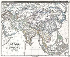
Background image1855 Collection: 1855 Spruner Map Of Asia Under The Mongol Empire

1855 Spruner Map Of Asia Under The Mongol Empire
1855, Spruner Map of Asia under the Mongol Empire

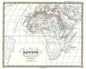
Background image1855 Collection: 1855 Spruner Map Of Africa Up To The Arab Conquests In The 7th Century

1855 Spruner Map Of Africa Up To The Arab Conquests In The 7th Century
1855, Spruner Map of Africa up to the Arab conquests in the 7th century

Background image1855 Collection: 1855 Spruneri Map Of The Empire Of Alexander The Great

1855 Spruneri Map Of The Empire Of Alexander The Great
1855, Spruneri Map of the Empire of Alexander the Great

Background image1855 Collection: 1855 Perthes Map Of Asia At The End Of The 17th Century

1855 Perthes Map Of Asia At The End Of The 17th Century
1855, Perthes Map of Asia at the end of the 17th Century

Background image1855 Collection: 1855 Jefferson Davis Map Of California From Pyramid Lake To The Sacramento River

1855 Jefferson Davis Map Of California From Pyramid Lake To The Sacramento River
1855, Jefferson Davis Map of California from Pyramid Lake to the Sacramento River

Background image1855 Collection: 1855 Colton Pocket Map Of The United States Topography

1855 Colton Pocket Map Of The United States Topography
1855, Colton Pocket Map of the United States

Background image1855 Collection: 1855 Colton Map Of Upper Canada Or Ontario Topography

1855 Colton Map Of Upper Canada Or Ontario Topography
1855, Colton Map of Upper Canada or Ontario

Background image1855 Collection: 1855 Spruner Map Of The Americas Since 1776 Topography

1855 Spruner Map Of The Americas Since 1776 Topography
1855, Spruner Map of the Americas since 1776

Background image1855 Collection: 1855 Colton Plan Or Map Of Washington D.C. Topography

1855 Colton Plan Or Map Of Washington D.C. Topography
1855, Colton Plan or Map of Washington D.C

Background image1855 Collection: 1855 Spruner Map Of Australia And Polynesia With An Overview Of Discoveries And Colonization

1855 Spruner Map Of Australia And Polynesia With An Overview Of Discoveries And Colonization
1855, Spruner Map of Australia and Polynesia with an overview of Discoveries and Colonization

Background image1855 Collection: 1855 Spruner Map Of Asia In The 9th And 10th Centuries

1855 Spruner Map Of Asia In The 9th And 10th Centuries
1855, Spruner Map of Asia in the 9th and 10th Centuries

Background image1855 Collection: 1855 Colton Plan Or Map Of Boston Topography

1855 Colton Plan Or Map Of Boston Topography
1855, Colton Plan or Map of Boston

Background image1855 Collection: 1855 Spruner Map Of Africa From The 8th To The 14th Century

1855 Spruner Map Of Africa From The 8th To The 14th Century
1855, Spruner Map of Africa from the 8th to the 14th century

Background image1855 Collection: 1855 Spruner Map Of Africa Since The Beginning Of The 15th Century

1855 Spruner Map Of Africa Since The Beginning Of The 15th Century
1855, Spruner Map of Africa since the beginning of the 15th century

Background image1855 Collection: 1855 Colton Map Of Wisconsin Topography Cartography

1855 Colton Map Of Wisconsin Topography Cartography
1855, Colton Map of Wisconsin

Background image1855 Collection: 1855 Colton World Mountains And Rivers Map Or Chart

1855 Colton World Mountains And Rivers Map Or Chart
1855, Colton World Mountains and Rivers Map or Chart

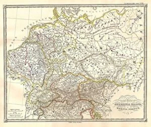
Background image1855 Collection: 1855 Spruneri Map Of Germany Or Germania Magna In Ancient Times

1855 Spruneri Map Of Germany Or Germania Magna In Ancient Times
1855, Spruneri Map of Germany or Germania Magna in Ancient Times

Background image1855 Collection: 1855 Colton Map Of Western Africa Topography

1855 Colton Map Of Western Africa Topography
1855, Colton Map of Western Africa

Background image1855 Collection: 1855 Colton Map Of Washington D.C. Topography

1855 Colton Map Of Washington D.C. Topography
1855, Colton Map of Washington D.C

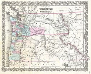
Background image1855 Collection: 1855 Colton Map Of Washington And Oregon Topography

1855 Colton Map Of Washington And Oregon Topography
1855, Colton Map of Washington and Oregon

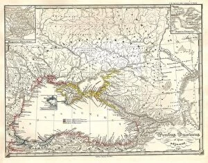
Background image1855 Collection: 1855 Spruneri Map Of The Black Sea Or Pontus Euxinus In Ancient Times

1855 Spruneri Map Of The Black Sea Or Pontus Euxinus In Ancient Times
1855, Spruneri Map of the Black Sea or Pontus Euxinus in Ancient Times

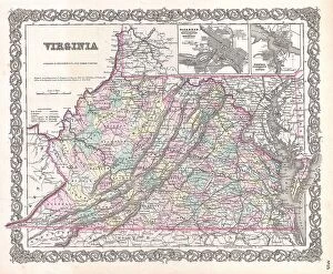
Background image1855 Collection: 1855 Colton Map Of Virginia Topography Cartography

1855 Colton Map Of Virginia Topography Cartography
1855, Colton Map of Virginia

Background image1855 Collection: 1855 Colton Map Of Vermont Topography Cartography

1855 Colton Map Of Vermont Topography Cartography
1855, Colton Map of Vermont

Background image1855 Collection: 1855 Spruneri Map Of India And Southeast Asia In Ancient Times

1855 Spruneri Map Of India And Southeast Asia In Ancient Times
1855, Spruneri Map of India and Southeast Asia in Ancient Times

Background image1855 Collection: 1855 Colton Map Of Upper Canada Or Ontario Topography

1855 Colton Map Of Upper Canada Or Ontario Topography
1855, Colton Map of Upper Canada or Ontario

Background image1855 Collection: 1855 Colton Map Of The World On Mercator Projection

1855 Colton Map Of The World On Mercator Projection
1855, Colton Map of the World on Mercator Projection

Background image1855 Collection: 1855 Colton Map Of The West Indies Topography

1855 Colton Map Of The West Indies Topography
1855, Colton Map of the West Indies

Background image1855 Collection: 1855 Colton Map Of The Western Hemisphere Topography

1855 Colton Map Of The Western Hemisphere Topography
1855, Colton Map of the Western Hemisphere

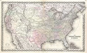
Background image1855 Collection: 1855 Colton Map Of The United States Topography

1855 Colton Map Of The United States Topography
1855, Colton Map of the United States

Background image1855 Collection: 1855 Colton Map Of The Arctic Or North Pole Topography

1855 Colton Map Of The Arctic Or North Pole Topography
1855, Colton Map of the Arctic or North Pole

Background image1855 Collection: 1855 Colton Map Of Texas Topography Cartography

1855 Colton Map Of Texas Topography Cartography
1855, Colton Map of Texas

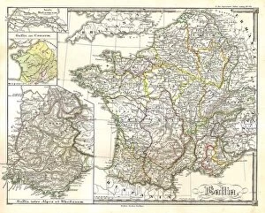
Background image1855 Collection: 1855 Spruneri Map Of France Gaul Gallia In Ancient Times

1855 Spruneri Map Of France Gaul Gallia In Ancient Times
1855, Spruneri Map of France, Gaul, Gallia in Ancient Times

Background image1855 Collection: 1855 Perthes Map Of Asia At The End Of The 18th Century

1855 Perthes Map Of Asia At The End Of The 18th Century
1855, Perthes Map of Asia at the end of the 18th Century

Background image1855 Collection: 1855 Magnus Map Of New York City And Brooklyn

1855 Magnus Map Of New York City And Brooklyn
1855, Magnus Map of New York City and Brooklyn

Background image1855 Collection: 1855 Perthes Map Of Africa Prior To The Arab Invasions Of The 7th Century

1855 Perthes Map Of Africa Prior To The Arab Invasions Of The 7th Century
1855, Perthes Map of Africa prior to the Arab Invasions of the 7th Century

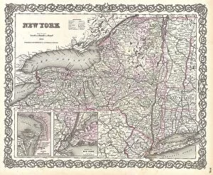
Background image1855 Collection: 1855 Colton Map Of New York Topography Cartography

1855 Colton Map Of New York Topography Cartography
1855, Colton Map of New York

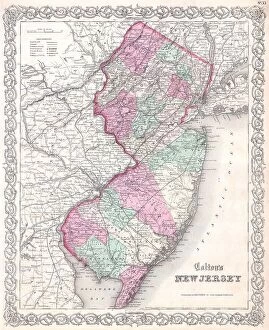
Background image1855 Collection: 1855 Colton Map Of New Jersey Topography Cartography

1855 Colton Map Of New Jersey Topography Cartography
1855, Colton Map of New Jersey

Background image1855 Collection: 1855 Colton Map Of New Jersey Topography Cartography

1855 Colton Map Of New Jersey Topography Cartography
1855, Colton Map of New Jersey

Background image1855 Collection: 1855 Colton Map Of New Hampshire Topography Cartography

1855 Colton Map Of New Hampshire Topography Cartography
1855, Colton Map of New Hampshire

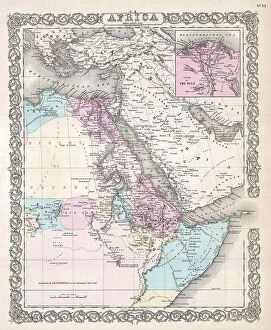
Background image1855 Collection: 1855 Colton Map Of Northeastern Africa Topography

1855 Colton Map Of Northeastern Africa Topography
1855, Colton Map of Northeastern Africa

Background image1855 Collection: 1855 Colton Map Of Mississippi Topography Cartography

1855 Colton Map Of Mississippi Topography Cartography
1855, Colton Map of Mississippi

Background image1855 Collection: 1855 Colton Map Of Missouri Topography Cartography

1855 Colton Map Of Missouri Topography Cartography
1855, Colton Map of Missouri

Background image1855 Collection: 1855 Colton Map Of Southern Africa Topography

1855 Colton Map Of Southern Africa Topography
1855, Colton Map of Southern Africa

Background image1855 Collection: 1855 Colton Map Of Michigan Topography Cartography

1855 Colton Map Of Michigan Topography Cartography
1855, Colton Map of Michigan


For sale as Licensed Images

Choose your image, Select your licence and Download the media

"1855: A Year of Triumphs, Tragedies, and Transformations" In 1855, the Rifleman of the 95th (Rifles) Regiment of Foot showcased their unparalleled marksmanship skills on the battlefield. Their precision and bravery became legendary during the Crimean War. Meanwhile, a beef cuts diagram from that year provided insight into the culinary preferences of the era. As people savored various cuts, they marveled at how food could unite even in times of conflict. The Crystal Palace in 1855 witnessed an extraordinary event as dinosaurs came to life through Punch magazine's imaginative illustrations. This whimsical display captivated visitors and transported them to a prehistoric world. Amidst these cultural marvels, John Moses Browning was born – a visionary who would revolutionize firearms design with his innovative inventions later in life. In Manchester, compassion prevailed as orphaned children found solace at the Warehousemen Orphan Schools in Cheadle Hulme. These institutions offered hope and education to those less fortunate. Inspired by Aesop's fable about Wind and Sun competing for supremacy over a traveler's cloak, individuals sought valuable lessons about gentleness triumphing over force during this time. However, not all stories ended happily. The Charge of the British Light Cavalry Brigade immortalized both courage and tragedy during their ill-fated assault at Balaclava during the Crimean War. On a brighter note, Withington Hospital opened its doors in Manchester – providing medical care to those in need while fostering advancements in healthcare practices throughout England. Across waters lay Royal Victoria Dock – bustling with trade ships from around the globe. This hub symbolized Britain's growing influence on international commerce during this era of expansionism. Philosopher Soren Kierkegaard delved deep into existential questions that challenged societal norms and beliefs - provoking introspection among intellectuals worldwide during this transformative period.