
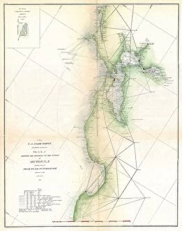
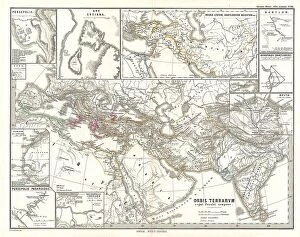
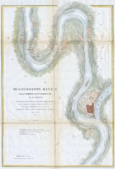
Aged Collection (page 9)
"Journey through Time: Exploring the Aged Beauty of History" As the Viking ship gracefully cuts through the sunset-kissed waves


For sale as Licensed Images
Choose your image, Select your licence and Download the media
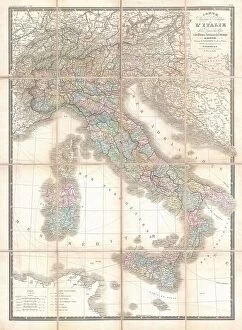
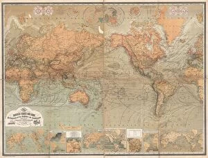
"Journey through Time: Exploring the Aged Beauty of History" As the Viking ship gracefully cuts through the sunset-kissed waves, its silhouette against the vibrant sky tells tales of a bygone era. Transport yourself to 1926-1927 London with this captivating view of an old pub nestled on the banks of River Thames, where whispers from the past echo in every corner. Step into Edinburgh's rich history as you trace your fingers over James Craig's meticulously crafted map from 1768, revealing the birth of New Town amidst Scotland's breathtaking topography. Immerse yourself in Africa's storied past with an antique map dating back to the 19th century, showcasing its diverse landscapes and igniting curiosity about distant lands. Unveil Italy's ancient charm through a beautifully damaged 19th-century map that bears witness to centuries-old stories etched upon its delicate surface. Delve into Southern Ancient Greece and Greek Isles' enchanting allure with Delisle's intricate cartographic masterpiece from 1794, offering a glimpse into forgotten worlds and mythical realms. Celebrate golfing legend Tom Morris senior as his portrait captures both his timeless spirit and his significant contributions to British sportsmanship around c1910. Embark on a celestial journey with a telescopic view and detailed lunar map from 1886, allowing you to explore uncharted territories beyond Earth while marveling at our moon’s rugged beauty. Napoleon Bonaparte comes alive in this striking portrait created by James Sant circa 1894-95; it encapsulates both his commanding presence and enigmatic persona that shaped history itself. Let Provence’s rustic charm beckon you through doors captured in mesmerizing shots adorning this vintage poster—a portal into France’s timeless countryside allure.