Boston Harbor Collection

"Boston Harbor: Where History and Beauty Converge" As the sun begins to rise, casting a golden glow over the city

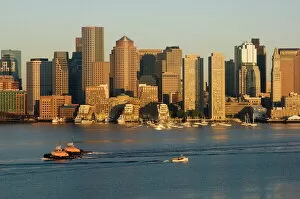
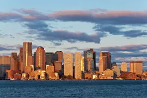
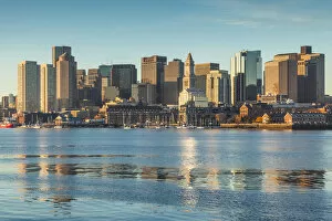
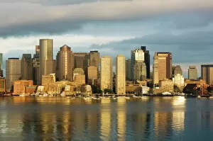
Background imageBoston Harbor Collection: The skyline of the Financial District across Boston Harbor at dawn

The skyline of the Financial District across Boston Harbor at dawn, Boston, Massachusetts, USA

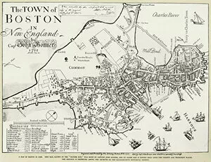
Background imageBoston Harbor Collection: BOSTON MAP, 1722. Engraved facsimile by George G. Smith, 1835, of a map of Boston, Massachusetts

BOSTON MAP, 1722. Engraved facsimile by George G. Smith, 1835, of a map of Boston, Massachusetts, by John Bonner, first printed in 1722, showing changes in the citys topography through 1769

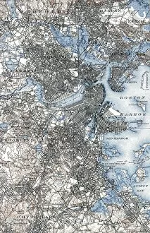
Background imageBoston Harbor Collection: BOSTON MAP, 1903. A map of Boston, Massachusetts. Engraving, 1903

BOSTON MAP, 1903. A map of Boston, Massachusetts. Engraving, 1903

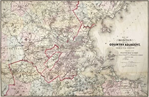
Background imageBoston Harbor Collection: MAP: BOSTON, 1883. Map of Boston, Massachusetts, and environs, published by Cupples, Upham & Co

MAP: BOSTON, 1883. Map of Boston, Massachusetts, and environs, published by Cupples, Upham & Co. 1883

Background imageBoston Harbor Collection: City skline viewed across Boston harbour at dawn, Boston, Massachusetts

City skline viewed across Boston harbour at dawn, Boston, Massachusetts, New England, United States of America, North America

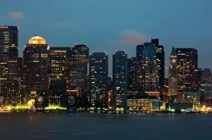
Background imageBoston Harbor Collection: City skyline at dawn across Boston Harbor

City skyline at dawn across Boston Harbor, Boston, Massachusetts, USA

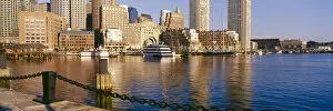
Background imageBoston Harbor Collection: The skyline of the Financial District across Boston Harbor

The skyline of the Financial District across Boston Harbor, Boston, Massachusetts, USA

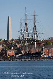
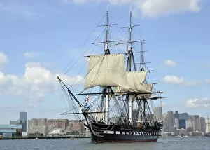
Background imageBoston Harbor Collection: Bunker Hill Monument and USS Constitution historic ship, Charlestown, Boston, MA

Bunker Hill Monument and USS Constitution historic ship, Charlestown, Boston, MA
USS Constitution historic ship, Old Ironsides a Three Masted Frigit, is seen near Bunker Hill Monument on harbor, Freedom Trail, Charlestown, Boston, MA

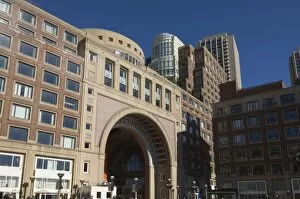
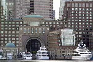
Background imageBoston Harbor Collection: Rowes Wharf by Boston Harbor

Rowes Wharf by Boston Harbor, Boston, Massachusetts, USA

Background imageBoston Harbor Collection: Destruction of the tea cargoes, known as the Boston Tea Party

Destruction of the tea cargoes, known as the Boston Tea Party
PNP330082 Destruction of the tea cargoes, known as the Boston Tea Party, 16 December 1773 (colour litho) by American School

Background imageBoston Harbor Collection: Boston Harbor, Boston, Massachusetts, USA

Boston Harbor, Boston, Massachusetts, USA

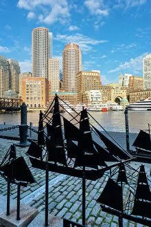
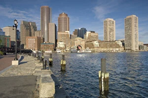
Background imageBoston Harbor Collection: Rowes Wharf, Boston Harbor, Boston, Massachusetts, USA

Rowes Wharf, Boston Harbor, Boston, Massachusetts, USA

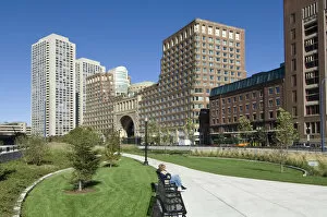
Background imageBoston Harbor Collection: Rose Kennedy Greenway & Rowes Wharf, Boston Harbor, Boston, Massachusetts, USA

Rose Kennedy Greenway & Rowes Wharf, Boston Harbor, Boston, Massachusetts, USA

Background imageBoston Harbor Collection: USA, New England, Massachusetts, Boston, city skyline from Boston Harbor

USA, New England, Massachusetts, Boston, city skyline from Boston Harbor

Background imageBoston Harbor Collection: Yacht Northern Light in Boston Harbor, 1845 (oil on canvas)

Yacht Northern Light in Boston Harbor, 1845 (oil on canvas)
2652559 Yacht Northern Light in Boston Harbor, 1845 (oil on canvas) by Lane, Fitz Henry (1804-65); 44.5x65.2 cm; Shelburne Museum, Vermont, USA; eShelburne Museum; Museum purchase

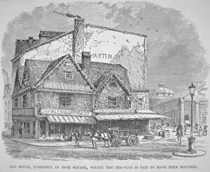
Background imageBoston Harbor Collection: Old House, formerly in Dock Square, where the tea-plot is said to have been hatched

Old House, formerly in Dock Square, where the tea-plot is said to have been hatched
PNP330084 Old House, formerly in Dock Square, where the tea-plot is said to have been hatched (litho) by American School, (19th century); Private Collection; (add.info.: Boston Tea Party)

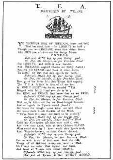
Background imageBoston Harbor Collection: Tea Destroyed by Indians, American broadside praising

Tea Destroyed by Indians, American broadside praising
PNP330083 Tea Destroyed by Indians, American broadside praising Ye Glorious sons of Freedom for raiding the British tea ships, 1773 (litho) by American School

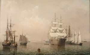
Background imageBoston Harbor Collection: Ships Leaving Boston Harbor, 1847 (oil on canvas)

Ships Leaving Boston Harbor, 1847 (oil on canvas)
2652557 Ships Leaving Boston Harbor, 1847 (oil on canvas) by Lane, Fitz Henry (1804-65); 508.x76.2 cm; Shelburne Museum, Vermont

Background imageBoston Harbor Collection: The Boston Tea Party, 16 December 1773, published London, 1789 (colour litho)

The Boston Tea Party, 16 December 1773, published London, 1789 (colour litho)
PNP330073 The Boston Tea Party, 16 December 1773, published London, 1789 (colour litho) by English School, (18th century); Private Collection; (add.info)

Background imageBoston Harbor Collection: Merchantmen Off Boston Harbor, 1863 (oil on canvas)

Merchantmen Off Boston Harbor, 1863 (oil on canvas)
2652555 Merchantmen Off Boston Harbor, 1863 (oil on canvas) by Lane, Fitz Henry (1804-65); 61.6x100 cm; Shelburne Museum, Vermont, USA; eShelburne Museum; Museum purchase

Background imageBoston Harbor Collection: Boston Harbor, (oil on canvas)

Boston Harbor, (oil on canvas)
822729 Boston Harbor, (oil on canvas) by Goodwin, Arthur Clifton (1866-1929); 84.5x99.5 cm; Private Collection; (add.info.: Boston Harbor. Arthur Clifton Goodwin (1866-1929). Oil on canvas

Background imageBoston Harbor Collection: The Destruction of Tea in Boston Harbor (engraving)

The Destruction of Tea in Boston Harbor (engraving)
727885 The Destruction of Tea in Boston Harbor (engraving) by English School, (19th century); Private Collection; (add.info.: The Destruction of Tea in Boston Harbor)

Background imageBoston Harbor Collection: The Boston Tea Party, 16 December 1773 (litho)

The Boston Tea Party, 16 December 1773 (litho)
PNP330075 The Boston Tea Party, 16 December 1773 (litho) by American School, (19th century); Private Collection; (add.info)

Background imageBoston Harbor Collection: The Dartmouth in Boston Harbour (litho)

The Dartmouth in Boston Harbour (litho)
PNP330074 The Dartmouth in Boston Harbour (litho) by American School, (19th century); Private Collection; (add.info.: one of the ships involved in the Boston Tea Party incident)

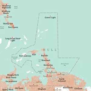
Background imageBoston Harbor Collection: MA Plymouth Hull Vector Road Map

MA Plymouth Hull Vector Road Map. All source data is in the public domain. U.S. Census Bureau Census Tiger. Used Layers: areawater, linearwater, roads, rails, cousub, pointlm, uac10

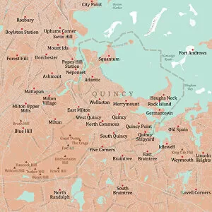
Background imageBoston Harbor Collection: MA Norfolk Quincy Vector Road Map

MA Norfolk Quincy Vector Road Map. All source data is in the public domain. U.S. Census Bureau Census Tiger. Used Layers: areawater, linearwater, roads, rails, cousub, pointlm, uac10

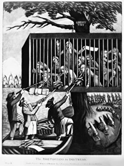
Background imageBoston Harbor Collection: THE BOSTONIANS IN DISTRESS. A British cartoon sympathizing with Bostons plight

THE BOSTONIANS IN DISTRESS. A British cartoon sympathizing with Bostons plight following the closing of its port by British parliament in 1774

Background imageBoston Harbor Collection: THE BOSTON TEA PARTY, 1773. The Boston Tea Party, 16 December 1773

THE BOSTON TEA PARTY, 1773. The Boston Tea Party, 16 December 1773. The earliest known American depiction of the event. Color engraving, 1789

Background imageBoston Harbor Collection: Boston Harbor American 1870 1880 Albumen silver print

Boston Harbor American 1870 1880 Albumen silver print
Boston Harbor; American; about 1870 - 1880; Albumen silver print

Background imageBoston Harbor Collection: 16 December 1773. German engraving by Daniel Chodowiecki, 1784

16 December 1773. German engraving by Daniel Chodowiecki, 1784
THE BOSTON TEA PARTY, 1773. 16 December 1773. German engraving by Daniel Chodowiecki, 1784

Background imageBoston Harbor Collection: View of Boston during the American Revolutionary War. North End with Old North (Christ)

View of Boston during the American Revolutionary War. North End with Old North (Christ)
BOSTON, 1770s. View of Boston during the American Revolutionary War. North End with Old North (Christ) Church is at left and Charlestown is seen in the background. Wood engraving, 19th century

Background imageBoston Harbor Collection: BOSTON TEA PARTY, 1773. The Boston Tea Party, 16 December 1773. Wood engraving, 19th century

BOSTON TEA PARTY, 1773. The Boston Tea Party, 16 December 1773. Wood engraving, 19th century

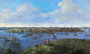
Background imageBoston Harbor Collection: VIEW OF BOSTON, 1738. Oil on canvas, 1738, by John Smibert

VIEW OF BOSTON, 1738. Oil on canvas, 1738, by John Smibert

Background imageBoston Harbor Collection: USA, Massachusetts, Boston. Boat leaves light trail on Boston Harbor at sunset. Credit as

USA, Massachusetts, Boston. Boat leaves light trail on Boston Harbor at sunset. Credit as: Nancy & Steve Ross / Jaynes Gallery / DanitaDelimont

Background imageBoston Harbor Collection: HMS Guerriere in the Boston Harbor

HMS Guerriere in the Boston Harbor
Boston, Massachusetts, August 23, 2013 - USS Constitution sets sail in Boston Harbor to commemorate the 201st anniversary of Constitutions battle with HMS Guerriere in the War of 1812

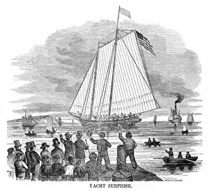
Background imageBoston Harbor Collection: YACHT: SURPRISE, 1851. The yacht, Surprise, in Boston. Engraving, American, 1851

YACHT: SURPRISE, 1851. The yacht, Surprise, in Boston. Engraving, American, 1851

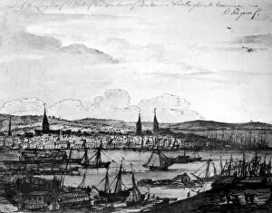
Background imageBoston Harbor Collection: BOSTON HARBOR, 1764. Boston seen from the Long Wharf in the harbor. Drawing, English

BOSTON HARBOR, 1764. Boston seen from the Long Wharf in the harbor. Drawing, English, 1764

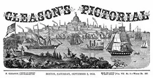
Background imageBoston Harbor Collection: BOSTON HARBOR, 1854. Front page of Gleasons Pictorial depicting Boston Harbor in Boston

BOSTON HARBOR, 1854. Front page of Gleasons Pictorial depicting Boston Harbor in Boston, Massachusetts, 2 September 1854

Background imageBoston Harbor Collection: VIEW OF BOSTON, c1722. Detail of William Burgis South East View of Boston, Massachusetts

VIEW OF BOSTON, c1722. Detail of William Burgis South East View of Boston, Massachusetts, c1722, the first known view of Boston

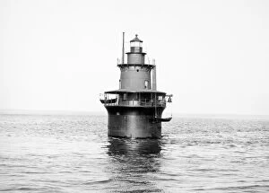
Background imageBoston Harbor Collection: DEER ISLAND LIGHT, 1906. Boston Harbor, Massachusetts. Photographed in 1906

DEER ISLAND LIGHT, 1906. Boston Harbor, Massachusetts. Photographed in 1906

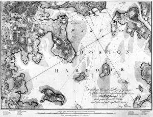
Background imageBoston Harbor Collection: BOSTON HARBOR MAP, 1777. Engraved English map of Boston Harbor, published in London

BOSTON HARBOR MAP, 1777. Engraved English map of Boston Harbor, published in London, 1777

Background imageBoston Harbor Collection: North America, USA, Massachusetts, Winthrop. Looking towards Winthrops houses

North America, USA, Massachusetts, Winthrop. Looking towards Winthrops houses
USA, Massachusetts, Winthrop. Looking towards Winthrops houses from the beach

Background imageBoston Harbor Collection: The Boston skyline from across Four Point Channel from Courthouse Plaza, Boston

The Boston skyline from across Four Point Channel from Courthouse Plaza, Boston
The Boston skyline from across Fort Point Channel from Courthouse Plaza, Boston, Massachusetts

Background imageBoston Harbor Collection: Morning light on the Boston skyline across the Inner Harbor from East Boston, Boston

Morning light on the Boston skyline across the Inner Harbor from East Boston, Boston, Massachusetts

Background imageBoston Harbor Collection: Sailboat in Boston Harbor, Boston, Massachusetts, USA

Sailboat in Boston Harbor, Boston, Massachusetts, USA

Background imageBoston Harbor Collection: Boston Harbor waterfront condominiums, Boston, Massachusetts, USA

Boston Harbor waterfront condominiums, Boston, Massachusetts, USA

Background imageBoston Harbor Collection: N. A. USA, Massachusettes, Boston Sailing in Boston Harbor

N. A. USA, Massachusettes, Boston Sailing in Boston Harbor
N.A. USA, Massachusettes, Boston, Sailing in Boston Harbor

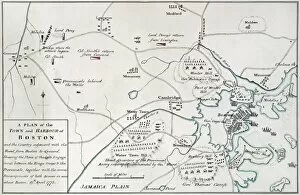
Background imageBoston Harbor Collection: Engraved map of Boston, Massachussetts, and the road to Concord

Engraved map of Boston, Massachussetts, and the road to Concord, as well as British and rebel camps, 1775
BOSTON-CONCORD MAP, 1775. Engraved map of Boston, Massachussetts, and the road to Concord, as well as British and rebel camps, 1775

Background imageBoston Harbor Collection: Casting tea overboard in Boston Harbor, 16 December 1773. Wood engraving, American, 1851

Casting tea overboard in Boston Harbor, 16 December 1773. Wood engraving, American, 1851
BOSTON TEA PARTY, 1773. Casting tea overboard in Boston Harbor, 16 December 1773. Wood engraving, American, 1851

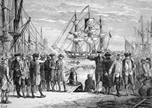
Background imageBoston Harbor Collection: Bostonians watching Sons of Liberty dumping tea into the harbor, 16 December 1773

Bostonians watching Sons of Liberty dumping tea into the harbor, 16 December 1773
BOSTON TEA PARTY, 1773. Bostonians watching Sons of Liberty dumping tea into the harbor, 16 December 1773. Lithograph after Daniel Chodowiecki, 1784, from a 19th century American book

Background imageBoston Harbor Collection: Line engraving, German, 1784

Line engraving, German, 1784
BOSTON TEA PARTY, 1773. Line engraving, German, 1784

Background imageBoston Harbor Collection: Emptying the tea into Boston Harbor, 16 December 1773. Engraving, 19th century

Emptying the tea into Boston Harbor, 16 December 1773. Engraving, 19th century
BOSTON TEA PARTY, 1773. Emptying the tea into Boston Harbor, 16 December 1773. Engraving, 19th century

Background imageBoston Harbor Collection: Postcard of Woman Standing on Buoy. ca. 1916, GIRL AND B(U)OY, BOSTON HARBOR, MASS

Postcard of Woman Standing on Buoy. ca. 1916, GIRL AND B(U)OY, BOSTON HARBOR, MASS

Background imageBoston Harbor Collection: Sunrise on the Boston skyline from East Boston, Boston, Massachusetts

Sunrise on the Boston skyline from East Boston, Boston, Massachusetts

Background imageBoston Harbor Collection: USA, Massachusetts, Boston. Boston Haror and Logan Airport, dawn

USA, Massachusetts, Boston. Boston Haror and Logan Airport, dawn

Background imageBoston Harbor Collection: USA, Massachusetts, Boston. The skyline at Rowes Wharf

USA, Massachusetts, Boston. The skyline at Rowes Wharf

Background imageBoston Harbor Collection: USA, Massachusetts, Boston, City skyline and Boston Harbor on spring morning

USA, Massachusetts, Boston, City skyline and Boston Harbor on spring morning

Background imageBoston Harbor Collection: USA, Massachusetts, Winthrop. A view of Winthrop from Deer Island

USA, Massachusetts, Winthrop. A view of Winthrop from Deer Island

Background imageBoston Harbor Collection: USA, Massachusetts, Boston. Boats and the skyline at Rowes Wharf

USA, Massachusetts, Boston. Boats and the skyline at Rowes Wharf

Background imageBoston Harbor Collection: A plan of the Siege of Boston, May 1775-March 1776

A plan of the Siege of Boston, May 1775-March 1776
SIEGE OF BOSTON MAP. A plan of the Siege of Boston, May 1775-March 1776

Background imageBoston Harbor Collection: 16 December 1773. Colored American line engraving, 1793

16 December 1773. Colored American line engraving, 1793
BOSTON TEA PARTY, 1773. 16 December 1773. Colored American line engraving, 1793

Background imageBoston Harbor Collection: View of Boston from Dorchester Neck. Engraving, English, 1776

View of Boston from Dorchester Neck. Engraving, English, 1776
BOSTON, 1776. View of Boston from Dorchester Neck. Engraving, English, 1776

Background imageBoston Harbor Collection: View of Boston from the heights of Charlestown. Drawing, 4 January 1776

View of Boston from the heights of Charlestown. Drawing, 4 January 1776, during the American siege of British-held
BOSTON, 1776. View of Boston from the heights of Charlestown. Drawing, 4 January 1776, during the American siege of British-held Boston, Massachusetts

Background imageBoston Harbor Collection: Contemporary wash drawing

Contemporary wash drawing
BOSTON TEA PARTY, 1773. Contemporary wash drawing

Background imageBoston Harbor Collection: View of Charlestown Peninsula and Bunker Hill across the Charles River from Copse Hill Battery

View of Charlestown Peninsula and Bunker Hill across the Charles River from Copse Hill Battery, Boston
BOSTON HARBOR, 1778. View of Charlestown Peninsula and Bunker Hill across the Charles River from Copse Hill Battery, Boston. English or loyalist drawing, 25 November 1778

Background imageBoston Harbor Collection: BOSTON HARBOR, c1770. Engraved certificate for an enlisted matross (gunners mate)

BOSTON HARBOR, c1770. Engraved certificate for an enlisted matross (gunners mate) at his Majestys North Battery in Boston Harbor. Christ Church is on the left and Charlestown across the water

Background imageBoston Harbor Collection: BOSTON, 1743. A view of Boston, Massachusetts, looking towards Long Wharf

BOSTON, 1743. A view of Boston, Massachusetts, looking towards Long Wharf. Line engraving by James Turner from the title page of American Magazine and Historical Chronicle, 1743

Background imageBoston Harbor Collection: BOSTON: CASTLE WILLIAM. The fortified Castle Island in Boston Harbor

BOSTON: CASTLE WILLIAM. The fortified Castle Island in Boston Harbor, which served as base of British operations during the siege of Boston, 1775-1776. Line engraving, American, 1789

Background imageBoston Harbor Collection: BOSTON, 1722. A South East View of the Great Town of Boston in New England in America

BOSTON, 1722. A South East View of the Great Town of Boston in New England in America. Color line engraving, English, 1722

Background imageBoston Harbor Collection: BOSTON HARBOR, 1769. Engraved English certificate for an enlisted matross (gunners mate)

BOSTON HARBOR, 1769. Engraved English certificate for an enlisted matross (gunners mate) at His Majestys South Gallery in Boston, 30 May 1769

Background imageBoston Harbor Collection: MAP: BOSTON, 1865. A map of Boston, Massachusetts, and adjacent cities, 1865, by George W. Colton

MAP: BOSTON, 1865. A map of Boston, Massachusetts, and adjacent cities, 1865, by George W. Colton

Background imageBoston Harbor Collection: BOSTON HARBOR, 1776. View of Boston Harbor from Fort Hill. Engraving, English, 1776

BOSTON HARBOR, 1776. View of Boston Harbor from Fort Hill. Engraving, English, 1776

Background imageBoston Harbor Collection: BOSTON: ALMSHOUSE, 1852. View of the then new almshouse on Deer Island in Boston Harbor

BOSTON: ALMSHOUSE, 1852. View of the then new almshouse on Deer Island in Boston Harbor, Massachusetts. Wood engraving, 1852

Background imageBoston Harbor Collection: BOSTON: CUSTOM HOUSE, 1851. Custom House at Boston, Massachusetts. Wood engraving, 1851

BOSTON: CUSTOM HOUSE, 1851. Custom House at Boston, Massachusetts. Wood engraving, 1851

Background imageBoston Harbor Collection: BOSTON, 1743. Line engraving by James Turner from the title page of American Magazine

BOSTON, 1743. Line engraving by James Turner from the title page of American Magazine and Historical Chronicle, 1743

Background imageBoston Harbor Collection: PETER FANEUIL (1700-1743). American merchant. Wood engraving, 19th century

PETER FANEUIL (1700-1743). American merchant. Wood engraving, 19th century

Background imageBoston Harbor Collection: FORT INDEPENDENCE, BOSTON. An early 19th century depiction of Fort Independence

FORT INDEPENDENCE, BOSTON. An early 19th century depiction of Fort Independence (formerly Castle William)
FORT INDEPENDENCE, BOSTON. An early 19th century depiction of Fort Independence (formerly Castle William, under British rule) on Castle Island in Boston Harbor, Boston, Massachusetts

Background imageBoston Harbor Collection: BOSTON HARBOR, 1854. American engraving, 19th century

BOSTON HARBOR, 1854. American engraving, 19th century

Background imageBoston Harbor Collection: BOSTON HARBOR, 1853. American engraving, 19th century

BOSTON HARBOR, 1853. American engraving, 19th century

Background imageBoston Harbor Collection: VIKINGS: NORTH AMERICA. Norse ships entering Boston Harbor. Wood engraving, American, 19th century

VIKINGS: NORTH AMERICA. Norse ships entering Boston Harbor. Wood engraving, American, 19th century

Background imageBoston Harbor Collection: BOSTON, MASS. 1838. Boston from the Dorchester Heights: colored engraving, 1838, after W. H

BOSTON, MASS. 1838. Boston from the Dorchester Heights: colored engraving, 1838, after W. H. Bartlett
BOSTON, MASS. 1838. Boston from the Dorchester Heights: colored engraving, 1838, after W.H. Bartlett

Background imageBoston Harbor Collection: BOSTON: REVERE PLAN, 1774. Engraved view of Boston, Massachusetts

BOSTON: REVERE PLAN, 1774. Engraved view of Boston, Massachusetts, by Paul Revere from the first issue of the Royal American Magazine, January 1774

Background imageBoston Harbor Collection: BOSTON TEA PARTY, 1773. Americans throwing the Cargoes of the Tea Ships into the River at Boston

BOSTON TEA PARTY, 1773. Americans throwing the Cargoes of the Tea Ships into the River at Boston, Massachusetts, 16 December 1773


For sale as Licensed Images

Choose your image, Select your licence and Download the media

"Boston Harbor: Where History and Beauty Converge" As the sun begins to rise, casting a golden glow over the city, the skyline of Boston's Financial District emerges across the tranquil waters of Boston Harbor. The dawn paints a breathtaking picture that epitomizes the charm and allure of this iconic harbor. Looking back in time, we glimpse into Boston's rich history through ancient maps. A facsimile of John Bonner's 1722 map reveals how the city's topography has evolved over centuries. Cupples, Upham & Co. 's 1883 map showcases an expanding metropolis on the cusp of modernization. Standing at Rowes Wharf by Boston Harbor, one can't help but feel connected to both past and present. This historic site serves as a gateway between old-world charm and contemporary vibrancy, and is here that you can witness Bunker Hill Monument proudly standing tall alongside USS Constitution – reminders of America's revolutionary spirit. The inner harbor unfolds before our eyes like a masterpiece painted with hues of blue and silver at dawn. The reflection of towering skyscrapers dances on gentle waves, creating an ethereal ambiance unique to this enchanting place. Boston Harbor is not just any harbor; it is where stories are woven into its very fabric. From its role in shaping American history to being a bustling hub for trade and commerce today – it encapsulates resilience and progress. So come explore this captivating destination where land meets sea – from picturesque views along its shores to vibrant neighborhoods waiting to be discovered. Immerse yourself in all that Boston Harbor has to offer because within these waters lies a world full of wonderment awaiting your arrival.

© Copyright Media Storehouse, All Rights Reserved 2003 - 2024
Facebook     Pinterest     Card Payments