Continental Collection (#22)

"Exploring the Continents: From Al-Idrisi's World Map to Satellite Images of Earth" Discovering the world has always been a fascinating journey, and throughout history

Background imageContinental Collection: Double ended tooth key, 19th century C017 / 8384

Double ended tooth key, 19th century C017 / 8384
Unusual double ended tooth key. Tooth extraction is the earliest known dental procedure, it was used as a last-resort cure for toothache

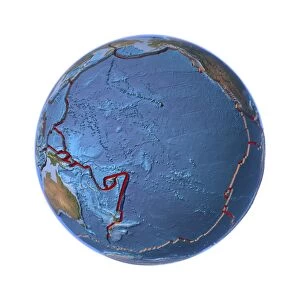
Background imageContinental Collection: Global tectonics, Pacific Plate C016 / 0582

Global tectonics, Pacific Plate C016 / 0582
Global tectonics. Satellite-based artwork of an Earth globe centred on the Pacific Plate. This is one of the seven primary tectonic plates that make up the Earths crust

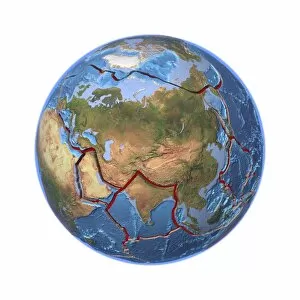
Background imageContinental Collection: Global tectonics, Eurasian Plate C016 / 0580

Global tectonics, Eurasian Plate C016 / 0580
Global tectonics. Satellite-based artwork of an Earth globe centred on the Eurasian Plate. This is one of the seven primary tectonic plates that make up the Earths crust

Background imageContinental Collection: Two pelican tooth extractors, circa 1750 C017 / 8364

Two pelican tooth extractors, circa 1750 C017 / 8364
Two pelican tooth extractors, one is in boxwood (left) and the other in ebony (right). Pelican extractors were an early type of dental forceps

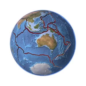
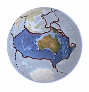
Background imageContinental Collection: Global tectonics, Australian Plate C016 / 0579

Global tectonics, Australian Plate C016 / 0579
Global tectonics. Satellite-based artwork of an Earth globe centred on the Australian Plate. This is one of the seven primary tectonic plates that make up the Earths crust

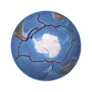
Background imageContinental Collection: Global tectonics, Antarctic Plate C016 / 0578

Global tectonics, Antarctic Plate C016 / 0578
Global tectonics. Satellite-based artwork of an Earth globe centred on the Antarctic Plate. This is one of the seven primary tectonic plates that make up the Earths crust

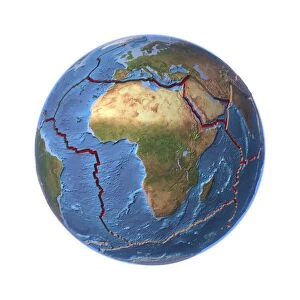
Background imageContinental Collection: Global tectonics, African Plate C016 / 0577

Global tectonics, African Plate C016 / 0577
Global tectonics. Satellite-based artwork of an Earth globe centred on the African Plate. This is one of the seven primary tectonic plates that make up the Earths crust

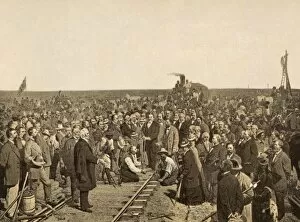
Background imageContinental Collection: Transcontinental Railroad celebration C016 / 4567

Transcontinental Railroad celebration C016 / 4567
Transcontinental Railroad celebration. Horsemen, engineers and workers celebrating the completion of the First Transcontinental Railroad in the USA

Background imageContinental Collection: The Americas, sea floor topography C016 / 3726

The Americas, sea floor topography C016 / 3726
The Americas, sea floor topography. Computer graphic of an Earth globe centred on the Americas, generated using satellite and mapping data

Background imageContinental Collection: Global tectonics, Eurasian Plate C016 / 3724

Global tectonics, Eurasian Plate C016 / 3724
Global tectonics. Satellite-based artwork of an Earth globe centred on the Eurasian Plate, one of Earths seven primary tectonic plates

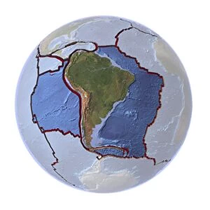
Background imageContinental Collection: Global tectonics, South American Plate C016 / 3712

Global tectonics, South American Plate C016 / 3712
Global tectonics. Satellite-based artwork of an Earth globe centred on the South American Plate. This is one of the seven primary tectonic plates that make up the Earths crust

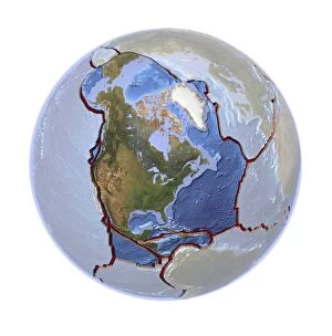
Background imageContinental Collection: Global tectonics, North American Plate C016 / 3710

Global tectonics, North American Plate C016 / 3710
Global tectonics. Satellite-based artwork of an Earth globe centred on the North American Plate, one of the seven primary tectonic plates that make up the Earths crust

Background imageContinental Collection: Global tectonics, Pacific Plate C016 / 3711

Global tectonics, Pacific Plate C016 / 3711
Global tectonics. Satellite-based artwork of an Earth globe centred on the Pacific Plate. This is one of the seven primary tectonic plates that make up the Earths crust

Background imageContinental Collection: Global tectonics, Eurasian Plate C016 / 3709

Global tectonics, Eurasian Plate C016 / 3709
Global tectonics. Satellite-based artwork of an Earth globe centred on the Eurasian Plate and Indian Plate. The Eurasian Plate is one of the seven primary tectonic plates that make up the Earths

Background imageContinental Collection: Global tectonics, Australian Plate C016 / 3708

Global tectonics, Australian Plate C016 / 3708
Global tectonics. Satellite-based artwork of an Earth globe centred on the Australian Plate. This is one of the seven primary tectonic plates that make up the Earths crust

Background imageContinental Collection: Global tectonics, Antarctic Plate C016 / 3707

Global tectonics, Antarctic Plate C016 / 3707
Global tectonics. Satellite-based artwork of an Earth globe centred on the Antarctic Plate. This is one of the seven primary tectonic plates that make up the Earths crust

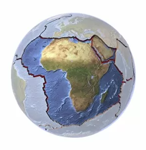
Background imageContinental Collection: Global tectonics, African Plate C016 / 3706

Global tectonics, African Plate C016 / 3706
Global tectonics. Satellite-based artwork of an Earth globe centred on the African Plate and Arabian Plate. The African Plate is one of the seven primary tectonic plates that make up the Earths

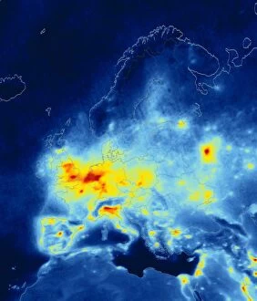
Background imageContinental Collection: European nitrogen dioxide emissions, 2008 C016 / 3063

European nitrogen dioxide emissions, 2008 C016 / 3063
European nitrogen dioxide emissions, 2008. Map of Europe showing average annual tropospheric nitrogen dioxide (NO2) measurements as recorded by the Ozone Monitoring Instrument (OMI)

Background imageContinental Collection: McDonnell Douglas DC-10 Series 10CF

McDonnell Douglas DC-10 Series 10CF
?McDonnell Douglas DC-10 Series 10CF convertible passenger freight transport aircraft in the insignia of Continental Air Lines?. Jane?s all the world?s aircraft 1975-76. p.393

Background imageContinental Collection: Virgatosphinctes, ammonite

Virgatosphinctes, ammonite
Shown here is an Ammonite fossil recovered from over 5000m above sea-level in the Himalaya region

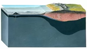
Background imageContinental Collection: Section through the Earths crust

Section through the Earths crust
Section showing the two main types of the Earths crust: oceanic and continental

Background imageContinental Collection: Origin of Gem Minerals

Origin of Gem Minerals
A diagram showing cross sections through the earths continental crust to a depth of 40kms. Many gemstones form within the crust at different levels and at different temperatures

Background imageContinental Collection: Oceanic and continental crust

Oceanic and continental crust
A cross section of the Earths surface showing the continental crust on the left and oceanic crust on the right. Beneath the surface layer lies the Basaltic layer (in green) and the Mantle (in grey)

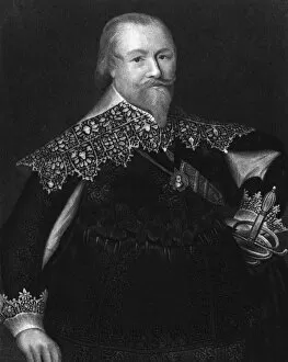
Background imageContinental Collection: First Earl of Leven

First Earl of Leven
ALEXANDER LESLIE, first earl of LEVEN Scottish military commander, engaged in continental service until the Civil War, in which he led the Covenanters. Date: 1580 - 1661

Background imageContinental Collection: Patagonia Argentina. Brazo Rico lake and red rocks, Perito Moreno glacier front

Patagonia Argentina. Brazo Rico lake and red rocks, Perito Moreno glacier front
Patagonia Argentina.Brazo Rico lake and red rocks, Perito Moreno glacier front

Background imageContinental Collection: Argentina, Santa Cruz Province, Glaciers National Park. Perito Moreno Glacier

Argentina, Santa Cruz Province, Glaciers National Park. Perito Moreno Glacier from a viewpoint kiosk

Background imageContinental Collection: Broadside written by Alexander Hamilton (anonymously) To the Electors of the State of New Jersey

Broadside written by Alexander Hamilton (anonymously) To the Electors of the State of New Jersey
ELECTION BROADSIDE, 1792. Broadside written by Alexander Hamilton (anonymously) To the Electors of the State of New Jersey, before the national election of 1792

Background imageContinental Collection: Rand, McNally & Co.s continental view of the Worlds Columb

Rand, McNally & Co.s continental view of the Worlds Columbian exposition, Chicago, U.S.A. 1893. Date c1892 Jun. 11. Rand, McNally & Co.s continental view of the Worlds Columbian exposition, Chicago

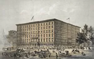
Background imageContinental Collection: Continental Hotel, corner of Chestnut & Ninth street Philade

Continental Hotel, corner of Chestnut & Ninth street Philadelphia. Continental Hotel, corner of Chestnut & Ninth street Philadelphia

Background imageContinental Collection: Repeated to-night grand combination Swiss bell ringers and C

Repeated to-night grand combination Swiss bell ringers and Continental Vocalists at the public hall. Date between 1850 and 1870

Background imageContinental Collection: Where Richard Montgomery fell, Quebec

Where Richard Montgomery fell, Quebec
A sign showing the location where Richard Montgomery, a brigadier-general in the Continental Army (during the American Revolutionary War) fell whilst leading the failed 1775 invasion of Canada

Background imageContinental Collection: Vauxhall Continental

Vauxhall Continental
The new big Vauxhall is a brave bid for the middle-range touring saloon market, just the thing for your next trip to the Continent. Date: 1937

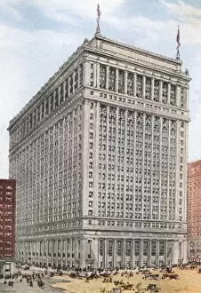
Background imageContinental Collection: Chicago Bank

Chicago Bank
American banks are not like your High Street Barclays : this is Chicagos New Continental and Commercial National Bank which will cost 6 million dollars in 1916. Date: 1916

Background imageContinental Collection: Cairo, Egypt - The Grand Continental Hotel

Cairo, Egypt - The Grand Continental Hotel Date: circa 1910s

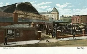
Background imageContinental Collection: Victoria Stn Continental

Victoria Stn Continental
The Continental Departures entrance, with horse-cabs waiting for fares. Date: circa 1905

Background imageContinental Collection: Baron Von Steuben

Baron Von Steuben
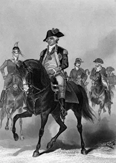
Friedrich Wilhelm Ludolf Gerhard Augustin, baron von STEUBEN, German commander of the continental allies of the Americans during the Revolutionary War Date: 1730 - 1794

Background imageContinental Collection: 1869 Continental Link

1869 Continental Link
The Union Pacific Railroad, the first transcontinental rail link, is completed at Promontory Point, Utah - Hold still, everyone, for the photographer ! Date: 10 May 1869

Background imageContinental Collection: Magic sensor X-ray

Magic sensor X-ray
Magic sensor. Coloured X-ray of a tyre fitted internally with an autonomous sensor (yellow). This long-lived sensor is powered solely by the changes in pressure it measures, needing no batte- ry

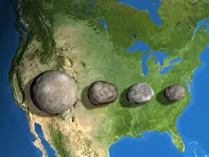
Background imageContinental Collection: Four largest asteroids, scale artwork

Four largest asteroids, scale artwork
Four largest asteroids, computer scale artwork. The asteroids are seen against North America for scale. From left, from largest to smallest, they are: Ceres, Vesta, Pallas, and Hygiea
Background imageContinental Collection: Continental breakfast

Continental breakfast comprising croissants, jam and marmalade, bread, buns and black coffee

Background imageContinental Collection: Barcoded Earth

Barcoded Earth, conceptual image. The barcode may represent a variety of concepts, like the placing of commercial interests above global environmental or human welfare issues
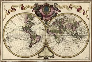
Background imageContinental Collection: Map of the world, 1720

Map of the world, 1720
18th century map of the world. Published in Paris in 1720, this French map shows the known world, including the new lands that had been discovered in the preceding centuries by Europeans exploring

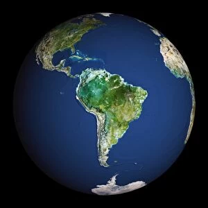
Background imageContinental Collection: Earth

Earth. Computer artwork of the Earth centred on Central America

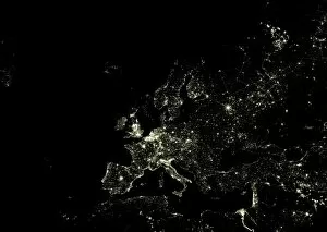
Background imageContinental Collection: Europe at night

Europe at night. Satellite image of city lights at night, centred on Europe. North converges towards top. Bright areas mark dense urban populations, and the European coastline is clearly seen

Background imageContinental Collection: Earth

Earth. Satellite image of the Earth, centred on the region of Oceania. North is at top. Water is blue, vegetation is green, arid areas are brown, and snow and ice are white

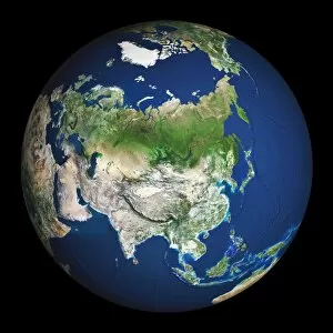
Background imageContinental Collection: Earth

Earth. Satellite image of the Earth, centred on Asia. The North Pole is at upper centre. Water is blue, vegetation is green, arid areas are brown, and snow and ice are white

Background imageContinental Collection: Western Asia, satellite image

Western Asia, satellite image
Western Asia, true-colour satellite image. North is at top. The region is dominated by deserts (brown). Bodies of water include the Red Sea (lower left) and Persian Gulf (centre)

Background imageContinental Collection: Earth

Earth. Satellite image of the Earth, centred on South America. North is at top. Water is blue, vegetation is green, arid areas are brown, and snow and ice are white


For sale as Licensed Images

Choose your image, Select your licence and Download the media

"Exploring the Continents: From Al-Idrisi's World Map to Satellite Images of Earth" Discovering the world has always been a fascinating journey, and throughout history, various maps and images have allowed us to explore the continents in different ways. In 1154, Al-Idrisi created a remarkable world map that showcased the vastness of our planet. Fast forward to modern times, where satellite imagery captures breathtaking views like Europe at night or an awe-inspiring snapshot of Earth from space. While maps provide us with geographical knowledge, they also serve as reminders of cultural milestones. The Bentley Continental R Mulliner represents luxury and elegance on wheels - a symbol of automotive craftsmanship that effortlessly traverses continents. Similarly, Oronce Fine's 1531 world map showcases how cartography evolved over time. Satellite images continue to amaze us with their ability to capture stunning visuals from above. North America at night reveals dazzling city lights illuminating its vast landscape while reminding us of human progress and innovation. On the other hand, Soho in London offers a glimpse into urban life on one particular street - 66 Old Compton Street W1 - bustling with activity day and night. Maps not only depict physical boundaries but also tell stories about our ever-changing planet. A map from 1720 takes us back in time when exploration was still ongoing, providing insights into how people perceived continents centuries ago. Additionally, continental drift maps shed light on geological processes that shape our landmasses even today. The Bentley R-Type Continental embodies both classic design and timeless sophistication—a testament to how automobiles can connect distant places through seamless travel experiences across continents. Lastly, continental drift reminds us that our Earth is constantly evolving; tectonic plates shift imperceptibly beneath our feet over millions of years—reshaping coastlines and forming mountain ranges—a reminder that change is inevitable.