Direction Collection (#85)

Embarking on a journey through time and space, these diverse images guide us in the right direction

Background imageDirection Collection: Traffic Police

Traffic Police
A policeman uses hand signals to stop the 273 bus to Roehampton, London. Date: 1930

Background imageDirection Collection: Pacific Crest Trail sign in desert, Whitewater Preserve, Southern California, U. S. A

Pacific Crest Trail sign in desert, Whitewater Preserve, Southern California, U. S. A
Pacific Crest Trail sign in desert, Whitewater Preserve, Southern California, U.S.A

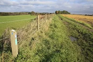
Background imageDirection Collection: Footpath direction sign, footpath beside paddock and arable field, Bacton, Suffolk, England, october

Footpath direction sign, footpath beside paddock and arable field, Bacton, Suffolk, England, october

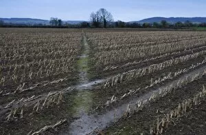
Background imageDirection Collection: Maize (Zea mays) crop, harvested field with footpath, Slimbridge, Gloucestershire, England, january

Maize (Zea mays) crop, harvested field with footpath, Slimbridge, Gloucestershire, England, january

Background imageDirection Collection: Little Ouse Walks wooden direction sign, beside fen meadow with windmill in background

Little Ouse Walks wooden direction sign, beside fen meadow with windmill in background, Little Ouse Headwaters Project, Parkers Piece, Thelnetham, Little Ouse Valley, Suffolk, England, june

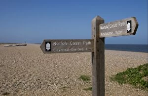
Background imageDirection Collection: Norfolk Coast Path direction sign on shingle beach, Cley Beach, Cley-next-the-sea, Norfolk

Norfolk Coast Path direction sign on shingle beach, Cley Beach, Cley-next-the-sea, Norfolk, England, april

Background imageDirection Collection: Direction sign and map on woodland path, Minsmere RSPB Reserve, Suffolk, England, november

Direction sign and map on woodland path, Minsmere RSPB Reserve, Suffolk, England, november

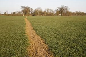
Background imageDirection Collection: Public footpath through sprayed off young cereal crop in arable farmland, Bacton, Suffolk

Public footpath through sprayed off young cereal crop in arable farmland, Bacton, Suffolk, England, march

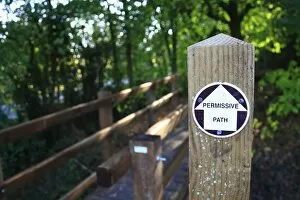
Background imageDirection Collection: Permissive Path sign beside footbridge at entrance to new Millenium woodland, Vicarage Plantation

Permissive Path sign beside footbridge at entrance to new Millenium woodland, Vicarage Plantation, Mendlesham, Suffolk, England, october

Background imageDirection Collection: United Utilities Permitted Footpath direction sign on footpath gate, England, april

United Utilities Permitted Footpath direction sign on footpath gate, England, april

Background imageDirection Collection: Angles Way National Trail, sign on post beside barbed wire fence, beside bridleway on farmland

Angles Way National Trail, sign on post beside barbed wire fence, beside bridleway on farmland, Hopton, Suffolk, England, november

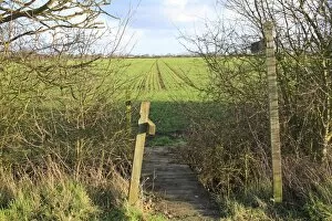
Background imageDirection Collection: Public Footpath sign and footbridge over ditch, crossing arable field with seedling crop, Bacton

Public Footpath sign and footbridge over ditch, crossing arable field with seedling crop, Bacton, Suffolk, England, february

Background imageDirection Collection: Purbeck Way bridleway and footpath sign, Dorset, England, november

Purbeck Way bridleway and footpath sign, Dorset, England, november

Background imageDirection Collection: Ridgeway, Whiteleaf and Circular Walk signs on signpost, Giles Wood

Ridgeway, Whiteleaf and Circular Walk signs on signpost, Giles Wood, Whiteleaf Hill Nature Reserve, Chilterns, Buckinghamshire, England, october

Background imageDirection Collection: Angles Way, Parish Walk and Permissive Path signs on post, at edge of valley fen reserve

Angles Way, Parish Walk and Permissive Path signs on post, at edge of valley fen reserve, Roydon Fen, Roydon, Upper Waveney Valley, Norfolk, England, june

Background imageDirection Collection: Wooden Public Footpath direction sign, England, april

Wooden Public Footpath direction sign, England, april

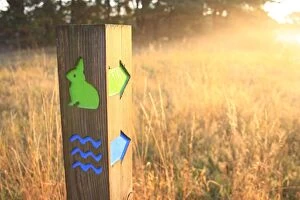
Background imageDirection Collection: Trail marker in breckland heathland at dawn, Knettishall Heath Country Park, Suffolk, England

Trail marker in breckland heathland at dawn, Knettishall Heath Country Park, Suffolk, England, october

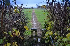
Background imageDirection Collection: Footpath through cereal field, with wooden stile and hedge, Slimbridge, Gloucestershire, England

Footpath through cereal field, with wooden stile and hedge, Slimbridge, Gloucestershire, England, january

Background imageDirection Collection: Do Not Follow Sat Nav sign on narrow road, warning drivers not to follow satallite navigation

Do Not Follow Sat Nav sign on narrow road, warning drivers not to follow satallite navigation system, England, april

Background imageDirection Collection: Wooden Public Footpath direction sign in countryside, England, march

Wooden Public Footpath direction sign in countryside, England, march

Background imageDirection Collection: Traditional old village green and signpost, Ham, West Berkshire, England, march

Traditional old village green and signpost, Ham, West Berkshire, England, march

Background imageDirection Collection: Public footpath sign with regulations for restoring disturbed crossfield footpaths

Public footpath sign with regulations for restoring disturbed crossfield footpaths, at edge of field in arable farmland, Bacton, Suffolk, England, april

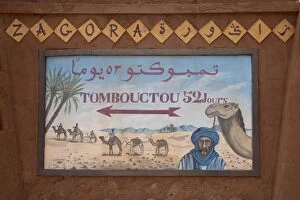
Background imageDirection Collection: Tombouctou 52 days direction sign in desert town, Zagora, Sahara, Morocco, may

Tombouctou 52 days direction sign in desert town, Zagora, Sahara, Morocco, may

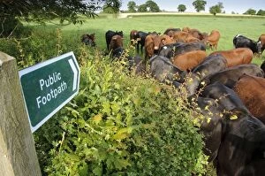
Background imageDirection Collection: Domestic Cattle, beef herd, gathered at field edge beside Public Footpath sign

Domestic Cattle, beef herd, gathered at field edge beside Public Footpath sign, Rosamond and Perkin's Village, Devon, England, may

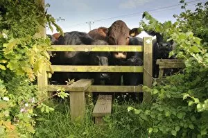
Background imageDirection Collection: Domestic Cattle, beef herd, gathered at public footpath stile entering field

Domestic Cattle, beef herd, gathered at public footpath stile entering field, Rosamond and Perkin's Village, Devon, England, may

Background imageDirection Collection: Red Deer (Cervus elaphus) stag, raising head to control direction of hind, during rutting season

Red Deer (Cervus elaphus) stag, raising head to control direction of hind, during rutting season, Minsmere RSPB Reserve, Suffolk, England, october

Background imageDirection Collection: Global wind patterns

Global wind patterns. Historical illustration of global air circulation, 1855. This model was designed by Matthew Fonataine Maury (1806-1873), a US naval lieutenant who was also an oceanographer

Background imageDirection Collection: School of fish

School of fish
School of bigeye scad fish (Selar crumenophthalmus) with one fish swimming in the opposite direction to the rest. Photographed in Bali, Indonesia

Background imageDirection Collection: Pointing hand

Pointing hand, artwork

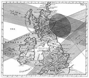
Background imageDirection Collection: Solar eclipse paths

Solar eclipse paths. Historical map of the paths of four solar eclipses over Great Britain during the 1700s. The map is from the book The use of globes

Background imageDirection Collection: Madrid Barajas International Airport

Madrid Barajas International Airport, Madrid, Spain. This is the interior of terminal 4. Terminal 4 was designed to give passengers a stress-free start to a journey through the careful design of its

Background imageDirection Collection: Compass

Compass, computer artwork. The needle aligns itself with Earths magnetic field, so indicating magnetic north

Background imageDirection Collection: Photoelastic stress

Photoelastic stress patterns of French curves, viewed using polarised light. The plastic the French curves are made from is displaying coloured interference fringe patterns

Background imageDirection Collection: Heart Maze, computer artwork

Heart Maze, computer artwork
Computer artwork of the human heart conceptualized as a maze

Background imageDirection Collection: Bee flight simulator

Bee flight simulator. Honeybee (Apis mellifera) tethered in a flight simulator. The panel of green light-emitting diodes (LEDs) produces a virtual world in which the bee can navigate

Background imageDirection Collection: Space tourist, conceptual artwork

Space tourist, conceptual artwork
Space tourist, conceptual computer artwork

Background imageDirection Collection: Signs in a hospital

Signs in a hospital giving directions and advising people not to smoke or use mobile phones

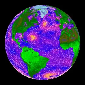
Background imageDirection Collection: Atlantic storms, QuikSCAT radar image

Atlantic storms, QuikSCAT radar image
Atlantic storms, radar image. This map, centred on the Atlantic, shows wind speeds measured by radar from the QuikSCAT satellite

Background imageDirection Collection: Compass rose, artwork

Compass rose, artwork
Compass rose. Computer artwork of a modern compass rose. A compass rose is a figure on a compass, map, nautical chart, or monument that is used to display the orientation of the cardinal directions

Background imageDirection Collection: 19th Century compass rose, artwork

19th Century compass rose, artwork
20 Century compass rose, artwork. A compass rose is a figure on a compass, map, nautical chart, or monument that is used to display the orientation of the cardinal directions - North, East

Background imageDirection Collection: Global winds, artwork

Global winds, artwork
Global winds. Computer artwork showing the path of the prevailing and dominant winds around the globe. Prevailing winds are winds that blow predominantly from a single general direction over a

Background imageDirection Collection: Beach fence

Beach fence across a sandy beach. This fence has been installed with the intention of preventing excess sand being blown off the beach by prevailing winds. Retaining sand helps to prevent erosion

Background imageDirection Collection: Photoelastic stress of French curves

Photoelastic stress of French curves
Photoelastic stress patterns of French curves, viewed using polarised light. The plastic the French curves are made from is displaying coloured interference fringe patterns

Background imageDirection Collection: Ocean circulation, artwork

Ocean circulation, artwork
Ocean circulation. Computer artwork showing the general direction in which water circulates around the surface of the Earth

Background imageDirection Collection: Fludds wind diagram

Fludds wind diagram
The winds of Earth. Diagram depicting winds coming from various directions. Each is associated with an origin, such as Europe or Africa

Background imageDirection Collection: Compass on a map

Compass on a map

Background imageDirection Collection: Lighthouse, Denmark

Lighthouse, Denmark
Lighthouse in Esbjerg, Denmark. -

Background imageDirection Collection: Compass and dividers on a map

Compass and dividers on a map
Navigational compass and dividers (also called a measuring compass, lower left) on a map


For sale as Licensed Images

Choose your image, Select your licence and Download the media

Embarking on a journey through time and space, these diverse images guide us in the right direction. From JMW Turner's iconic painting 'The Fighting Temeraire' to the ancient Mappa Mundi inked on parchment, we navigate history's vast tapestry. An antique map of Tasmania leads us to uncharted territories, while the Sturgeon Bay Lighthouse stands as a beacon of hope in Door County, Wisconsin. The rugged cliffs and lighthouse at Butt of Lewis remind us that even amidst nature's challenges, guidance is always present. In contrast, a painting showcasing Kim Jong Il and Kim Il Sung reveals an authoritarian direction taken by North Korea. Yet, it serves as a reminder that they can be shaped by ideology too. Fanad Head Lighthouse transports us to Ireland's stunning coastline where light pierces through darkness. A Viking ship silhouette against a sunset sky reminds us of our ancestors' adventurous spirit and their quest for new horizons. Meanwhile, police officers guiding children symbolize protection and nurturing guidance within our communities. Victorian engravings depict maps like the one showcasing Malvern Hills in Worcestershire; they invite exploration into England's picturesque landscapes. Griffiths Island lighthouse invites wanderers to discover its hidden beauty along Australia's coast. Lastly, National Aviation Day Display poster inspires dreams to take flight with its depiction of soaring planes against blue skies – reminding us that sometimes all we need is a little push towards our aspirations. Through artistry and imagery from various corners of the world, these captivating visuals point towards different directions – both literal and metaphorical – inviting us to embark on unique journeys filled with wonderment.