Earth Observation Collection (#22)

"Earth Observation: Glimpses of Our Pale Blue Dot and Beyond" In the vast expanse of space

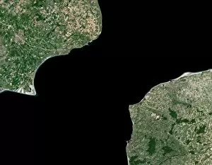
Background imageEarth Observation Collection: English Channel, satellite image

English Channel, satellite image
English Channel. Satellite image of the English Channel, the stretch of water that separates southern England from northern France. North is at top

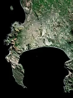
Background imageEarth Observation Collection: Cape Town, South Africa, satellite image

Cape Town, South Africa, satellite image
Cape Town, South Africa. Satellite image of the city of Cape Town (upper centre and left) and its surrounding area in western South Africa. North is at top. Robben Island is at top left

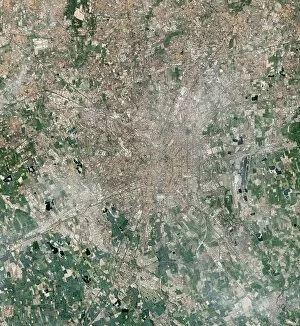
Background imageEarth Observation Collection: Milan, Italy, satellite image

Milan, Italy, satellite image
Milan, Italy. Satellite image of the city of Milan (centre) and its surrounding area in northern Italy. North is at top. Forested areas are dark green

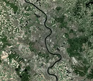
Background imageEarth Observation Collection: Cologne, Germany, satellite image

Cologne, Germany, satellite image
Cologne, Germany. Satellite image of the city of Cologne (centre) and its surrounding area in western Germany. North is at top. The River Rhine is seen running through the city from top to bottom

Background imageEarth Observation Collection: Krakow, satellite image

Krakow, satellite image
Krakow. Satellite image of the city of Krakow (centre) and its surrounding area in southern Poland. North is at top. Forested areas are dark green

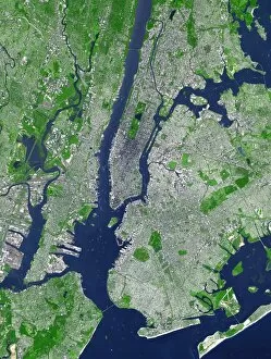
Background imageEarth Observation Collection: New York City, USA, satellite image

New York City, USA, satellite image. North is attop. The island of Manhattan is at upper centre, bordered by the Hudson (left) and East (right)rivers

Background imageEarth Observation Collection: Stockholm, satellite image

Stockholm, satellite image. North is at top. Wateris blue, vegeatation is green, bare ground brownand urbanised areas are grey. Cloud cover iswhite. Stockholm is the captial city of Sweden

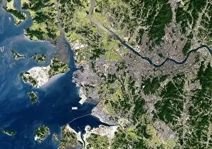
Background imageEarth Observation Collection: Seoul, satellite image

Seoul, satellite image. North is at top.Vegetation is green, urbanised areas are grey andsediments are grey/brown. Seoul (upper right) isthe capital city of South Korea

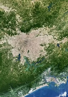
Background imageEarth Observation Collection: Sao Paulo, satellite image

Sao Paulo, satellite image. North is at top.Vegetation is green, water is azure and blue andurbanised areas are cream. Sao Paulo is a city inBrazil near the coast of the South Atlantic Ocean(bottom)

Background imageEarth Observation Collection: San Francisco, satellite image

San Francisco, satellite image. North is at top.Vegetation is green, water is blue, bare ground isshades of brown and urbanised areas are grey

Background imageEarth Observation Collection: Paris, satellite image

Paris, satellite image. North is at top. Forest isdark green, cultivated land is light green andcream and urbanised areas are pink and grey.Paris is the capital city of France

Background imageEarth Observation Collection: Mexico City, satellite image

Mexico City, satellite image. North is at top.Vegetation is green. Urbanised areas are grey, bare or arid ground is brown. Mexico City is thecapital city of Mexico

Background imageEarth Observation Collection: Madrid, satellite image

Madrid, satellite image
Madrid metropolitan area, satellite image. Northis at top. Vegetation is green, densely populatedareas are pink. Arid or bare ground is shades ofcream and orange, water is blue

Background imageEarth Observation Collection: Beijing, China, satellite image

Beijing, China, satellite image. North is at top, urban areas are grey and vegetation is green.Beijing is the capital of the Peoples Republic ofChina

Background imageEarth Observation Collection: London, coloured satellite image

London, coloured satellite image
London, UK, coloured satellite image. Theregion has been colour-coded: red areas areresidences, cyan areas are industrial and greenand yellow areas represent thick and shortvegetation respectively

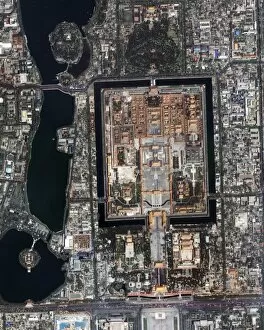
Background imageEarth Observation Collection: Forbidden Palace, Beijing

Forbidden Palace, Beijing
Forbidden Palace. Satellite image of the largecomplex of historical royal buildings known as theForbidden Palace, in Beijing, China. Image takenby the Ikonos satellite on 26 April 2002

Background imageEarth Observation Collection: Agricultural fields around Bourtange

Agricultural fields around Bourtange
Agricultural fields. Satellite image of thefields surrounding the star-shaped 17th centuryfortress (centre) and town of Bourtange, theNetherlands


For sale as Licensed Images

Choose your image, Select your licence and Download the media

"Earth Observation: Glimpses of Our Pale Blue Dot and Beyond" In the vast expanse of space, Voyager 1 captured an awe-inspiring image that forever changed our perspective. The iconic "Pale Blue Dot" photograph revealed Earth as a tiny speck in the cosmic ocean, reminding us of our interconnectedness on this magnificent planet. Zooming in closer, we witness the intricate details of human achievements. The Wimbledon tennis complex stands out amidst the bustling cityscape of London, UK. From high above, a satellite image showcases the British Isles with its lush green landscapes and rugged coastlines – a testament to nature's beauty. As night falls, lights illuminate cities across Europe like constellations on Earth's canvas. A mesmerizing satellite image captures the brilliance of UK at night from space – a tapestry woven by millions living their lives under starry skies. Expanding further into darkness reveals Europe at night; clusters of light representing vibrant metropolises and quiet towns alike. And then there it is - an astonishing view showcasing our entire planet bathed in nocturnal glow - Whole Earth at night seen from space. Venturing beyond terrestrial boundaries, Tenerife emerges through a satellite lens – its volcanic terrain contrasting against azure waters surrounding this Spanish island paradise. The International Space Station floats gracefully in orbit around Earth during 2008 – humanity's outpost where astronauts conduct research while gazing back upon their home planet with wonderment. From afar, another satellite image depicts Earth from space - swirling clouds dance over continents and oceans; an ever-changing masterpiece painted by atmospheric currents and weather patterns. Closer to home once more, Scotland's stunning landscape unfolds beneath us through yet another captivating satellite image. Majestic mountains blend seamlessly with lochs and glens creating breathtaking scenery that captivates all who behold it.