East River Collection (#22)

"Captivating East River: A Glimpse into the Heart of Manhattan" Behold the mesmerizing aerial view of Lower Manhattan at dusk

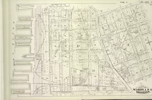
Background imageEast River Collection: Vol. 6. Plate, T. Map bound by First St. Second St. S. 11th St. Third St. S. 10th St

Vol. 6. Plate, T. Map bound by First St. Second St. S. 11th St. Third St. S. 10th St
Vol. 6. Plate, T. Map bound by First St. Second St. S.11th St. Third St. S.10th St. Fourth St. 5th St. 6th St. 7th St. 8th St. 9th St. Rodney St. Marcy Ave. Keap St. Lee Ave. Wilson St

Background imageEast River Collection: Vol. 6. Plate, B. Map bound by Huron St. Oakland St

Vol. 6. Plate, B. Map bound by Huron St. Oakland St. Calyer St. East River; Including India St. Java St. Kent St. Green Point St. Milton St. Noble St. Oak St. West St. Franklin St. Guernsey St

Background imageEast River Collection: Vol. 5. Plate, N. Map bound by Hamilton Ave. Carroll St. Columbia St. Verona St

Vol. 5. Plate, N. Map bound by Hamilton Ave. Carroll St. Columbia St. Verona St. East River; Including India St. Atlantic Basin, Summit St. Rapelyea St. Woodhull St. Bowne St. Seabring St

Background imageEast River Collection: Vol. 5. Plate, K. Map bound by Harrison St. Henry St. Carroll St. Hamilton Ave

Vol. 5. Plate, K. Map bound by Harrison St. Henry St. Carroll St. Hamilton Ave. East River; Including Irving St. Sedgwick St. Degraw St. Sackett St. Union St. President St. Beach Pl. Van Brunt St

Background imageEast River Collection: Vol. 6. Plate, N. Map bound by S. Sixth St. Broadway, Seventh St. Division Ave

Vol. 6. Plate, N. Map bound by S. Sixth St. Broadway, Seventh St. Division Ave. S. Eleventh St. East River; Including S. Eighth St. S. Ninth St. S. Tenth St. First St. Second St. Third St. Fourth St

Background imageEast River Collection: Vol. 6. Plate, M. Map bound by Grand St. Seventh St

Vol. 6. Plate, M. Map bound by Grand St. Seventh St. Broadway, S. Sixth St. East River; Including S. First St. S. Second St. S. Third St. S. Fourth St. S. Fifth St. River St. First St. Second St

Background imageEast River Collection: Vol. 6. Plate, L. Map bound by N. 6th St. Sixth St. Grand St. East River; Including N

Vol. 6. Plate, L. Map bound by N. 6th St. Sixth St. Grand St. East River; Including N
Vol. 6. Plate, L. Map bound by N.6th St. Sixth St. Grand St. East River; Including N.5th St. N.4th St. N.3rd St. N.2nd St. Fillmore Pl. N.1St St. First St. Second St. Third St. Fourth St. Fifth St

Background imageEast River Collection: Vol. 6. Plate, K. Map bound by Bushwick Inlet, N

Vol. 6. Plate, K. Map bound by Bushwick Inlet, N.14th St. Fifth St. N.6th St. East River; Including Banker St. N.13th St. N.12th St. N.11th St. N.10th St. N.9th St. N.8th St. N.7th St. First St

Background imageEast River Collection: Vol. 5. Plate, H. Map bound by Atlantic Ave

Vol. 5. Plate, H. Map bound by Atlantic Ave. Clinton St. Harrison St. East River; Including Pacific St. Amity St. Congress St. Verandan Pl. Warren St. Baltic St. Columbia St. Hicks St. Henry St

Background imageEast River Collection: Vol. 5. Plate, E. Map bound by Pierrepont St. Fulton St. Court St. Atlantic Ave

Vol. 5. Plate, E. Map bound by Pierrepont St. Fulton St. Court St. Atlantic Ave. East River; Including Montague St. Remsen St. Grace Court, Joralemon St. Livingston St. Schermerhorn St. State St

Background imageEast River Collection: Vol. 5. Plate, C. Map bound by Poplar St. Sands St. Jay St. Pearl St. Johnson St

Vol. 5. Plate, C. Map bound by Poplar St. Sands St. Jay St. Pearl St. Johnson St. Pierrepont St. East River; Including Middagh St. High St. Cranberry St. Orange St. Nassau St. Pineapple St

Background imageEast River Collection: Vol. 5. Plate, A. Map bound by U. S. Navy Yard, Concord St

Vol. 5. Plate, A. Map bound by U. S. Navy Yard, Concord St
Vol. 5. Plate, A. Map bound by U.S. Navy Yard, Concord St. Bridge St. East River; Including Little St. Navy St. Old Bridge RD, Hudson St. Greene Lane, Gold St. Charles St. Duffield St. U.S. St

Background imageEast River Collection: Vol. 5. Plate, B. Map bound by East River, Bridge St

Vol. 5. Plate, B. Map bound by East River, Bridge St. Sands St. Poplar St.; Including Marshall St. John St. PLymouth St. Water St. Front St. Fulton St. Doughty St. Vine St. York St. Franklin Pl

Background imageEast River Collection: Plate 31: Bounded by Second Avenue, E. 101st Street, East River, Avenue B and and E

Plate 31: Bounded by Second Avenue, E. 101st Street, East River, Avenue B and and E. 84th Street

Background imageEast River Collection: Plate 7: Bounded by E. 3rd Street, East River, Piers 60-64 Tompkins Street, East River

Plate 7: Bounded by E. 3rd Street, East River, Piers 60-64 Tompkins Street, East River, Piers 55-60 East Street, Water Street, Corlears Street, Grand Street, Attorney Street, Essex Street

Background imageEast River Collection: Plate 27: Bounded by E. 14th Street, East River, E. 8th Street, and Avenue B

Plate 27: Bounded by E. 14th Street, East River, E. 8th Street, and Avenue B

Background imageEast River Collection: Plate 108: Map bounded by East 57th Street, East River, East 52nd Street, Second Avenue

Plate 108: Map bounded by East 57th Street, East River, East 52nd Street, Second Avenue. 1857, 1862, Perris and Browne, New York, USA

Background imageEast River Collection: Plate 67: Map bounded by East 26th Street, East River, East 22nd Street, Second Avenue

Plate 67: Map bounded by East 26th Street, East River, East 22nd Street, Second Avenue. 1857, 1862, Perris and Browne, New York, USA

Background imageEast River Collection: Plate 39: Map bounded by Houston Street, Avenue D, 3rd Street, East River, Rivington

Plate 39: Map bounded by Houston Street, Avenue D, 3rd Street, East River, Rivington Street, Willett Street. 1852, 1854, William Perris, New York, N.Y. USA

Background imageEast River Collection: Plate 4: Map bounded by East River, Bridge Street, York Street, Main Street. 1855

Plate 4: Map bounded by East River, Bridge Street, York Street, Main Street. 1855, William Perris, Brooklyn, New York, N.Y. USA

Background imageEast River Collection: Plate 3: Map bounded by East River, Brooklyn Navy Yard, York Street, Bridge Street

Plate 3: Map bounded by East River, Brooklyn Navy Yard, York Street, Bridge Street. 1855, William Perris, Brooklyn, New York, N.Y. USA

Background imageEast River Collection: Plate 82: Map bounded by East 52nd Street, East River, East 47th Street, Second Avenue

Plate 82: Map bounded by East 52nd Street, East River, East 47th Street, Second Avenue. 1857, 1862, Perris and Browne, New York, USA

Background imageEast River Collection: Plate 79: Map bounded by East 47th Street, East River, East 42nd Street, Second Avenue

Plate 79: Map bounded by East 47th Street, East River, East 42nd Street, Second Avenue. 1857, 1862, Perris and Browne, New York, USA

Background imageEast River Collection: Plate 76: Map bounded by East 42nd Street, East River, East 37th Street, Second Avenue

Plate 76: Map bounded by East 42nd Street, East River, East 37th Street, Second Avenue. 1857, 1862, Perris and Browne, New York, USA

Background imageEast River Collection: Plate 70: Map bounded by East 32nd Street, East River, East 26th Street, Second Avenue

Plate 70: Map bounded by East 32nd Street, East River, East 26th Street, Second Avenue. 1857, 1862, Perris and Browne, New York, USA

Background imageEast River Collection: Plate 50: Map bounded by East 20th Street, East River, East 16th Street, Avenue C

Plate 50: Map bounded by East 20th Street, East River, East 16th Street, Avenue C, East 13th Street, Avenue A. 1852, 1854, William Perris, New York, N.Y. USA

Background imageEast River Collection: Plate 42: Map bounded by Eighth Street, East River, Third Street, Avenue D, Sixth Street

Plate 42: Map bounded by Eighth Street, East River, Third Street, Avenue D, Sixth Street, Avenue C. 1852, 1854, William Perris, New York, N.Y. USA

Background imageEast River Collection: Plate 46: Map bounded by East 22nd Street, East River, East 20th Street, Avenue A

Plate 46: Map bounded by East 22nd Street, East River, East 20th Street, Avenue A, East 17th Street, Second Avenue. 1857, 1862, Perris and Browne, New York, USA

Background imageEast River Collection: Plate 38: Map bounded by East 15th Street, East River, 8th Street, Avenue C. 1857

Plate 38: Map bounded by East 15th Street, East River, 8th Street, Avenue C. 1857, 1862, Perris and Browne, New York, USA

Background imageEast River Collection: Plate 42: Map bounded by East 20th Street, East River, East 17th Street, East River

Plate 42: Map bounded by East 20th Street, East River, East 17th Street, East River, East 15th Street, Avenue C, East 13th Street, Avenue A. 1857, 1862, Perris and Browne, New York, USA

Background imageEast River Collection: Plate 34: Map bounded by 8th Street, East river, 3rd Street, Avenue D, 6th Street

Plate 34: Map bounded by 8th Street, East river, 3rd Street, Avenue D, 6th Street, Aventue C. 1857, 1862, Perris and Browne, New York, USA

Background imageEast River Collection: Plate 120: Map bounded by East 72nd Street, East River, East 63rd Street, First Avenue

Plate 120: Map bounded by East 72nd Street, East River, East 63rd Street, First Avenue. 1857, 1862, Perris and Browne, New York, USA

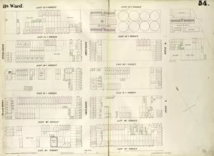
Background imageEast River Collection: Plate 54: Map bounded by East 22nd Street, East River, East 20th Street, Avenue A

Plate 54: Map bounded by East 22nd Street, East River, East 20th Street, Avenue A, East 17th Street, Second Avenue. 1852, 1854, William Perris, New York, N.Y. USA

Background imageEast River Collection: Plate 46: Map bounded by East 15th Street, East River, Eighth Street, Avenue C. 1852

Plate 46: Map bounded by East 15th Street, East River, Eighth Street, Avenue C. 1852, 1854, William Perris, New York, N.Y. USA

Background imageEast River Collection: Plate 109: Map bounded by East 62nd Street, First Avenue, East 63rd Street, East River

Plate 109: Map bounded by East 62nd Street, First Avenue, East 63rd Street, East River, East 57th Street, Second Avenue. 1857, 1862, Perris and Browne, New York, USA

Background imageEast River Collection: Plate 73: Map bounded by East 37th Street, East River, East 32nd Street, Second Avenue

Plate 73: Map bounded by East 37th Street, East River, East 32nd Street, Second Avenue. 1857, 1862, Perris and Browne, New York, USA

Background imageEast River Collection: BROOKLYN BRIDGE, c1900. View of the Brooklyn Bridge and East River, New York. Photograph

BROOKLYN BRIDGE, c1900. View of the Brooklyn Bridge and East River, New York. Photograph, c1900

Background imageEast River Collection: BROOKLYN BRIDGE, c1901. A view of the bridge looking from Brooklyn toward Manhattan, New York

BROOKLYN BRIDGE, c1901. A view of the bridge looking from Brooklyn toward Manhattan, New York. Photograph, December c1901

Background imageEast River Collection: NEW YORK CITY, c1905. View of the city looking East from the Singer Tower, New York

NEW YORK CITY, c1905. View of the city looking East from the Singer Tower, New York. Photograph, c1905

Background imageEast River Collection: WILLIAMSBURG BRIDGE, c1903. A view of the bridge from Brooklyn, New York. Photograph

WILLIAMSBURG BRIDGE, c1903. A view of the bridge from Brooklyn, New York. Photograph, c1903

Background imageEast River Collection: BROOKLYN BRIDGE, c1905. Steamboat parked at a marine terminal next to the Brooklyn Bridge

BROOKLYN BRIDGE, c1905. Steamboat parked at a marine terminal next to the Brooklyn Bridge, New York. Photograph, c1905

Background imageEast River Collection: NYC: SWIMMING RACE, 1908. A swimming race in the East River to Coney Island in New York City

NYC: SWIMMING RACE, 1908. A swimming race in the East River to Coney Island in New York City. Photograph, 16 August 1908

Background imageEast River Collection: NEW YORK CITY, c1820. A view of New York City from Fort Columbus on Governors Island

NEW YORK CITY, c1820. A view of New York City from Fort Columbus on Governors Island. Engraving, 1820

Background imageEast River Collection: NEW YORK CITY, c1820. A view of New York City from Governors Island. Aquatint, c1820

NEW YORK CITY, c1820. A view of New York City from Governors Island. Aquatint, c1820

Background imageEast River Collection: NEW YORK CITY, c1873. Aerial view of New York City, looking north from Lower Manhattan

NEW YORK CITY, c1873. Aerial view of New York City, looking north from Lower Manhattan. Lithograph by George Schlegel, c1873

Background imageEast River Collection: NEW YORK CITY, 1853. View of New York City from the East River. Wood engraving

NEW YORK CITY, 1853. View of New York City from the East River. Wood engraving, American, 1853

Background imageEast River Collection: NEW YORK WATERFRONT, 1901. South Street on the East River in lower Manhattan, 1901

NEW YORK WATERFRONT, 1901. South Street on the East River in lower Manhattan, 1901

Background imageEast River Collection: NEW YORK: SKYLINE, 1896. The Sky Line of New York. Lithograph after Charles Graham

NEW YORK: SKYLINE, 1896. The Sky Line of New York. Lithograph after Charles Graham, 1896


For sale as Licensed Images

Choose your image, Select your licence and Download the media

"Captivating East River: A Glimpse into the Heart of Manhattan" Behold the mesmerizing aerial view of Lower Manhattan at dusk, as the vibrant lights illuminate the city that never sleeps. The iconic Brooklyn Bridge gracefully connects two worlds, showcasing the enchanting skyline of Lower Manhattan at night. This architectural marvel, which opened its gates in 1883, witnessed a bustling crowd crossing its path during its inaugural year. As we traverse along this majestic river, we encounter Long Island City on East River - a testament to New York's diverse landscape. The panoramic view captures both the grandeur of Lower Manhattan's skyline and South Street Seaport across the shimmering waters. The Williamsburg Bridge stands tall as an emblematic structure spanning over the East River, symbolizing connectivity and progress. At nightfall, when darkness blankets Manhattan, Brooklyn Bridge emerges as a beacon of light amidst towering skyscrapers. Gazing upon East Midtown Skyline from afar evokes awe-inspiring feelings; it is a testament to human ingenuity and ambition. Such breathtaking sights have inspired artists throughout history like Nathaniel Currier who immortalized New York's beauty in his lithograph "View of New York from Brooklyn Heights" back in 1849. Even renowned painter Claude Monet found inspiration beyond borders with his masterpiece "Japanese Bridge at Giverny, " reminiscent of our very own Brooklyn Bridge. Both bridges serve as symbols bridging cultures and eras together. Since its inception in 1883 until now, Brooklyn Bridge has stood strong against time while witnessing countless stories unfold within its embrace. It remains an enduring symbol not only for New Yorkers but for all those who appreciate remarkable feats of engineering intertwined with artistic allure. So come forth and immerse yourself in the captivating charm that is East River – where history meets modernity amidst one of America's most iconic cities.