
Faden Collection
Explore the historical cartography of the New World with these intriguing maps from the 18th and 19th centuries


For sale as Licensed Images
Choose your image, Select your licence and Download the media
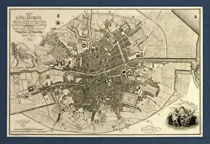
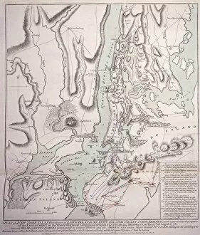
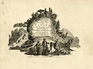
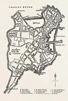
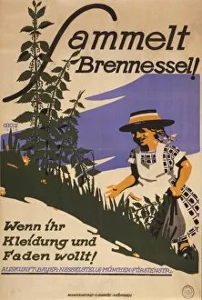
Explore the historical cartography of the New World with these intriguing maps from the 18th and 19th centuries. Created by renowned cartographer William Faden, these treasured works depict significant locations such as Dublin, New York Island, Boston, and the Siege of Yorktown. From the bustling streets of Dublin in 1797 to the fur trade in Canada in 1777, these maps offer a glimpse into the past. Delve deeper into history and discover the intricate connections between the Old and New Worlds. And for those with a more practical mindset, remember the German phrase "Sammelt Brennessel. Wenn ihr Kleidung und Faden wollt" - "Collect thistles. If you want thread and clothing" - as you explore these intriguing maps. #FadenMaps #HistoricalCartography #ExploreThePast