From Space Collection (#8)

"Exploring the vastness of space, we catch a glimpse of our humble abode - the Pale Blue Dot

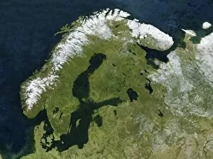
Background imageFrom Space Collection: Scandinavia, satellite image C017 / 9060

Scandinavia, satellite image C017 / 9060
Scandinavia, satellite image. North is at top. Snow tops the mountains of Norway (white, left) with forests and lakes covering most of Sweden (centre left) and Finland (upper centre)

Background imageFrom Space Collection: Tibet, China, relief map

Tibet, China, relief map
Tibet, China. North is at top. Relief map compiled from satellite data, showing the Tibet Autonomous Region (Tibet, yellow) and the surrounding Chinese provinces and regions (grey)

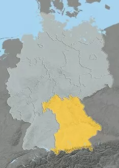
Background imageFrom Space Collection: Bavaria, Germany, relief map

Bavaria, Germany, relief map
Bavaria, Germany. North is at top. Relief map compiled from satellite data, showing the state of Bavaria (yellow), Germany, with the surrounding German states shaded out (grey)
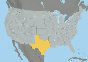
Background imageFrom Space Collection: Texas, USA, relief map

Texas, USA, relief map
Texas, USA. North is at top. Relief map compiled from satellite data of the USA, showing the state of Texas (yellow), with the surrounding states shaded out (grey). The USA consists of 50 states

Background imageFrom Space Collection: Ile-de-France, France, satellite image

Ile-de-France, France, satellite image
Ile-de-France, France. North is at top. Natural colour satellite image of a close-up on the Ile-de-France administrative region of France

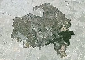
Background imageFrom Space Collection: Val-de-Marne, France, satellite image

Val-de-Marne, France, satellite image
Val-de-Marne, France. North is at top. Natural colour satellite image showing the French department of Val-de-Marne, with the surrounding regions shaded out. Paris can be seen at upper left

Background imageFrom Space Collection: Seine-Saint-Denis, France

Seine-Saint-Denis, France. North is at top. Natural colour satellite image showing the French department of Seine-Saint-Denis, with the surrounding regions shaded out

Background imageFrom Space Collection: Paris, France, satellite image

Paris, France, satellite image
Paris, France. North is at top. Natural colour satellite image showing Paris, with the surrounding regions shaded out. France is located in Western Europe

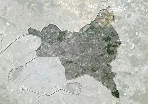
Background imageFrom Space Collection: Hauts-de-Seine, France, satellite image

Hauts-de-Seine, France, satellite image
Hauts-de-Seine, France. North is at top. Natural colour satellite image showing the French department of Hauts-de-Seine, with the surrounding regions shaded out. France is located in Western Europe

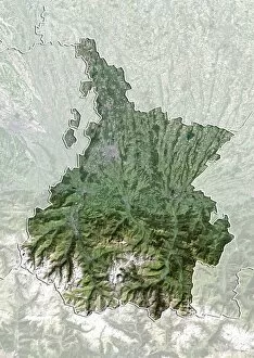
Background imageFrom Space Collection: Hautes-Pyrenees, France, satellite image

Hautes-Pyrenees, France, satellite image
Hautes-Pyrenees, France. North is at top. Natural colour satellite image showing the French department of Hautes-Pyrenees, with the surrounding regions shaded out

Background imageFrom Space Collection: Aveyron, France, satellite image

Aveyron, France, satellite image
Aveyron, France. North is at top. Natural colour satellite image showing the French department of Aveyron, with the surrounding regions shaded out. France is located in Western Europe

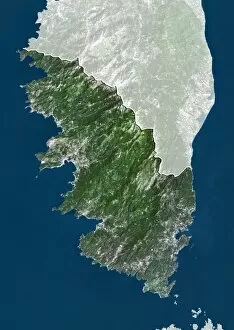
Background imageFrom Space Collection: Corse-du-Sud, France, satellite image

Corse-du-Sud, France, satellite image
Corse-du-Sud, France. North is at top. Natural colour satellite image showing the French department of Corse-du-Sud, with the surrounding regions shaded out. France is located in Western Europe

Background imageFrom Space Collection: Wyoming, USA, satellite image

Wyoming, USA, satellite image
Wyoming, USA. North is at top. Natural colour satellite image of the USA, showing the state of Wyoming, with the surrounding states shaded out. The USA consists of 50 states

Background imageFrom Space Collection: Washington, USA, satellite image

Washington, USA, satellite image
Washington, USA. North is at top. Natural colour satellite image of the USA, showing the state of Washington, with the surrounding states shaded out. The Pacific Ocean (blue) is also shown

Background imageFrom Space Collection: Virginia, USA, satellite image

Virginia, USA, satellite image
Virginia, USA. North is at top. Natural colour satellite image of the USA, showing the state of Virginia, with the surrounding states shaded out. The Atlantic Ocean (blue) is also shown

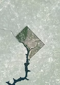
Background imageFrom Space Collection: Washington DC, USA, satellite image

Washington DC, USA, satellite image
Washington DC, USA. North is at top. Natural colour satellite showing Washington, D.C. in the Mid Atlantic region of the USA, with the surrounding states shaded out

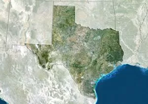
Background imageFrom Space Collection: Texas, USA, satellite image

Texas, USA, satellite image
Texas, USA. North is at top. Natural colour satellite image of the USA, showing the state of Texas, with the surrounding states shaded out. The USA consists of 50 states

Background imageFrom Space Collection: Utah, USA, satellite image

Utah, USA, satellite image
Utah, USA. North is at top. Natural colour satellite image of the USA, showing the state of Utah, with the surrounding states shaded out. The USA consists of 50 states

Background imageFrom Space Collection: New Jersey, USA, satellite image

New Jersey, USA, satellite image
New Jersey, USA. North is at top. Natural colour satellite image of the USA, showing the state of New Jersey, with the surrounding states shaded out. The Atlantic Ocean (blue) is also shown

Background imageFrom Space Collection: Montana, USA, satellite image

Montana, USA, satellite image
Montana, USA. North is at top. Natural colour satellite image of the USA, showing the state of Montana, with the surrounding states shaded out. The USA consists of 50 states

Background imageFrom Space Collection: Michigan, USA, satellite image

Michigan, USA, satellite image
Michigan, USA. North is at top. Natural colour satellite image of the USA, showing the state of Michigan with the surrounding states shaded out. The USA consists of 50 states

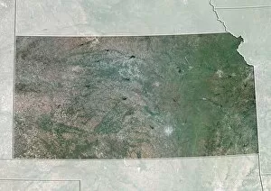
Background imageFrom Space Collection: Kansas, USA, satellite image

Kansas, USA, satellite image
Kansas, USA. North is at top. Natural colour satellite image of the USA, showing the state of Kansas with the surrounding states shaded out. The USA consists of 50 states

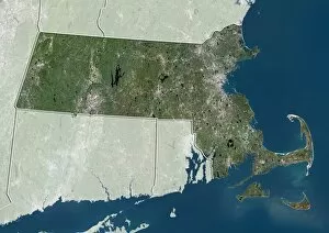
Background imageFrom Space Collection: Massachusetts, USA, satellite image

Massachusetts, USA, satellite image
Massachusetts, USA. North is at top. Natural colour satellite image of the USA, showing the state of Massachusetts with the surrounding states shaded out. The USA consists of 50 states

Background imageFrom Space Collection: Iowa, USA, satellite image

Iowa, USA, satellite image
Iowa, USA. North is at top. Natural colour satellite image of the USA, showing the state of Iowa with the surrounding states shaded out. The USA consists of 50 states

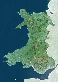
Background imageFrom Space Collection: Wales, UK, satellite image

Wales, UK, satellite image
Wales, UK. North is at top. Natural colour satellite image showing Wales in the United Kingdom, with the surrounding territories shaded out

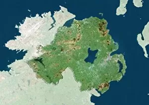
Background imageFrom Space Collection: Northern Ireland, UK, satellite image

Northern Ireland, UK, satellite image
Northern Ireland, UK. North is at top. Natural colour satellite image showing Northern Ireland in the United Kingdom, with the surrounding territories shaded out

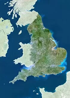
Background imageFrom Space Collection: England, UK, satellite image

England, UK, satellite image
England, UK. North is at top. Natural colour satellite image showing England in the United Kingdom, with the surrounding territories shaded out

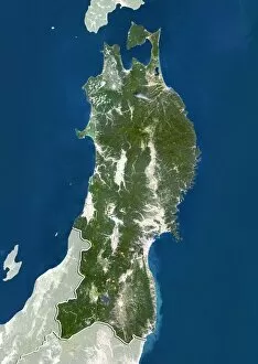
Background imageFrom Space Collection: Tohoku, Japan, satellite image

Tohoku, Japan, satellite image
Tohoku, Japan. North is at top. Natural colour satellite image showing the Tohoku region of Japan, with the surrounding regions shaded out. Japan is an island nation in East Asia

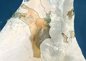
Background imageFrom Space Collection: Sharjah, UAE, satellite image

Sharjah, UAE, satellite image
Sharjah, United Arab Emirates. North is at top. Natural colour satellite image showing the emirate of Sharjah, United Arab Emirates (UAE), with the surrounding emirates shaded out

Background imageFrom Space Collection: Kyushu, Japan, satellite image

Kyushu, Japan, satellite image
Kyushu, Japan. North is at top. Natural colour satellite image showing the island of Kyushu, Japan, with the surrounding regions shaded out. Japan is an island nation in East Asia

Background imageFrom Space Collection: Kansai, Japan, satellite image

Kansai, Japan, satellite image
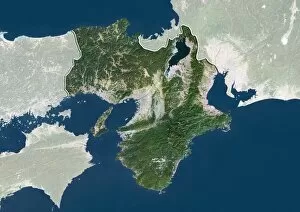
Kansai, Japan. North is at top. Natural colour satellite image showing the Kansai region of Japan, with the surrounding regions shaded out. Japan is an island nation in East Asia

Background imageFrom Space Collection: Calabria, Italy, satellite image

Calabria, Italy, satellite image
Calabria, Italy. North is at top. Natural colour satellite image showing the region of Calabria, in Italy, with the surrounding Italian regions shaded out

Background imageFrom Space Collection: Chugoku, Japan, satellite image

Chugoku, Japan, satellite image
Chugoku, Japan. North is at top. Natural colour satellite image showing the Chugoku region of Japan, with the surrounding regions shaded out. Japan is an island nation in East Asia

Background imageFrom Space Collection: Abruzzo, Italy, satellite image

Abruzzo, Italy, satellite image
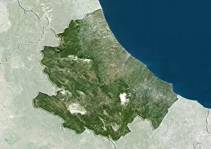
Abruzzo, Italy. North is at top. Natural colour satellite image showing the region of Abruzzo, in Italy, with the surrounding Italian regions shaded out

Background imageFrom Space Collection: Uttarakhand, India, satellite image

Uttarakhand, India, satellite image
Uttarakhand, India. North is at top. Natural colour satellite image showing the state of Uttarakhand, India, with the surrounding states shaded out. India is located in South Asia

Background imageFrom Space Collection: Tamil Nadu, India, satellite image

Tamil Nadu, India, satellite image
Tamil Nadu, India. North is at top. Natural colour satellite image showing the state of Tamil Nadu, India, with the surrounding states shaded out. India is located in South Asia

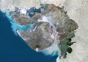
Background imageFrom Space Collection: Gujarat, India, satellite image

Gujarat, India, satellite image
Gujarat, India. North is at top. Natural colour satellite image showing the state of Gujarat, India, with the surrounding states shaded out. India is located in South Asia

Background imageFrom Space Collection: Delhi, India, satellite image

Delhi, India, satellite image
Delhi, India. North is at top. Natural colour satellite image showing the National Capital Territory of Delhi, India, with the surrounding states shaded out. India is located in South Asia

Background imageFrom Space Collection: Xinjiang, China, satellite image

Xinjiang, China, satellite image
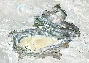
Xinjiang, China. North is at top. Natural colour satellite image showing the Xinjiang region of China, with the surrounding Chinese provinces and regions shaded out

Background imageFrom Space Collection: Flanders, Belgium, satellite image

Flanders, Belgium, satellite image
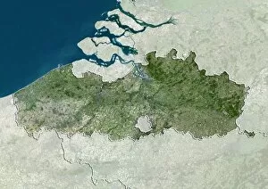
Flanders, Belgium. North is at top. Natural colour satellite image showing the Flemish region of Belgium, with the surrounding regions shaded out

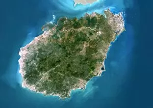
Background imageFrom Space Collection: Hainan, China, satellite image

Hainan, China, satellite image
Hainan, China. North is at top. Natural colour satellite image showing Hainan Island off the coast of China (top). Hainan is located in the South China Sea (blue)

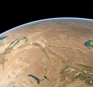
Background imageFrom Space Collection: Baikonur, Kazakhstan, satellite artwork C015 / 6584

Baikonur, Kazakhstan, satellite artwork C015 / 6584
Vostok 1 Launch. Simulated satellite image of Kazakhstan taken from low Earth orbit, showing the launch of the Soviet Vostok 1 spacecraft

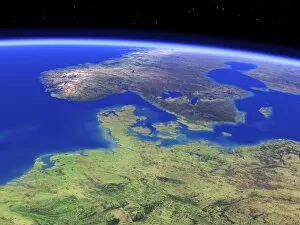
Background imageFrom Space Collection: Northern Europe, satellite artwork C015 / 6583

Northern Europe, satellite artwork C015 / 6583
Northern Europe. Simulated panoramic satellite image of northern Europe taken from low Earth orbit, created using a cloud-free mosaic of satellite images

Background imageFrom Space Collection: Scandinavia, satellite artwork C015 / 6582

Scandinavia, satellite artwork C015 / 6582
Scandinavia. Simulated satellite image of Scandinavia taken from low Earth orbit, created using a cloud-free mosaic of satellite images

Background imageFrom Space Collection: US South West, satellite artwork C015 / 6578

US South West, satellite artwork C015 / 6578
US South West. Simulated panoramic satellite image of the southwestern United States taken from low Earth orbit. Image created using a cloud-free mosaic of satellite images of the Earths surface

Background imageFrom Space Collection: British Isles, satellite artwork C015 / 6581

British Isles, satellite artwork C015 / 6581
British Isles. Simulated satellite image of the British Isles taken from low Earth orbit, created using a cloud-free mosaic of satellite images

Background imageFrom Space Collection: Nunavut, Canada, satellite image

Nunavut, Canada, satellite image. North is at top. Natural colour satellite image showing the Canadian province of Nunavut

Background imageFrom Space Collection: Australia and New Zealand, 3D artwork C015 / 6576

Australia and New Zealand, 3D artwork C015 / 6576
Australia and New Zealand. 3D computer graphic map of Australia and New Zealand, and the surrounding sea floor in the Pacific and Southern oceans


For sale as Licensed Images

Choose your image, Select your licence and Download the media

"Exploring the vastness of space, we catch a glimpse of our humble abode - the Pale Blue Dot. Voyager 1's iconic image reminds us of Earth's insignificance in the grand scheme of things. " "The breathtaking Earthrise over Moon captured by Apollo 8 serves as a reminder that even from space, our home planet remains an awe-inspiring sight to behold. " "A mesmerizing view of the Whole Earth, also known as Blue Marble 2000, showcases the stunning beauty and fragility of our precious planet. " "From high above, a satellite image reveals the intricate details and natural splendor of the British Isles, offering a unique perspective on this enchanting region. " "As night falls upon the UK, its illuminated cities create a dazzling spectacle when viewed from space. The vibrant lights paint a picture of human activity against the dark canvas of night. " "Gazing down at Europe at night through satellite imagery unveils an interconnected web of bustling metropolises and tranquil landscapes intertwined under twinkling stars. " "Inspired by darkness, Europe at night captivates with its ethereal glow emanating from countless cities scattered across its diverse lands. A testament to humanity's constant motion even after sunset. " "Astonishingly beautiful yet hauntingly mysterious, witnessing Whole Earth at night through satellite imagery evokes contemplation about our place in this vast universe and how we illuminate it with life. " "Jupiter and Io dance gracefully in their celestial ballet as captured by New Horizons' lens. This captivating image transports us beyond our own world into realms where giants roam amidst swirling storms. " "Awe-inspiring from any angle; an exquisite satellite image captures Earth's majestic presence against infinite blackness. A reminder that every corner holds hidden wonders waiting to be discovered. "With remarkable clarity seen from above Scotland within UK is unveiled like never before through detailed satellite imaging—a land steeped in history and adorned with rugged beauty.