Geological Collection

"Unveiling Earth's Ancient Secrets: A Journey through Geological Wonders" Embark on a captivating journey through time as we explore the fascinating world of geology

Background imageGeological Collection: William Smith Geological Map

William Smith Geological Map

Background imageGeological Collection: Amber

Amber. The smaller pieces have been polished, the two larger pieces are unpolished. The amber at bottom right has an insect fossilised in it

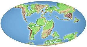
Background imageGeological Collection: Continental drift after 250 million years

Continental drift after 250 million years, showing the supercontinent of Pangea Ultima, which was named for the ancient supercontinent of Pangea

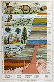
Background imageGeological Collection: Geological Strata 19C

Geological Strata 19C
A schematic representation of geology and palaeontology

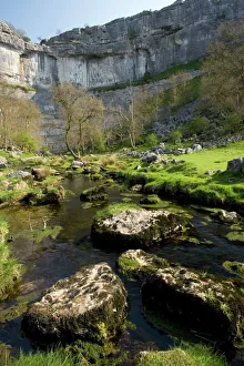
Background imageGeological Collection: Malham Cove, Yorkshire Dales

Malham Cove, Yorkshire Dales National Park, England. This curving limestone cliff feature was formed by glacial action. It used to have a waterfall running over it

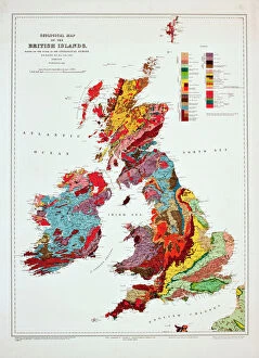
Background imageGeological Collection: Geological map of the British Islands

Geological map of the British Islands. 1941

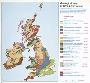
Background imageGeological Collection: Geological map of Britain and Ireland

Geological map of Britain and Ireland
Fig 9 from Britain Before Man (1978), a Geological Museum publication

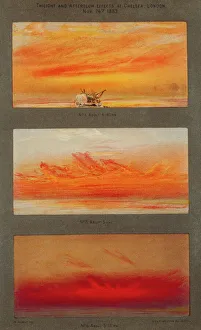
Background imageGeological Collection: Krakatoa sunsets, 1883 artworks

Krakatoa sunsets, 1883 artworks
Krakatoa sunsets. Artwork of the spectacular red and orange sunsets caused in London, England, by the August 1883 eruption of Krakatoa, a volcano thousands of kilometres away in Indonesia

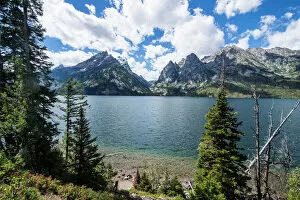
Background imageGeological Collection: Jenny Lake in front of the Teton range in the Grand Teton National Park, Wyoming

Jenny Lake in front of the Teton range in the Grand Teton National Park, Wyoming, United States of America, North America

Background imageGeological Collection: Seven Sisters Chalk Cliffs, and coastguard cottages, Cuckmere Haven, near Seaford

Seven Sisters Chalk Cliffs, and coastguard cottages, Cuckmere Haven, near Seaford, East Sussex, England

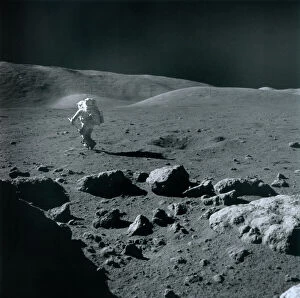
Background imageGeological Collection: Apollo 17 astronaut

Apollo 17 astronaut. US astronaut and geologist Dr Harrison Schmitt exploring the Taurus-Littrow region of the Moon, as part of NASAs Apollo 17 mission

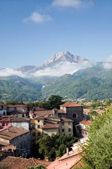
Background imageGeological Collection: Barga, Italy

Barga, Italy
Barga. View from the mediaeval Tuscan town of Barga across the Serchio river valley, towards the summit of Pania Secca (1171 metres) in the Apuan Alps, Italy

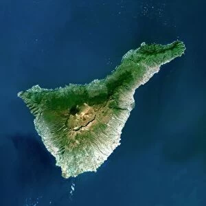
Background imageGeological Collection: Tenerife, satellite image

Tenerife, satellite image. Satellite image of Tenerife showing Mount Teide (lower centre). Vegetation is green, and water is blue

Background imageGeological Collection: Copper and magnesium sulphate, LM

Copper and magnesium sulphate, LM
Copper and magnesium sulphate crystals. Polarised light micrograph (LM) of copper sulphate (CuSO4) and magnesium sulphate (MgSO4) crystals

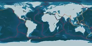
Background imageGeological Collection: Earths tectonic plates

Earths tectonic plates. Global map showing the boundaries of the tectonic plates that make up the Earths crust. The eight major plates are the: African Plate, Antarctic Plate, Indian Plate

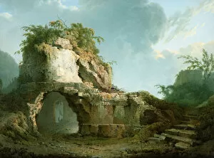
Background imageGeological Collection: Virgils Tomb

Virgils Tomb (1785). Wright, Joseph of Derby 1734-1797. Wright travelled in Italy from 1774-76 and produced many fine drawings of classical subjects and geological curiosities

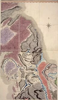
Background imageGeological Collection: First geological map of Britain, 1815 C016 / 5683

First geological map of Britain, 1815 C016 / 5683
First geological map of Britain, detail of the north east coast (figure 8). This map was published in 1815 by British geologist William Smith (1769-1839)

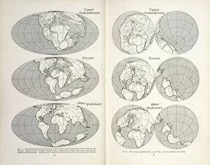
Background imageGeological Collection: Continental drift maps

Continental drift maps
Reconstruction of the map of the world for three periods according to the Displacement Theory. Figs 1-2 from The Origin of Continents and Oceans (1924) by Alfred Wegener

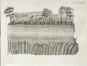
Background imageGeological Collection: Geological unconformity on the river Jed

Geological unconformity on the river Jed. Plate 3 from Theory of the Earth (1795) Vol. 1, by James Hutton

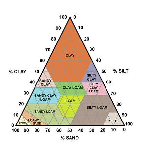
Background imageGeological Collection: Soil triangle diagram

Soil triangle diagram. This diagram is used to work out the type of soil in an area. A sample of soil is left to settle in water. Larger particles settle out of suspension faster than smaller ones

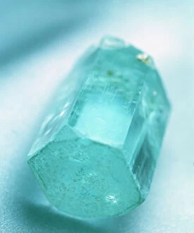
Background imageGeological Collection: Aquamarine crystal

Aquamarine crystal. Aquamarine is a transparent blue or blue-green variety of beryl (beryllium aluminium silicate). The colour is due to trace amounts of iron within the crystal structure

Background imageGeological Collection: Cornish tin mines, 19th century

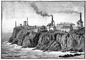
Cornish tin mines, 19th century
Cornish tin mines, 19th-century artwork. These mines are in the parish of St Just in Penwith, Cornwall, UK. 19th-century tin mines in this area date back to 1721

Background imageGeological Collection: Continental drift, 100 million years ago

Continental drift, 100 million years ago. Map of the Earth showing the continents some 100 million years after the start of the break-up of the ancient supercontinent of Pangea

Background imageGeological Collection: Mountain Avens among Fossil coral on Parker Ridge, Banff National Park, Rockies, Canada

Mountain Avens among Fossil coral on Parker Ridge, Banff National Park, Rockies, Canada
ROG-14054 Mountain Avens among Fossil coral on Parker Ridge, Banff National Park, Rockies, Canada Dryas octopetala Bob Gibbons Please note that prints are for personal display purposes only

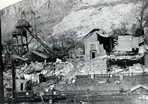
Background imageGeological Collection: New Tredegar Colliery, Rhymney Valley, South Wales

New Tredegar Colliery, Rhymney Valley, South Wales
An engine house damaged by subsidence at New Tredegar Colliery, Rhymney Valley, South Wales. This colliery suffered from many landslips and other geological problems, and eventually closed in 1930

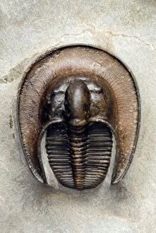
Background imageGeological Collection: Trilobite fossil

Trilobite fossil. Fossil of a trilobite (Aristoharpes sp.) from the Devonian period (around 370 million years ago), showing the species characteristic, spade-like shape

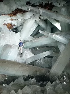
Background imageGeological Collection: Cave of Crystals, Naica Mine, Mexico

Cave of Crystals, Naica Mine, Mexico
^BCave of Crystals.^b Geologist in the Cave of Crystals (^ICueva de los Cristales^i) in Naica Mine, Chihuahua, Mexico. The crystals are the largest known in the world

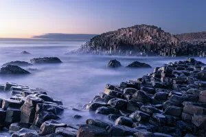
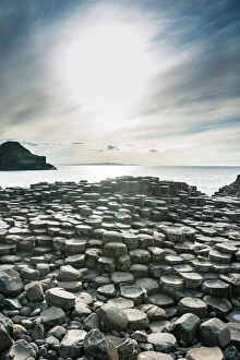
Background imageGeological Collection: The Giants Causeway rises out of the Atlantic late at night as the last light of

The Giants Causeway rises out of the Atlantic late at night as the last light of the sun disappears below the horizon, County Antrim, Northern Ireland, United Kingdom, Europe

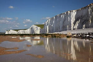
Background imageGeological Collection: Seven Sisters Chalk Cliffs, Birling Gap, East Sussex, England, United Kingdom

Seven Sisters Chalk Cliffs, Birling Gap, East Sussex, England, United Kingdom
Seven Sisters Chalk Cliffs, Birling Gap, East Sussex, England

Background imageGeological Collection: The Giants Causeway, UNESCO World Heritage Site, County Antrim, Ulster, Northern Ireland

The Giants Causeway, UNESCO World Heritage Site, County Antrim, Ulster, Northern Ireland, United Kingdom, Europe

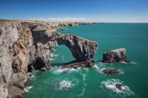
Background imageGeological Collection: Green Bridge of Wales, Pembrokeshire Coast, Wales, United Kingdom, Europe

Green Bridge of Wales, Pembrokeshire Coast, Wales, United Kingdom, Europe

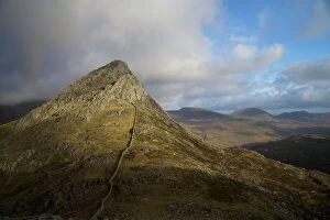
Background imageGeological Collection: South ridge of Tryfan from Glyder Fach, Snowdonia National Park, Gwynedd, Wales, United Kingdom

South ridge of Tryfan from Glyder Fach, Snowdonia National Park, Gwynedd, Wales, United Kingdom, Europe

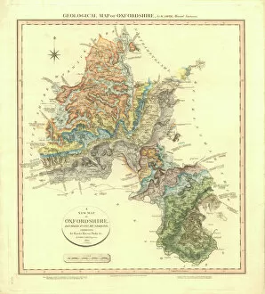
Background imageGeological Collection: Geological Map of Oxfordshire

Geological Map of Oxfordshire
Delineation of Strata of Oxfordshire by William Smith

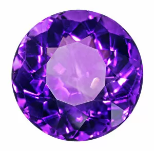
Background imageGeological Collection: Birthstone Series: Amythest Quartz

Birthstone Series: Amythest Quartz
An Amythest quartz specimen. Amythest is a form of quartz that is usually purple in colour, it is the birthstone for the month of March. Natural History Museum specimen number 84817

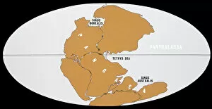
Background imageGeological Collection: Continental Drift

Continental Drift
The world 200 million years ago in Upper Triassic times, showing the single continent of Pangaea and the universal ocean, Panthalassa

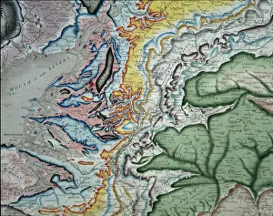
Background imageGeological Collection: William Smiths geological map

William Smiths geological map
Part of William Smiths geological map of Great Britain, published in 1815

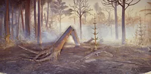
Background imageGeological Collection: Coal forest diorama

Coal forest diorama
A diorama of a Carboniferous coal forest (354 to 290 million years ago) previously on display at the former Geological Museum which is now part of the Natural History Museum, London

Background imageGeological Collection: Standing stones

Standing stones. This is Castlerigg Stone Circle, Cumbria, England. It is on the level top of a hill in the Lake District

Background imageGeological Collection: Mars Exploration Rover

Mars Exploration Rover on the surface of Mars, artwork. The first of two identical NASA rovers, Spirit, landed on Mars on 4 January 2004

Background imageGeological Collection: Northern Corries at dawn

Northern Corries at dawn. View looking west just before sunrise across Coire an t-Sneachda (hollow area) to Coire Lochain. The ridge separating the two hollows is is the Fiacaill Ridge

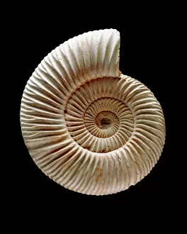
Background imageGeological Collection: Ammonite

Ammonite fossil. Ammonites are extinct marine invertebrates. They first appeared in the Late Silurian to Early Devonian period (around 400 million years ago)

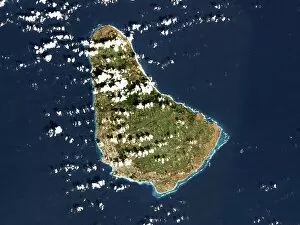
Background imageGeological Collection: Barbados, satellite image

Barbados, satellite image
Barbados. Landsat image of the island of Barbados in the Caribbean sea. North is at top. Barbados has a total land area of about 430 square kilometres

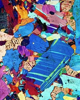
Background imageGeological Collection: Polarised LM of a thin section of gabbro rock

Polarised LM of a thin section of gabbro rock
Gabbro. Polarised light micrograph of a thin section of gabbro, an igneous rock. Gabbro is coarse-grained, containing the minerals olivine and plagioclase feldspar

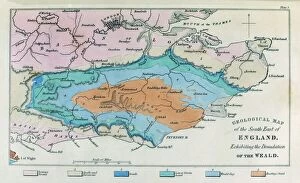
Background imageGeological Collection: Geological map, South-East England, 1830s

Geological map, South-East England, 1830s. This map, dating from between 1830 and 1833, shows the denudation of The Weald

Background imageGeological Collection: Oil well, 19th century

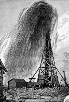
Oil well, 19th century
Oil well. Crude oil erupting from a wellhead in a 19th-century oil field. The wellhead is the structure used to contain and pump oil as it reaches the surface from deep underground, often, as here

Background imageGeological Collection: The Jurassic Coast of Lyme Regis, Dorset

The Jurassic Coast of Lyme Regis, Dorset

Background imageGeological Collection: Venus radar map, North Pole

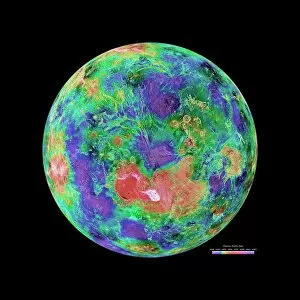
Venus radar map, North Pole
Venus radar map, centred on the Venusian North Pole. The map is colour-coded for altitude, going from low altitude (purple) through blue, green, yellow and orange to high altitude (red)

Background imageGeological Collection: Bedruthan Steps, Newquay, Cornwall, England, United Kingdom, Europe

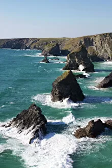
Bedruthan Steps, Newquay, Cornwall, England, United Kingdom, Europe

Background imageGeological Collection: Continental drift diagrams

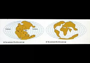
Continental drift diagrams
A) The continents 175 million years ago. B) The continents 50 million years ago. Figs 65 & 67 from The Age of the Earth. See also < a href= http://piclib.nhm.ac.uk/results.asp

Background imageGeological Collection: Bedruthan Steps, Cornwall, England, United Kingdom, Europe

Bedruthan Steps, Cornwall, England, United Kingdom, Europe

Background imageGeological Collection: Green apophyllite

Green apophyllite from Jalgaon, India

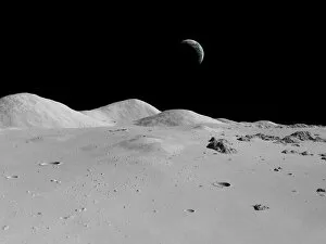
Background imageGeological Collection: Lunar surface, artwork

Lunar surface, artwork
Lunar surface. Computer artwork of a view across the surface of the Moon towards Earth in the distance. The Moon has no atmosphere to scatter sunlight

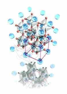
Background imageGeological Collection: Perovskite crystal structure

Perovskite crystal structure. Perovskite is the name for the mineral calcium titanium oxide (CaTiO3). It forms a crystal structure that is very common in oxide minerals

Background imageGeological Collection: Arches National Park, Utah, United States of America, North America

Arches National Park, Utah, United States of America, North America

Background imageGeological Collection: Calcareous phytoplankton fossil, SEM Z100 / 0213

Calcareous phytoplankton fossil, SEM Z100 / 0213
Calcareous phytoplankton fossil. Coloured scanning electron micrograph (SEM) of a fossil of the skeleton (coccosphere) of a coccolithotrope, a small marine algal organism

Background imageGeological Collection: Martian landscape

Martian landscape, artwork. Mars is a rocky desert world with no surface water. The red colour of the rocks is due to a high content of iron oxides

Background imageGeological Collection: Giants Causeway

Giants Causeway. Columns of basalt rock at the Giants Causeway, in County Antrim, Northern Ireland. This site has been designated a World Heritage Site

Background imageGeological Collection: Diamond, computer artwork

Diamond, computer artwork
Cut and polished diamond, computer artwork. Diamond is a naturally occurring form of carbon that has crystallised under great pressure

Background imageGeological Collection: Copper sulphate crystals, LM

Copper sulphate crystals, LM
Copper sulphate crystals. Polarised light micrograph (LM) of copper sulphate (CuSO4) crystals

Background imageGeological Collection: Steppe-desert border, satellite image

Steppe-desert border, satellite image. North is at top. Arid areas of desert rock are brown, while grassy steppe areas are green. A small area of desert sands (yellow) is seen at far centre right

Background imageGeological Collection: Ancient bristlecone pine trees on Wheeler Peak, Great Basin National Park

Ancient bristlecone pine trees on Wheeler Peak, Great Basin National Park
ROG-12244 Ancient bristlecone pine trees Wheeler Peak, Great Basin National Park, Nevada, USA Pinus longaeva Bob Gibbons Please note that prints are for personal display purposes only

Background imageGeological Collection: The huge caldera of the Crater Lake National Park, Oregon, United States of America, North America

The huge caldera of the Crater Lake National Park, Oregon, United States of America, North America

Background imageGeological Collection: Continental Drift

Continental Drift
5 diagrams illustrating the positions of the continents 380 mya, 200 mya, 135 mya, 50 mya and the present

Background imageGeological Collection: Aquamarine crystal

Aquamarine crystal. Aquamarine is a transparent blue or blue-green variety of beryl (beryllium aluminium silicate). The colour is due to trace amounts of iron within the crystal structure

Background imageGeological Collection: Peridot

Peridot. The specimens at top right and middle right are polished and the specimens at left are in their natural state. Peridot is a variety of the mineral olivine (magnesium iron silicate)

Background imageGeological Collection: Mining Geological profiles lithograph 1895

Mining Geological profiles lithograph 1895
Encyclopedia Britannica 9th Edition Vol I New York, Samuel Hall 1878

Background imageGeological Collection: Sandy beach on Redfish Lake in a valley north of Sun Valley, Sawtooth National Forest, Idaho

Sandy beach on Redfish Lake in a valley north of Sun Valley, Sawtooth National Forest, Idaho, United States of America, North America

Background imageGeological Collection: Davy experimenting at Vesuvius, 1819

Davy experimenting at Vesuvius, 1819
Davy experimenting at Vesuvius. 19th-century artwork of British chemist Humphrey Davy (1778-1829) in 1819 carrying out experiments on the slopes of the volcano Mount Vesuvius, near Naples, Italy

Background imageGeological Collection: Roussanou Monastery at sunset, Meteora, Greece

Roussanou Monastery at sunset, Meteora, Greece

Background imageGeological Collection: Geological map of the European Alps, lithograph, published in 1897

Geological map of the European Alps, lithograph, published in 1897
Geological map of the European Alps. Lithograph, published in 1897

Background imageGeological Collection: Milky Way above Delicate Arch, Arches National Park, Moab, Grand County, Utah, United

Milky Way above Delicate Arch, Arches National Park, Moab, Grand County, Utah, United States of America, North America

Background imageGeological Collection: The Queens Head rock formation at the Yehliu GeoPark, Wanli in Taiwan

The Queens Head rock formation at the Yehliu GeoPark, Wanli in Taiwan
The Queens Head rock formation at the Yehliu GeoPark, part of the Daliao Miaocene Formation in Wanli in Taiwan

Background imageGeological Collection: Redfish Lake in a valley north of Sun Valley, Sawtooth National Forest, Idaho

Redfish Lake in a valley north of Sun Valley, Sawtooth National Forest, Idaho, United States of America, North America

Background imageGeological Collection: William Smiths Geological Map

William Smiths Geological Map
Fig. 6 from Delineation of Strata of England and Wales (1815) by William Smith

Background imageGeological Collection: Planets internal structures

Planets internal structures, and Pluto, computer artwork. Mercury, Mars and Venus consist of a large iron core (spherical), surrounded by a thick silicate mantle (yellow) covered in a surface crust

Background imageGeological Collection: Nikolay Urvantsev, Soviet geologist

Nikolay Urvantsev, Soviet geologist
Nikolay Nikolayevich Urvantsev (1893-1985), Soviet geologist, speaking in public at his 80th birthday celebration. Urvantsev is best known for his exploration of northern Siberia and the Arctic

Background imageGeological Collection: Richat Structure, satellite image

Richat Structure, satellite image. North is at top. Desert sands are pale yellow/white (top left and lower right), while less sandy, rocky areas are green, and volcanic rocks are blue

Background imageGeological Collection: Cornish tin mining, 19th century

Cornish tin mining, 19th century
Cornish tin mining, 19th-century artwork. Miners working in a shaft in a tin mine in Cornwall, UK. Many such excavations were near the coast and extended out under the sea for nearly a kilometre

Background imageGeological Collection: Apollo 17 sample of lunar basalt

Apollo 17 sample of lunar basalt. The dark areas visible on the Moon (the lunar maria) are plains of flood basaltic lava flows

Background imageGeological Collection: Dinosaurs of the Mesozoic Era - China

Dinosaurs of the Mesozoic Era - China
An artificial reconstruction by Neave Parker (with the co-operation of Dr. W. E. Swinton) of Dinosaurs of the Mesozoic Era found in China especially in the Provinces of Kansu and Szechuan

Background imageGeological Collection: View of Ha Long Bay, Quang Ninh Province, Vietnam

View of Ha Long Bay, Quang Ninh Province, Vietnam
Ha Long Bay is a UNESCO World Heritage Site and popular travel destination in Quang Ninh Province, Vietnam. Administratively, the bay belongs to H Long City, Cam Pha town

Background imageGeological Collection: Aerial view of the San Juan River cutting through Raplee Anticline west of the town of Bluff

Aerial view of the San Juan River cutting through Raplee Anticline west of the town of Bluff, Utah

Background imageGeological Collection: Olduvai Gorge landscape, Tanzania C015 / 6429

Olduvai Gorge landscape, Tanzania C015 / 6429
Olduvai Gorge landscape, Tanzania. This gorge (also called Oldupai Gorge) is famous for the fossils discovered here of extinct hominins that form part of the human evolutionary tree

Background imageGeological Collection: Mars 96 surface station, artwork

Mars 96 surface station, artwork
Mars 96 surface station. Artwork showing one of the surface stations of the Russian Mars 96 mission landing on Mars after being released from orbit


For sale as Licensed Images

Choose your image, Select your licence and Download the media

"Unveiling Earth's Ancient Secrets: A Journey through Geological Wonders" Embark on a captivating journey through time as we explore the fascinating world of geology. From William Smith's groundbreaking geological map to the awe-inspiring phenomenon of continental drift after 250 million years, every step reveals nature's hidden treasures. Marvel at the majestic Malham Cove in Yorkshire Dales, where towering limestone cliffs stand as a testament to millions of years processes. The intricate details captured in the geological map of Britain and Ireland showcase the diverse landscapes that have shaped our islands over centuries. Delve into history with a glimpse into 19th-century geological strata, unraveling layers upon layers of ancient stories etched within rocks. Jenny Lake stands serenely before the magnificent Teton range in Grand Teton National Park, reminding us how geology intertwines with breathtaking natural beauty across North America. Witness mankind's exploration beyond Earth as Apollo 17 astronauts ventured into space, capturing mesmerizing images that unveiled celestial bodies' geological wonders. Barga in Italy and Tenerife seen from satellite imagery offer glimpses into unique geological formations that leave us marveling at Mother Nature's artistry. Transport yourself back to 1883 when Krakatoa erupted, painting vibrant sunsets across skies worldwide - immortalized by artists who sought to capture this extraordinary display inspired by volcanic activity. The comprehensive British Islands' geological map unravels secrets buried deep beneath our feet while shedding light on their mineral wealth like copper and magnesium sulphate. Join us on this incredible expedition through time and space as we uncover Earth’s most remarkable geological phenomena – an adventure you won't want to miss.

© Copyright Media Storehouse, All Rights Reserved 2003 - 2024
Facebook     Pinterest     Card Payments