Geological Collection (#95)

"Unveiling Earth's Ancient Secrets: A Journey through Geological Wonders" Embark on a captivating journey through time as we explore the fascinating world of geology

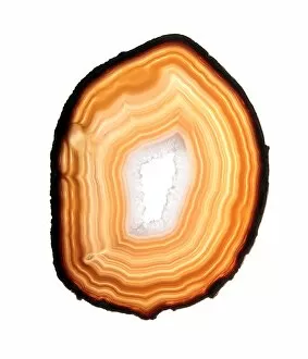
Background imageGeological Collection: Agate slice

Agate slice. Agate is an aggregate of different forms of silica (silicon dioxide, SiO2) that have formed concentric bands within a geode

Background imageGeological Collection: Repairing Earth

Repairing Earth. Conceptual computer artwork of scaffolding on the Earth. This could represent repairing the worldwide environment

Background imageGeological Collection: Frozen Mars, satellite image

Frozen Mars, satellite image

Background imageGeological Collection: Cerberus Fossae, Mars, satellite image

Cerberus Fossae, Mars, satellite image

Background imageGeological Collection: Antoniadi Crater, Mars, satellite image

Antoniadi Crater, Mars, satellite image

Background imageGeological Collection: Cave formations, Borneo

Cave formations, Borneo
Cave formations. Limestone stalagmites leaning at various angles in a cave in Borneo due to earthquake activity. This area is in the Drunken Forest Cave, located in Gunung Mulu National Park

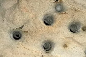
Background imageGeological Collection: Bat cave roosting holes

Bat cave roosting holes. Bats roost in these holes high up on the ceiling of a limestone cave. One bat is seen in the hole at left

Background imageGeological Collection: Phytokarst rock formation

Phytokarst rock formation. This type of karst rock formation is created in areas of limestone caves where sunlight is present

Background imageGeological Collection: Sand dunes on Mars, satellite image

Sand dunes on Mars, satellite image

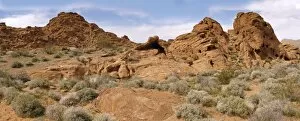
Background imageGeological Collection: Valley of Fire, Nevada, USA

Valley of Fire, Nevada, USA
Valley of Fire state park Nevada USA

Background imageGeological Collection: Geyser Valley, Kamchatka

Geyser Valley, Kamchatka, Russia. Steam rising from a hillside in the geothermal area of Geyser Valley, the second-largest geothemal area in the world

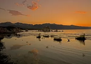
Background imageGeological Collection: Lake Mono at sunset

Lake Mono at sunset. This lake in California, USA, is an important habitat for species of bird. In the mid-20th century the lakes tributaries were diverted to support the growth of Los Angeles

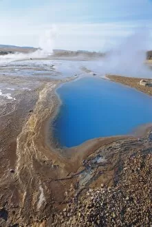
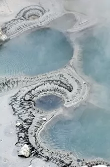
Background imageGeological Collection: Geothermal pool

Geothermal pools. Hot water flows from underground to form these pools. The water is heated by volcanic activity and is at high pressure

Background imageGeological Collection: Australian landscape

Australian landscape. This is Kakadu National Park on the north-western coast of Australia, east of Darwin. The landscape varies from lowland plains, some of which flood when the rains arrive

Background imageGeological Collection: White sand dunes

White sand dunes of gypsum. These dunes are found in the Tularosa Basin at the northern end of the Chihuahuan Desert, USA. This area is the largest gypsum sand dune field in the world

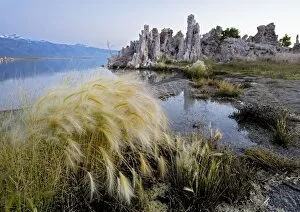
Background imageGeological Collection: Tufa towers at Lake Mono

Tufa towers at Lake Mono, California, USA. Tufa is a mineral deposit formed by the precipitation of calcium salts from water saturated with bicarbonates

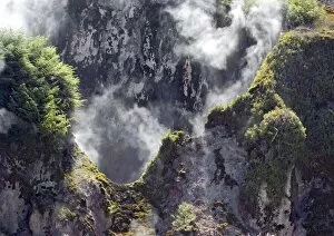
Background imageGeological Collection: The Sulphur Cave, New Zealand

The Sulphur Cave, New Zealand
The Sulphur Cave at the Wai-O-Tapu (Sacred Waters) Thermal Wonderland Park, near Rotorua, on North Island in New Zealand

Background imageGeological Collection: Quartz stalactites

Quartz stalactites hanging down from the ceiling of a cave. These stalactites are icicle-shaped deposits of silicon oxide

Background imageGeological Collection: West Fjords, Iceland

West Fjords, Iceland, satellite image. This jagged coastline is found in the West Fjords (Vestfirdir) peninsula in the north-west of Iceland. White snow and ice covers the mountain peaks

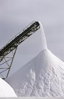
Background imageGeological Collection: Salt pan industry

Salt pan industry. Conveyor belt moving salt onto large piles. Salt is produced by allowing seawater to evaporate from shallow areas. The mineral salt deposits left behind are collected and sold

Background imageGeological Collection: Geothermal mud pool

Geothermal mud pool. Eruption of volcanic gases and steam from a mud pool in a geothermal area. Geothermal pools form in areas where volcanic activity causes hot water to rise up from beneath

Background imageGeological Collection: Dunes surrounding the Sossusvlei clay pan

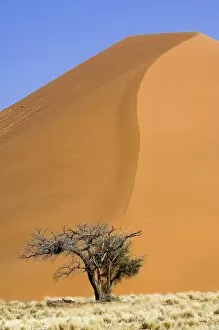
Dunes surrounding the Sossusvlei clay pan. The red sand dunes near the Sossusvlei are the oldest and tallest in the world, some towering over 300 metres from trough to crest

Background imageGeological Collection: Stalactites

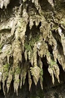
Stalactites at the entrance of Clearwater Cave, Mulu National Park, Sarawak, Malaysia. Mulu is home to many unique species of plant including the one leaf plant (Monophyllae sp)

Background imageGeological Collection: Dried mud slopes

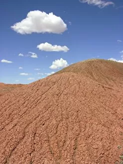
Dried mud slopes in a desert. The uneven surface of the slopes is caused by run-off during rain showers. Photographed in Arizona, USA

Background imageGeological Collection: The Devils Bath, New Zealand

The Devils Bath, New Zealand
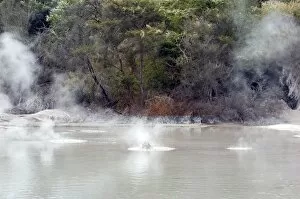
The Devils Bath at the Wai-O-Tapu (Sacred Waters) Thermal Wonderland Park, near Rotorua, on the North Island, in New Zealand

Background imageGeological Collection: Cairngorms plateaux, Scotland

Cairngorms plateaux, Scotland
Cairngorms plateaux, Cairngorms National Park, Aberdeenshire, Scotland. This view is of the eastern Cairngorms, featuring Beinn a Bhuird (1196 metres, left)

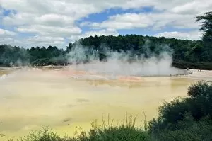
Background imageGeological Collection: The Frying Pan Flat, New Zealand

The Frying Pan Flat, New Zealand
The Frying Pan Flat and Alum Cliffs at the Wai-O- Tapu (Sacred Waters) Thermal Wonderland Park, near Rotorua, on the North Island in New Zealand

Background imageGeological Collection: Normal soil

Normal soil
Soil testing. A pH meter testing the acidity or alkalinity of soil. Farmers and gardeners use pH meters to determine the level of acidity in soil to assess its suitability for different plants

Background imageGeological Collection: Geothermal mud pool, New Zealand

Geothermal mud pool, New Zealand
Geothermal mud pool. Eruption of volcanic gases from a mud pool in a geothermal area. Geothermal pools form in areas where volcanic activity causes hot water to rise up from beneath the Earths

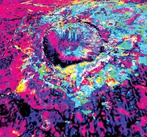
Background imageGeological Collection: Barringer Crater geology

Barringer Crater geology
Barringer Crater. Coloured map of the geological structure of this crater in Arizona, USA. It is also called Meteor Crater

Background imageGeological Collection: Wistmans Wood, Dartmoor

Wistmans Wood, Dartmoor
Light rain falling in Wistmans Wood, Dartmoor. This wood is one of three surviving remnants of ancient woodland in Dartmoor

Background imageGeological Collection: Geyser

Geyser erupting. A geyser is a deep natural well in a geothermal rock fissure. The water lies in a large chamber at the wells base

Background imageGeological Collection: Japanese Cave

Japanese Cave. This cave stretches for three kilometres and was the headquarters of the Japanese occupation forces in West Papua during World War Two

Background imageGeological Collection: Hot spring

Hot spring. The waters of the Liard River are heated by geothermal energy to temperatures as high as 52 degree Celsius. Photographed in the Provincial Park, British Columbia, Canada

Background imageGeological Collection: The Champagne Pool, New Zealand

The Champagne Pool, New Zealand
The Champagne Pool at the Wai-O-Tapu (Sacred Waters) Thermal Wonderland Park, near Rotorua, on the North Island, in New Zealand

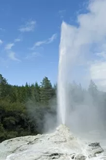
Background imageGeological Collection: Lady Knox Geyser, New Zealand

Lady Knox Geyser, New Zealand
Lady Knox Geyser erupting at the Wai-O-Tapu (Sacred Waters) Thermal Wonderland Park, near Rotorua, on the North Island, in New Zealand. A geyser is a deep natural well in a geothermal rock fissure

Background imageGeological Collection: Tufa towers

Tufa towers at Lake Mono, California, USA. Tufa is a mineral deposit formed by the precipitation of calcium salts from water saturated with bicarbonates

Background imageGeological Collection: Jellyfish cave formation

Jellyfish cave formation in Langs Cave, Mulu National Park, Sarawa, Malaysia. Set in Gunung Mulu (Mt. Mulu), a sandstone mountain that is surrounded by limestone upheavals that are riddled with huge

Background imageGeological Collection: Mammoth Hot Springs mineral terrace

Mammoth Hot Springs mineral terrace in the Yellowstone National Park, Wyoming, USA. The terraces form at the outflow of geothermal springs. The water is heated under pressure deep underground

Background imageGeological Collection: Mineral terrace

Mineral terrace. The white material on the terrace is the mineral travertine. These terraces form at the outflow of a geothermal spring

Background imageGeological Collection: Geysers, Rotorua, New Zealand

Geysers, Rotorua, New Zealand
Geysers erupting in a geothermal area. These geysers are the Prince of Wales Feather geyser (left) and Pohutu geyser (centre), in the geothermal area of Whakarewarewa, near Rotorua

Background imageGeological Collection: Geyser erupting

Geyser erupting next to tourists. A geyser is a deep natural well in a geothermal rock fissure. The water lies in a large chamber at the wells base

Background imageGeological Collection: Cretaceous-Tertiary Impact, artwork

Cretaceous-Tertiary Impact, artwork
Cretaceous-Tertiary Impact. Computer artwork of a large asteroid hitting Earth 65 million years ago. The impact formed the Chicxulub crater on Mexicos Yucatan Peninsula

Background imageGeological Collection: Hot springs and geysers

Hot springs and geysers
Craters of the moon geothermal area, near Taupo, North Island, New Zealand

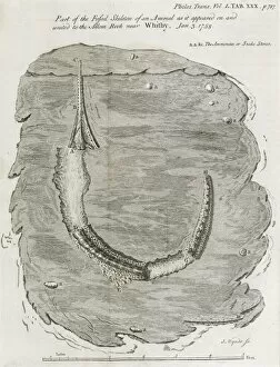
Background imageGeological Collection: Fossil fish, 18th century

Fossil fish, 18th century

Background imageGeological Collection: Mount Ararat

Mount Ararat. View of the snow-capped peak of Mount Ararat, Turkey. Ararat is a dormant volcano located close to the border with Iran and Armenia

Background imageGeological Collection: Fossil animal, 18th century

Fossil animal, 18th century

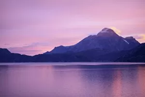
Background imageGeological Collection: Mount Kunait, Greenland

Mount Kunait, Greenland
Mount Kunait, in southwest Greenland, on a tranquil evening


For sale as Licensed Images

Choose your image, Select your licence and Download the media

"Unveiling Earth's Ancient Secrets: A Journey through Geological Wonders" Embark on a captivating journey through time as we explore the fascinating world of geology. From William Smith's groundbreaking geological map to the awe-inspiring phenomenon of continental drift after 250 million years, every step reveals nature's hidden treasures. Marvel at the majestic Malham Cove in Yorkshire Dales, where towering limestone cliffs stand as a testament to millions of years processes. The intricate details captured in the geological map of Britain and Ireland showcase the diverse landscapes that have shaped our islands over centuries. Delve into history with a glimpse into 19th-century geological strata, unraveling layers upon layers of ancient stories etched within rocks. Jenny Lake stands serenely before the magnificent Teton range in Grand Teton National Park, reminding us how geology intertwines with breathtaking natural beauty across North America. Witness mankind's exploration beyond Earth as Apollo 17 astronauts ventured into space, capturing mesmerizing images that unveiled celestial bodies' geological wonders. Barga in Italy and Tenerife seen from satellite imagery offer glimpses into unique geological formations that leave us marveling at Mother Nature's artistry. Transport yourself back to 1883 when Krakatoa erupted, painting vibrant sunsets across skies worldwide - immortalized by artists who sought to capture this extraordinary display inspired by volcanic activity. The comprehensive British Islands' geological map unravels secrets buried deep beneath our feet while shedding light on their mineral wealth like copper and magnesium sulphate. Join us on this incredible expedition through time and space as we uncover Earth’s most remarkable geological phenomena – an adventure you won't want to miss.